Hazards BeachAustralia Beach Guide
Wild silica sands earned by a proper Tasmanian hike
About
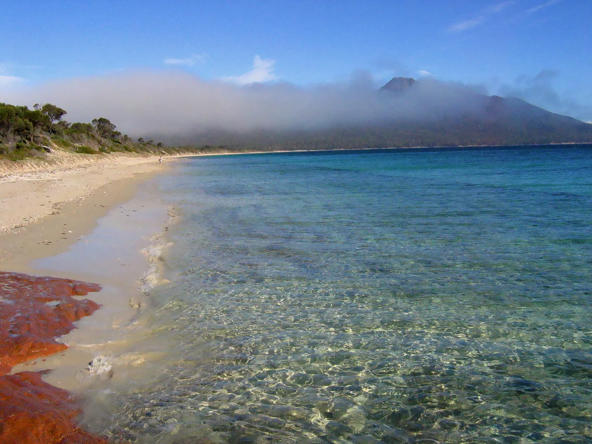
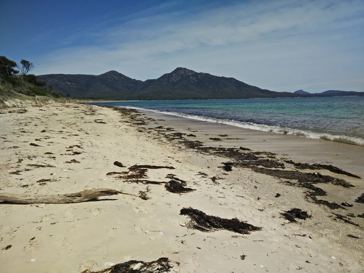
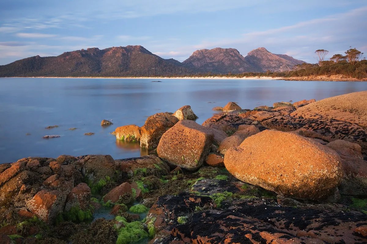
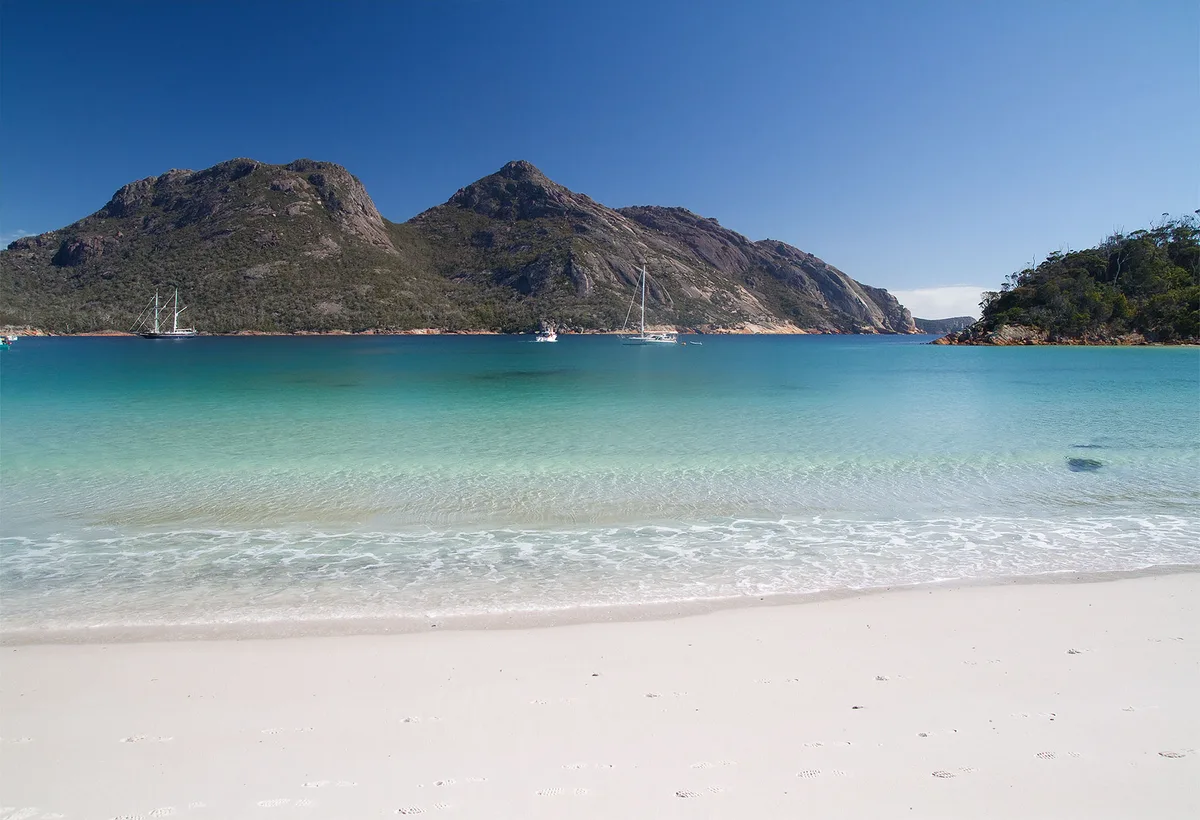
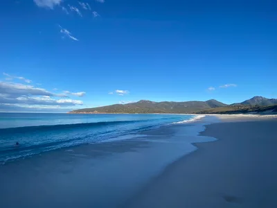
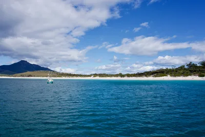
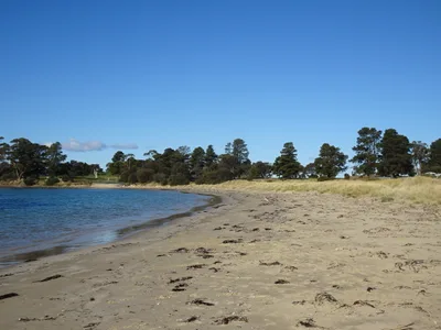
Hazards Beach stretches roughly 3 kilometres along the western flank of the Freycinet Peninsula, backed by the blush-pink granite of the Hazards mountain range and facing an open, blue Southern Ocean. The silica-white sand is the kind that squeaks underfoot — fine, bright, and startlingly clean given how few people make it here. Westerly swells roll in with force, shaping a raw, exposed shoreline that feels genuinely wild rather than postcard-pretty. Wombats and wallabies are regular visitors at dusk, wandering the scrub fringe where the bush meets the sand. This is a waypoint on the Freycinet Peninsula Circuit, so the walkers you'll share it with have all earned their place here.
How to get there
Hazards Beach is hike-only — there is no road, no vehicle access, and no shortcut. From the Wineglass Bay car park, you can reach it via the direct Hazards Beach Track in around 2 hours, or loop in via Wineglass Bay on the full circuit in around 4 hours. Park at the Wineglass Bay car park or Coles Bay trailhead; parking is paid at AUD 40 per vehicle per day, which covers national park entry and goes toward conservation of Tasmania's parks. The beach is open 24 hours, but plan your hike timing carefully — the trail is rough bush track and conditions deteriorate fast in poor weather.
Who it's for
For couples
A long, quiet beach with almost no other visitors, pink granite peaks as a backdrop, and wombats appearing at dusk — it's a genuinely romantic setting for couples who don't mind earning it with a two-hour hike each way.
For families
The multi-hour hike on rough bush track makes this a poor fit for young children or anyone with limited mobility — the beach is not accessible and there are no facilities on site. Older kids who are confident hikers and comfortable with a full day on the trail may find the wildlife sightings and wild scenery rewarding.
Our take
Hazards Beach doesn't give itself up easily, and that's exactly the point. The two-hour minimum hike filters out the casual visitor and leaves you with a long sweep of silica-white sand, a blue Southern Ocean horizon, and a real sense of wilderness that most Tasmanian beaches can't match. Swim with caution — exposed westerly swells are powerful, there are no lifeguards, and conditions can change without warning. The wildlife sightings at dusk are a genuine bonus, not a marketing line. Skip the winter months entirely; June through August brings dangerous swells and deteriorating trail conditions. Come between December and March, start early, carry plenty of water, and treat this as a full day in the bush — because that's exactly what it is.
What to do
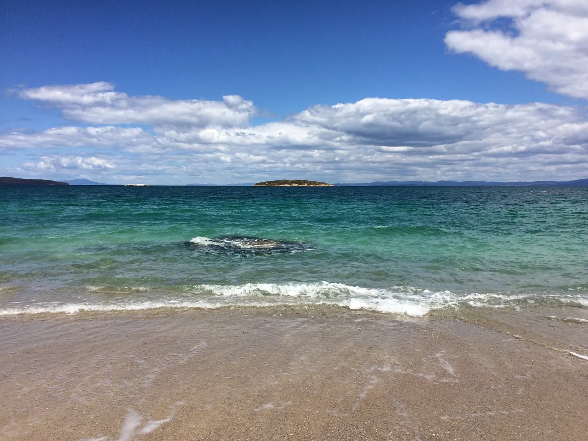
Hazards Beach sits on the Freycinet Peninsula Circuit, a 30-kilometre multi-day walk that circumnavigates the peninsula and also passes Wineglass Bay — Tasmania's most iconic beach, just 3.5 kilometres away and reachable via the circuit. From the sand on a clear day you can spot Schouten Island, an uninhabited national park island 16 kilometres offshore, accessible by boat from Coles Bay. Back near the trailhead, the Wineglass Bay Lookout and Coles Bay Lookout — both around 2.4 kilometres from the car park — offer elevated views worth the short detour on your way in or out.
Stand at the waterline and shoot back toward the Hazards peaks — the contrast of silica-white sand, blue ocean, and pink granite in a single frame is the defining image of this beach.
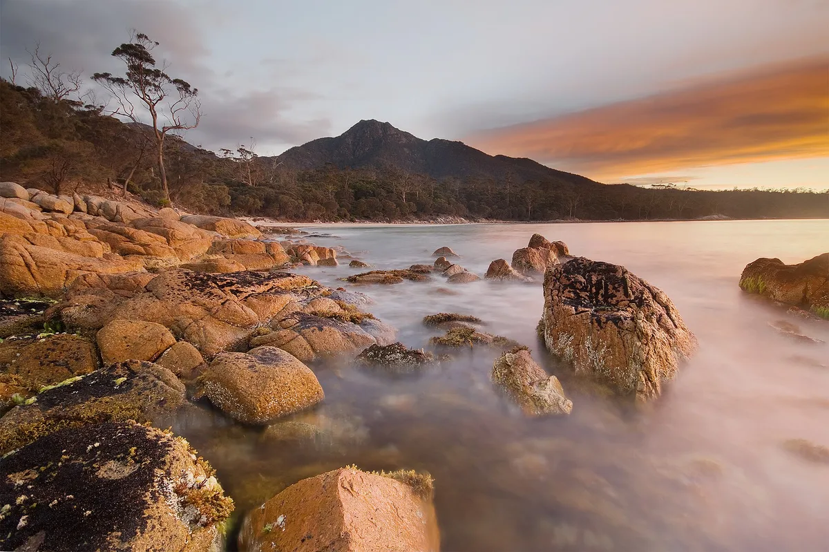
The approach trail also offers an elevated vantage point where you can capture the full arc of the beach curving into the peninsula before you descend to the sand.
Where to eat
There's nothing to eat at the beach itself, so pack your own supplies and carry out every wrapper. Back in the Coles Bay area, Richardson's Bistro and The Bay Restaurant & Hazards Bar are both around 4.6 kilometres from the trailhead and make a well-earned post-hike dinner a straightforward proposition.
Where to stay
Freycinet Lodge, rated 4.5 out of 5 across more than a thousand reviews and just 4.6 kilometres from the trailhead, is the most established base for exploring the peninsula. For something smaller, Freycinet Sanctuary (4.7/5) and Freycinet Stone Studio 4 (4.5/5) are both around 5.2 kilometres away, while BIG4 Iluka on Freycinet Holiday Park offers a more budget-flexible option at 5.4 kilometres.
Photography
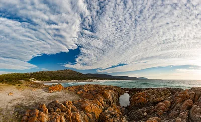
The classic shot is from the sand looking northeast toward the pink granite Hazards peaks — early morning light turns the rock face a deep rose and reflects off the silica-white sand with real drama. For a wider compositional frame, the elevated sections of the Hazards Beach Track on approach give you the full sweep of the blue Southern Ocean against the white shoreline before you descend.
Good to know
No dogs are permitted anywhere in Freycinet National Park, so leave them at home. Campfires are banned except at designated sites, you must pack out all waste, and overnight stays require a camping permit obtained in advance. There are no lifeguards on this beach — swimming is rated moderate, but exposed westerly swells can be powerful and unpredictable, so assess conditions carefully before entering the water. Carry more water than you think you need, and check the forecast before you set out: weather on the Freycinet Peninsula can shift from clear to dangerous within the hour. Avoid June, July, and August — winter westerly swells make the beach hazardous and trail conditions deteriorate significantly.
Map
Nearby places
Richardson's Bistro
The Bay Restaurant & Hazards Bar
Freycinet Lodge
Freycinet Stone Studio 4
Freycinet Sanctuary
BIG4 Iluka on Freycinet Holiday Park
The Loft
Things to see around Coles Bay
Freycinet Peninsula Circuit
A 30km multi-day walk circumnavigating the peninsula, passing both Hazards Beach and Wineglass Bay.
Wineglass Bay
Tasmania's most iconic beach, reachable from Hazards Beach via the Peninsula Circuit.
Schouten Island
Uninhabited national park island visible from Hazards Beach, accessible by boat from Coles Bay.
Frequently asked
The information on this page is provided for guidance only and may evolve. Access conditions, safety and infrastructure can change without notice. Always check official sources before traveling.
Nearest beaches
Other wild beaches in Australia
Reviews of this beach
- No reviews yet, what a shame — leave yours and share your experience.
Photo credits
Sources and licenses for the photos shown above.
- Photo 1 — Ray Hayward · source · CC BY-SA 3.0
- Photo 2 — andrewharvey4 · source · CC BY 2.0
- Photo 3 — TineImWunderland · source · CC BY-ND 2.0
- Photo 4 — JJ Harrison (https://www.jjharrison.com.au/) · source · CC BY-SA 3.0
- Photo 5 — JJ Harrison (https://www.jjharrison.com.au/) · source · CC BY-SA 3.0
- Photo 6 — JJ Harrison (https://www.jjharrison.com.au/) · source · CC BY-SA 3.0