Garcey BeachSpain Beach Guide
Black sand, rusted wreck, raw Atlantic wilderness
About
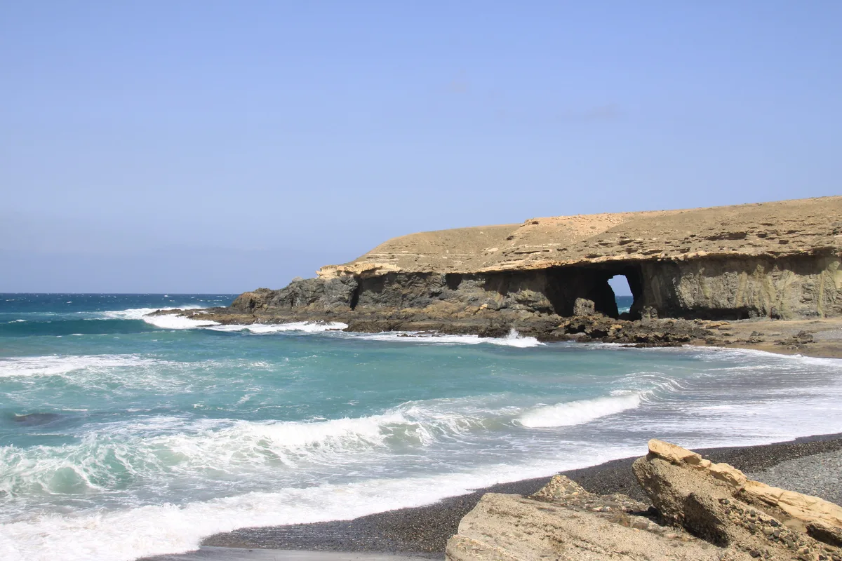
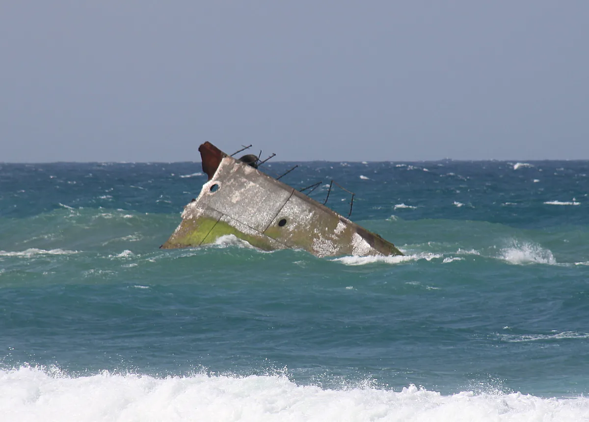
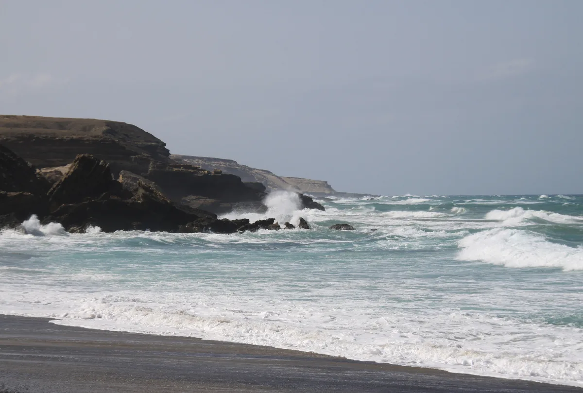
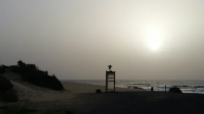
Playa de Garcey stretches for 3 kilometres along Fuerteventura's west coast without a single building, vendor, or sunbed in sight. The sand is volcanic black, coarse underfoot, backed by dramatic volcanic cliffs that drop sharply to the shore. Out in the deep blue Atlantic, a rusted shipwreck sits offshore — visible, weathered, and utterly photogenic against the open ocean horizon. A dry barranco mouth meets the beach, adding another layer of raw, geological drama to the landscape. This is Fuerteventura stripped of every tourist convenience, and that is precisely the point.
How to get there
Playa de Garcey sits within the municipality of Pájara on Fuerteventura's west coast. Reach it by car from the FV-605 west coast road, turning onto a dirt track that takes roughly 15 minutes to navigate — expect an uneven, slow drive. There is no formal parking area at the end of the track, so you'll need to leave your vehicle wherever the terrain allows. Fuerteventura Airport (FUE) is approximately 33 kilometres away; a ferry service operated by Naviera Armas also connects to the island, though the crossing takes around 390 minutes.
Who it's for
For couples
Playa de Garcey rewards couples who want genuine solitude — no other visitors, no background noise, just black volcanic sand, open ocean, and a shipwreck on the horizon to contemplate together. It's a place for slow walks and long silences, not sunbeds and cocktails.
For families
Playa de Garcey is not suitable for families with young children. Swimming is strictly not recommended due to strong Atlantic currents, there are no facilities whatsoever on site, and the dirt track access is difficult — the combination of hazards makes this an adult-only adventure destination.
Our take
Let's be direct: Playa de Garcey is not a swimming beach, not a family beach, and not a beach for anyone expecting comfort. Strong Atlantic currents mean the water is off-limits, full stop. What it is, however, is one of the most visually striking stretches of coastline on Fuerteventura — 3 kilometres of black volcanic sand, a rusted shipwreck offshore, volcanic cliffs behind you, and not another soul in sight. You earn it with a 15-minute rattle down a dirt track and the discipline to bring your own water, food, and sun protection. Come between June and September for the most stable conditions, and stay well clear in December, January, and February when Atlantic swells make even standing near the shore feel precarious. For photographers and anyone who wants to experience Fuerteventura's raw, unmediated west coast, this is the detour that delivers.
What to do
The beach itself is the main event — walk the full 3-kilometre stretch of undeveloped shoreline and take in the shipwreck offshore and the volcanic cliff backdrop at your own pace. About 6.5 kilometres away, the Mirador Astronómico de Sicasumbre offers a completely different perspective on Fuerteventura's landscape. Nearby Ajuy Beach and the Cuevas de Ajuy — around 8 kilometres from Garcey — are well worth combining into the same day trip: the sea caves there expose 70-million-year-old ocean floor. The historic town of Betancuria, roughly 12.8 kilometres away, and Pájara Church at around 20 kilometres round out the cultural options in the area.
The offshore shipwreck shot from the black sand shoreline is the defining image of Garcey — shoot it at golden hour when the rusted hull catches the light against the deep blue Atlantic.
The volcanic cliff backdrop framing the empty 3-kilometre beach makes for a powerful wide-angle landscape, and the dry barranco mouth adds a stark, geological foreground that sets this place apart from any other Fuerteventura beach.
Where to eat
There are absolutely no food or drink facilities at Playa de Garcey — pack everything before you leave. The nearest cluster of restaurants is around 6.5 kilometres away near Ajuy, where you'll find Cuevas de Ajuy, Jaula de Oro, and La Bodeguita de Ajuy, along with La Pescadora and La Maresia a little further along at roughly 6.6 kilometres. Plan to eat before or after your visit, not during.
Where to stay
Overnight options near Garcey are limited — the only listed property in the area is Hôtel Rural Huerta Viejo, situated approximately 10.3 kilometres from the beach. It's a rural hotel, which suits the unhurried, off-grid character of this part of Fuerteventura well. Book ahead, as options in this corner of the island are sparse.
Photography
The rusted shipwreck offshore is the undisputed hero shot — frame it against the deep blue Atlantic from the black sand shoreline. The dry barranco mouth where it meets the beach offers a compelling foreground element for wide landscape compositions, and the 3-kilometre stretch of undeveloped shore gives you room to find your own isolated frame.
Good to know
Do not enter the water. The beach faces the open Atlantic with strong currents, and swimming is strictly not recommended at any time of year. Between December and January and February, winter Atlantic swells make the shore break extremely dangerous — avoid those months entirely. There are no facilities, no shade, and no water on site, so bring everything you need before you leave the road. Mobile coverage is limited or non-existent out here, so download offline maps and tell someone your plans before heading down the dirt track.
Map
Nearby places
Cuevas de Ajuy
Jaula de Oro
La Bodeguita de Ajuy
La Pescadora
La Maresia
Hôtel rural Huerta Viejo
Things to see around Pájara
Ajuy Beach and Cuevas de Ajuy
Black sand fishing village beach with sea caves exposing 70-million-year-old ocean floor.
Pájara Church
Betancuria
Frequently asked
The information on this page is provided for guidance only and may evolve. Access conditions, safety and infrastructure can change without notice. Always check official sources before traveling.
Nearest beaches
Other wild beaches in Canary Islands
More beaches in Canary Islands
Reviews of this beach
- No reviews yet, what a shame — leave yours and share your experience.