Malabar BeachAustralia Beach Guide
Wild white-sand cove earned by a forest hike
About
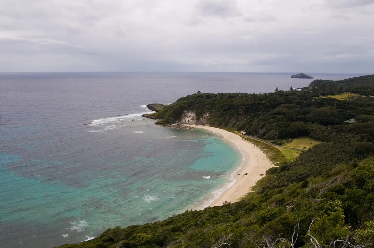
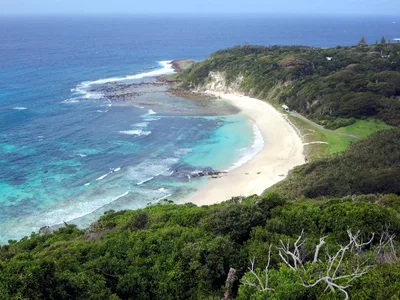
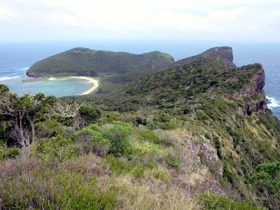
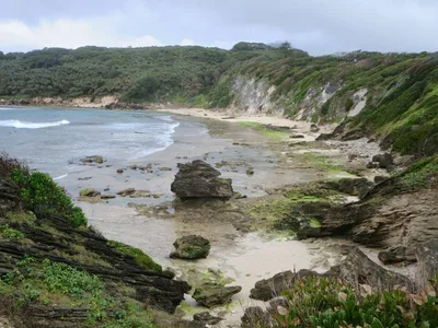
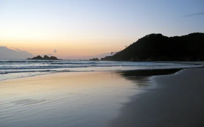
Malabar Beach is a small, remote cove on the northern coast of Lord Howe Island, reached only on foot through a corridor of kentia palms and banyan forest canopy. The white sand is compact and clean, lapped by open blue water that reflects the sky rather than a sheltered lagoon. At roughly 150 metres wide, the cove feels intimate — and on most days you'll have it entirely to yourself. Above the treeline, red-tailed tropicbirds wheel and nest, their calls the only soundtrack. No facilities, no signage, no services — just the beach and the forest behind it.
How to get there
Malabar Beach is reachable only on foot via the Malabar Track, starting from the northern settlement on Lord Howe Island. The walk takes approximately 45 minutes each way and passes through the Lord Howe Island Permanent Park Preserve. There is no parking at the beach and no road access — leave from the northern settlement on foot. No entry fee applies, but the track is entirely within a UNESCO-listed protected area.
Who it's for
For couples
The 45-minute forest walk and the near-guarantee of having the white sand and blue water entirely to yourselves makes this one of the more genuinely private beaches on Lord Howe Island — no performance required, just the two of you and the tropicbirds.
For families
The hike is rewarding but demands sure footing on a track that can turn slippery after rain, making it unsuitable for very young children or anyone who struggles on uneven terrain; older kids with solid hiking experience will find the tropicbird spotting and forest canopy genuinely exciting.
Our take
Assess the north coast swell before you enter the water — conditions can change and there are no lifeguards, no mobile signal, and no one nearby to help if something goes wrong. That safety caveat stated plainly: Malabar Beach is one of the most rewarding beaches on Lord Howe Island precisely because reaching it costs you something. The 45-minute forest walk through kentia palms and banyan canopy is not a chore — it's the experience. You arrive at a compact arc of white sand and open blue water with, in all likelihood, nobody else there. Red-tailed tropicbirds nest in the cliffs above. The UNESCO-listed parkland presses in on three sides. Skip it in June, July and August when winter rains make the track hazardous and north coast swell builds. Come between December and March, check in with the visitor centre, tell your accommodation where you're going, and walk.
What to do
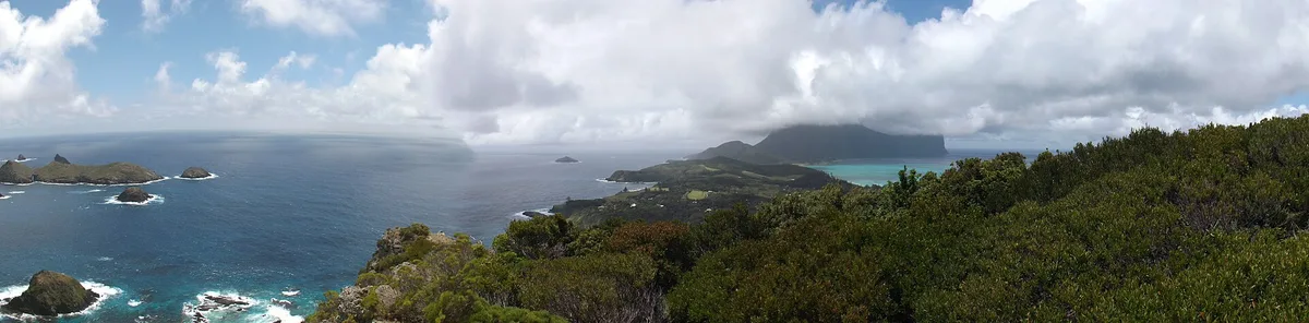
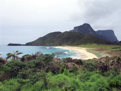
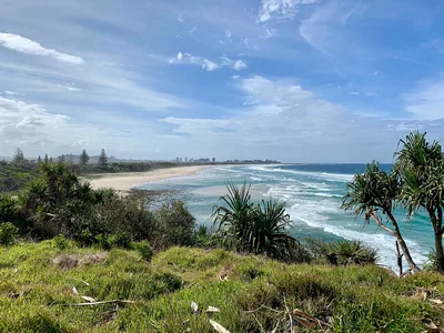
The walk itself is the main event — the Malabar Track passes through the Lord Howe Island Permanent Park Preserve, a UNESCO-listed reserve covering 75% of the island, and the kentia palm and banyan forest is worth slowing down for. Pooles Lookout sits right at the trailhead and rewards you with elevated views before you descend to the cove. Snorkelling is available nearby, and North Beach — about 1.5 kilometres away — offers pisonia forest and seabird nesting for those keen to extend their exploration.
Frame the white sand from the waterline looking back into the banyan canopy — the contrast of pale sand, blue water and dark forest is striking.
The kentia palm corridor on the Malabar Track offers a natural tunnel shot that rewards patience and a wide lens. If a red-tailed tropicbird is in flight above the cove, that's your hero frame — shoot from low on the sand with the blue sky as backdrop.
Where to eat
There are no facilities or food options at the beach, so pack everything you need before you set out. Back in the settlement, Beach House on the Moon Restaurant and Arajilla Restaurant are both within 500 metres of the trailhead and make a good post-hike stop. Miss Saigon Restaurant and the Bowling Club are further options if you want more variety after the walk.
Where to stay
Arajilla Retreat, rated 4.5/5 across 56 reviews and just 500 metres from the trailhead, is the closest base and doubles as the nearest coworking-friendly spot on the island. Milky Way Holiday Accommodation and Somerset Apartments, both rated 4.7/5, sit within 600 metres and offer a comfortable return after the hike. Admiralty Apartments holds a perfect 5/5 score from its reviewers and is also within easy walking distance of the track start.
Photography
The best shots are from the beach looking back toward the banyan canopy, especially in the soft morning light when the blue water is calm and the white sand is unmarked by footprints. The forest approach — kentia palms arching overhead — makes a strong frame for wide-angle shots; aim for the golden hour before midday when light filters through the canopy.
Good to know
Stay on the marked track at all times — the surrounding land is protected parkland and straying damages fragile habitat. Do not approach or disturb nesting red-tailed tropicbirds; observe from a distance only. No camping is permitted at the beach. The track can be muddy and slippery after rain, so check conditions at the island's visitor centre before setting out; there is no mobile coverage on the track or at the beach, so inform your accommodation of your plans before you leave.
Map
Nearby places
Beach House on the Moon Restaurant
Arajilla Restaurant
Miss Saigon Restaurant
Bowling Club
Pinetrees Restaurant
Milky Way Holiday Accommodation
Arajilla Retreat
Admiralty Apartments
Somerset Apartments
Ocean View Apartments
Things to see around Lord Howe Island
Lord Howe Island Permanent Park Preserve
UNESCO-listed park covering 75% of the island; the Malabar Track passes through it.
North Beach
Northern tip beach with pisonia forest and seabird nesting.
Ned's Beach
Iconic north-east beach with wild fish hand-feeding.
Frequently asked
The information on this page is provided for guidance only and may evolve. Access conditions, safety and infrastructure can change without notice. Always check official sources before traveling.
Nearest beaches
Other wild beaches in Australia
Reviews of this beach
- No reviews yet, what a shame — leave yours and share your experience.
Photo credits
Sources and licenses for the photos shown above.