La Dama BeachSpain Beach Guide
Black sand, barranco mouth, zero infrastructure — earn it
About
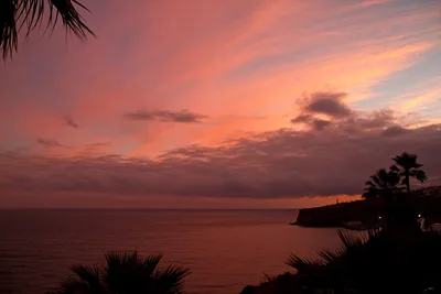
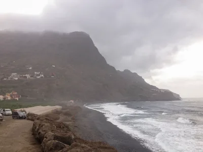
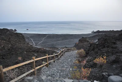
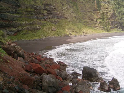
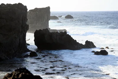
Playa de La Dama sits at the mouth of a barranco on La Gomera's south coast, where a dry ravine opens onto a short stretch of black volcanic sand and deep blue Atlantic water. The beach is framed by abandoned agricultural terraces climbing the hillside and the crumbling walls of a ruined stone farmhouse — remnants of a life that once worked this remote corner of the island. There is no café, no sunbed, no lifeguard, and no mobile signal worth relying on. The south-coast swells roll in unbroken, and the silence is broken only by wind and wave. This is La Gomera stripped back to its bones.
How to get there
Playa de La Dama is reached on foot only, via a steep barranco trail descending from La Dama village on the south coast of La Gomera. The hike is rated difficult — the path drops sharply into the ravine and requires sure footing on loose terrain. There is no parking facility at the beach itself; the trail begins in La Dama village. The beach has no entry fee, but it sits within a protected natural park zone.
Who it's for
For couples
Couples who are comfortable on difficult trails and happy with complete solitude will find Playa de La Dama genuinely rewarding — the ruins, the black sand, and the absence of any other visitors create a rare sense of having discovered something unshared.
For families
Not suitable for families with young children: the steep barranco trail is physically demanding, swimming is dangerous due to strong currents, there are no facilities whatsoever, and flash flood risk in the ravine adds a serious hazard that is difficult to manage with children in tow.
Our take
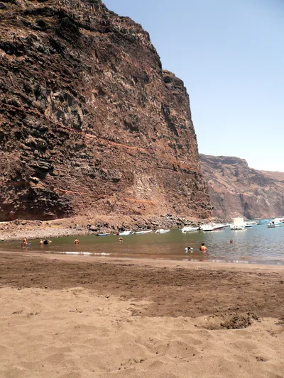
Playa de La Dama is not a beach you visit for a swim or a sunbathe — the currents are dangerous, there is no rescue service, and the water should be left alone. That said, for photographers, hikers, and anyone drawn to landscapes shaped by abandonment and geology, this place is genuinely singular. The black volcanic sand, the ruined farmhouse, the terraces slowly being reclaimed by scrub — it reads like a place that simply forgot to be a tourist destination. The difficult access is the point: it keeps the beach empty and the atmosphere intact. Go between June and September, check the weather carefully before entering the barranco, and treat the no-camping and no-fires rules as non-negotiable in this protected zone. Come for the landscape, stay dry, and leave nothing behind.
What to do
Before or after the hike, the Mirador de la Hila just 0.3km away offers elevated views over the south coast that put the beach's isolation into perspective. Back in San Sebastián de La Gomera, the 15th-century Torre del Conde is one of the best-preserved medieval military structures in the Canary Islands and worth an hour of your time. If you have a full day to spare, Garajonay National Park — a UNESCO World Heritage laurisilva cloud forest covering the island's central plateau — is around 30km away and a complete contrast to the arid south coast.
The crumbling stone farmhouse against the black sand and blue Atlantic is the defining shot — frame it from the lower terraces with the sea behind.
The abandoned agricultural terraces themselves, stacked up the hillside in geometric layers of dry stone, reward a wider lens and a high vantage point. The barranco mouth where the ravine meets the shore gives a dramatic leading-line composition at low sun angles.
Where to eat
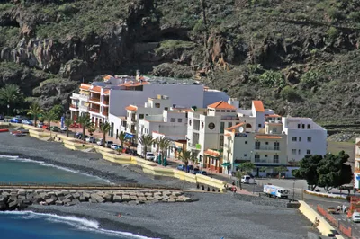
There is nothing to eat or drink at the beach, so pack everything you need before you descend. Back in San Sebastián de La Gomera, Tasca Las Cruces II (0.4km) and El Pejin (0.5km) are among the closest options for a post-hike meal. Bar Restaurante Breñusca and Colón are also within 0.5km if you want to compare menus.
Where to stay
Torre del Conde (0.6km) and La Colombina (0.8km) put you right in San Sebastián de La Gomera, the closest town to the beach. For something more rural, Hotel El Cabrito is around 4.9km away and suits travellers who want to stay closer to the wild south-coast atmosphere.
Photography
The ruined stone farmhouse and the abandoned terraces above the black sand make for compelling foreground subjects — shoot in the soft directional light of early morning when the barranco walls cast long shadows. The contrast between the dark volcanic sand and the deep blue open ocean is strongest on clear days between June and September.
Good to know
Do not enter the water — strong south-coast currents make swimming genuinely dangerous, and there is no lifeguard or rescue service of any kind. If there has been recent rainfall, stay out of the barranco channel entirely: flash flooding is a real and documented risk in this ravine. Camping is strictly prohibited, and fires are banned throughout this protected natural park zone. Avoid visiting in December, January, or February — winter rains sharply raise the flash flood risk and Atlantic swells make the shore hazardous.
Map
Nearby places
Tasca Las Cruces II
Colón
Bar Restaurante Breñusca
El Pejin
La Fortuna
Torre del Conde
La Colombina
Hotel El Cabrito
Pensión La Gaviota
Casa Rural Vista Mar Altozano
Garajonay National Park
Playa de Santiago
Torre del Conde, San Sebastián de La Gomera
Things to see around Alajeró
Garajonay National Park
UNESCO World Heritage laurisilva cloud forest covering the central plateau of La Gomera.
Playa de Santiago
The main resort beach of southern La Gomera, with black pebble and sand shore and ferry connections.
Torre del Conde, San Sebastián de La Gomera
15th-century fortified tower in the island capital, one of the best-preserved medieval military structures in the Canary Islands.
Frequently asked
The information on this page is provided for guidance only and may evolve. Access conditions, safety and infrastructure can change without notice. Always check official sources before traveling.
Nearest beaches

Other wild beaches in Canary Islands
More beaches in Canary Islands
Reviews of this beach
- No reviews yet, what a shame — leave yours and share your experience.
Photo credits
Sources and licenses for the photos shown above.
- Photo 1 — Alexey Kudinkin · source · CC BY 3.0
- Photo 2 — Jörg Bergmann · source · CC BY 2.0
- Photo 3 — CTHOE · source · CC BY-SA 3.0
- Photo 4 — Rolf Dietrich Brecher · source · CC BY-SA 2.0