Echentive BeachSpain Beach Guide
Raw lava coast where the island meets the Atlantic
About
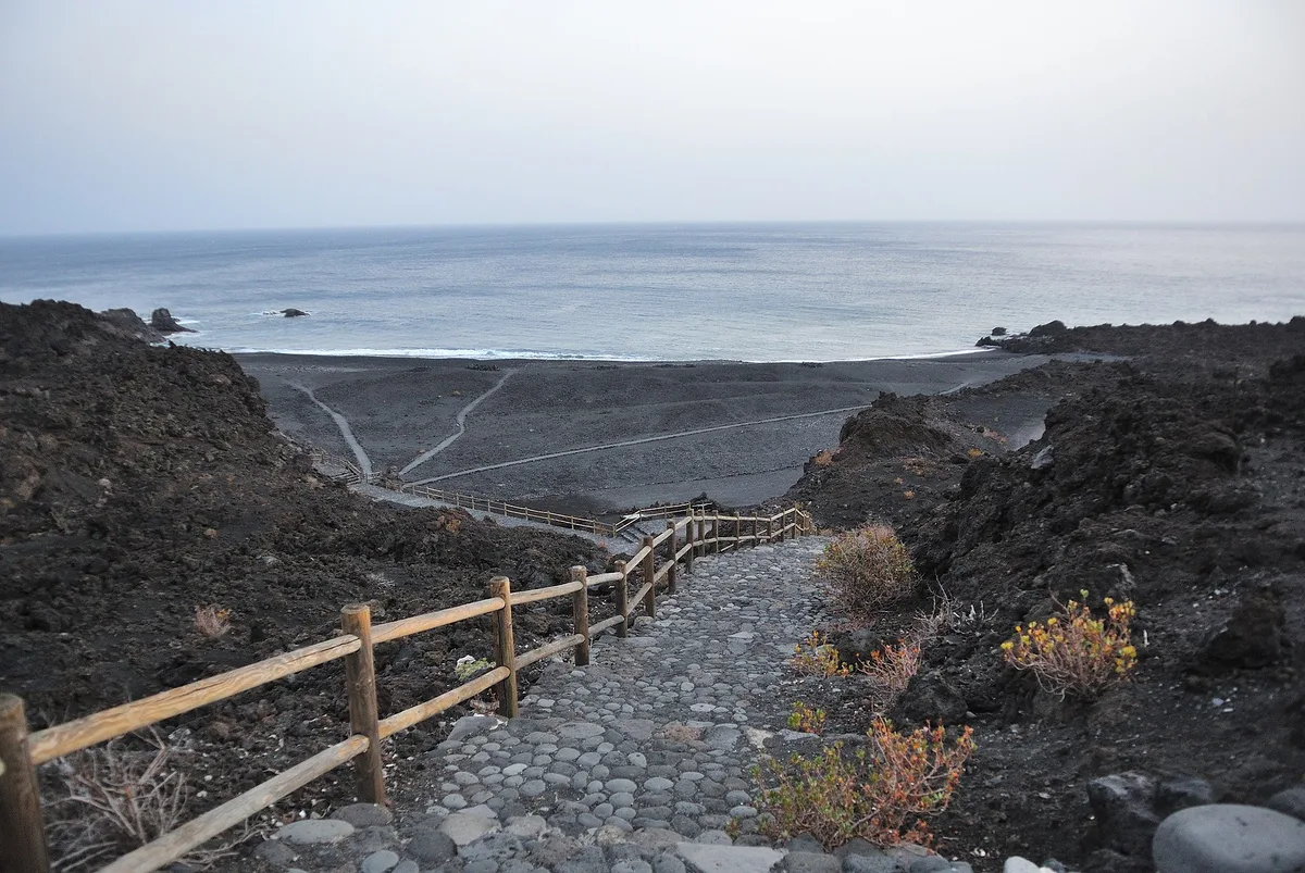
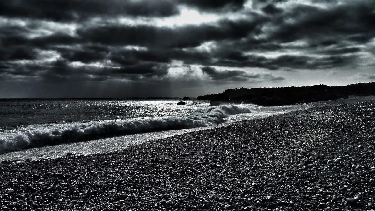
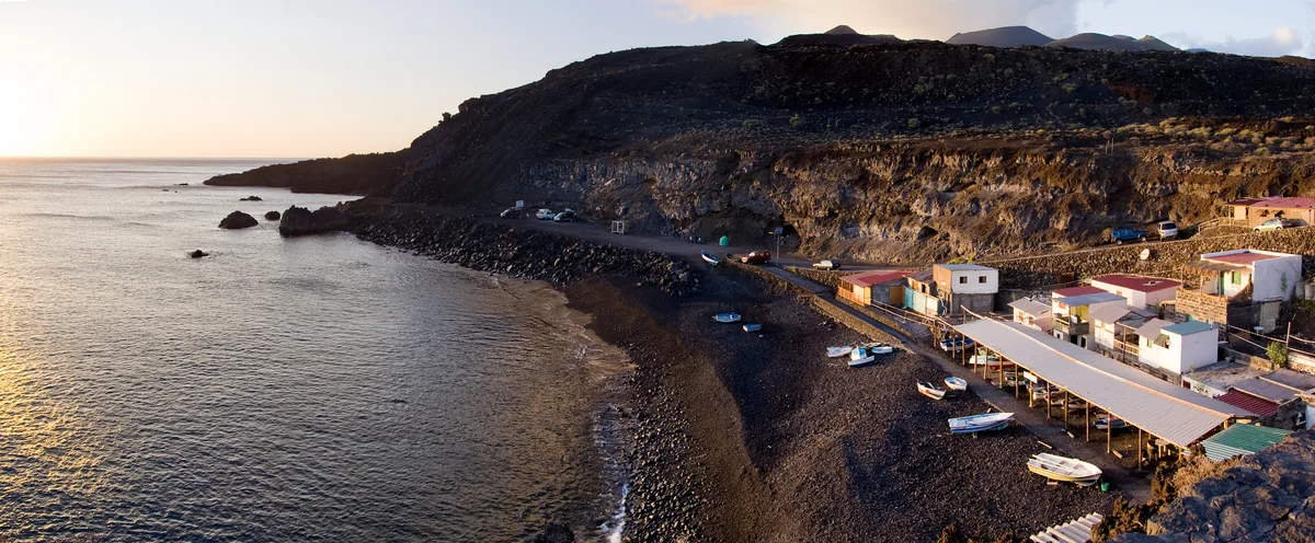
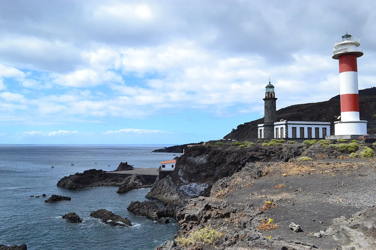
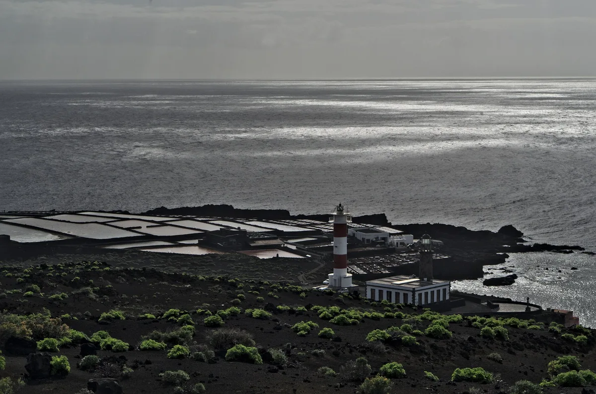
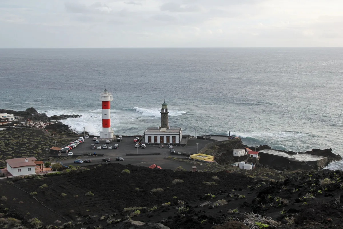
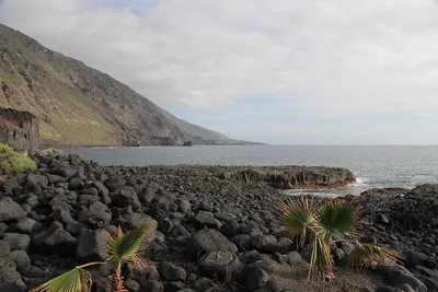
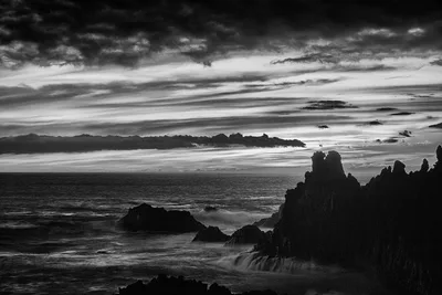
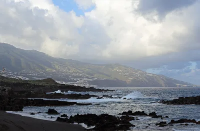
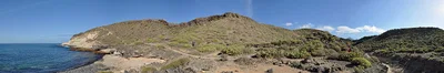
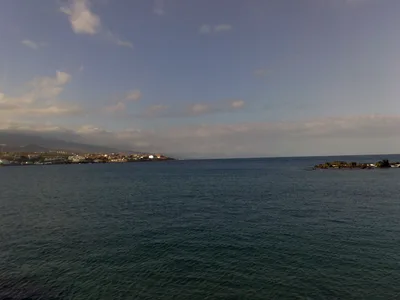
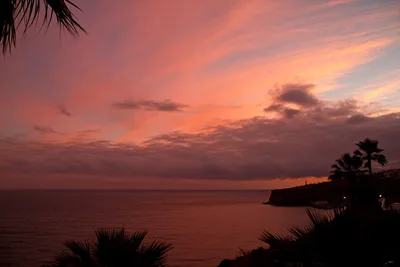
Playa de Echentive sits at the southern tip of La Palma, Canary Islands, shaped by the 1971 Teneguía eruption that pushed new land into the sea. The shoreline is a collision of black volcanic sand and open blue Atlantic — dramatic, unpolished, and deliberately hard to reach. You walk in on foot, with no facilities waiting at the other end, just raw lava rock and the sound of waves hitting ancient coastline. The Faro de Fuencaliente lighthouse stands close by, and the whole scene feels less like a beach and more like the edge of the world. It's quiet by nature — not by accident.
How to get there
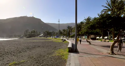
You can reach Playa de Echentive by car to the small free car park near the beach entrance or in the Fuencaliente lighthouse area, then continue on foot — the beach itself is foot-access only. Bus Route 23 from Los Canarios drops you nearby in around 5 minutes. Alternatively, hike in from the Fuencaliente lighthouse car park. There is no entry fee.
Who it's for
For couples
Playa de Echentive suits couples who want solitude and scenery over sunbeds — the walk-only access and absence of facilities keeps it genuinely quiet, and the raw lava coastline with the lighthouse in the distance is striking without being performative.
For families
Not recommended for families with young children — there are no facilities, no lifeguard, swimming is dangerous due to strong currents, and the lava path requires sturdy footwear. The terrain and water conditions make it unsuitable for little ones.
Our take
Do not come here expecting a beach day in the conventional sense — swimming is dangerous, there are no facilities, and the path in demands proper footwear. That said, Playa de Echentive is one of the most geologically honest places on La Palma. The black sand was laid down by a volcano that erupted within living memory, the lighthouse marks the island's southern edge, and the blue Atlantic stretches uninterrupted toward the horizon. It rewards the curious and the patient — people who want to understand a landscape, not just photograph it from a sun lounger. Come between June and September, check the flags, stay out of the water, and give it the respect it asks for.
What to do
The Faro de Fuencaliente lighthouse, just 1km away, offers panoramic views toward Tenerife and El Hierro — worth the short walk alone. Volcán de Teneguía, the volcano that last erupted in 1971 and directly created part of this shoreline, is 2km away and gives the geology here its full context. Nearby Fuente Santa, only 0.1km from the beach, and the Mirador Volcán de San Antonio at 2.6km round out a half-day of volcanic landscape exploration.
The black volcanic sand meeting the deep blue Atlantic gives you a high-contrast frame that needs no filter — shoot low from the shoreline.
The Faro de Fuencaliente lighthouse from the coastal path offers a clean, graphic composition with open ocean behind it. The raw lava rock formations along the shore, remnants of the 1971 Teneguía eruption, photograph well in raking side-light at dusk.
Where to eat
El Jardín de la Sal, 1km away, is your closest option — a regional restaurant with a focus on fish that suits the coastal setting well. La Casa del Volcán, 3.2km out, leans into regional cuisine with a volcanic-landscape backdrop. There is nothing to eat at the beach itself, so plan ahead.
Where to stay
La Palma & Teneguía Princess, 5.3km from the beach, is the closest full-service hotel option in the area. Villa los Torres II sits 5.1km away for a smaller-scale stay. Both require a short drive to reach the beach.
Photography
Shoot from the lava shoreline at golden hour — the contrast between black volcanic sand and deep blue Atlantic water is sharpest in low morning or late afternoon light. The Faro de Fuencaliente lighthouse framed against the open ocean makes a strong wide-angle composition from the coastal path.
Good to know
Do not enter the water — the beach is exposed to strong currents and swells that make open-sea swimming dangerous, particularly from November through March when southerly swells intensify. No lifeguard is on duty and there are zero facilities, so bring everything you need. Wear sturdy footwear; the path over lava rock is rough. Always check the flag system before approaching the shoreline, watch for rocks and possible jellyfish, and respect the protected coastal zone — this is a designated natural area.
Map
Nearby places
El Jardín de la Sal
La Guildera
La Casa del Volcán
Imperial
Parilla Junonia
Fuente Santa
Mirador Volcán de San Antonio
Mirador Astronómico Volcán de San Antonio
Faro de Fuencaliente (Lighthouse)
Volcán de Teneguía
Bodegas Carballo (Fuencaliente wine route)
Things to see around Fuencaliente de La Palma
Faro de Fuencaliente (Lighthouse)
Southernmost lighthouse of La Palma with panoramic views toward Tenerife and El Hierro.
Volcán de Teneguía
Volcano that last erupted in 1971, creating new land including part of this beach's shoreline.
Bodegas Carballo (Fuencaliente wine route)
Volcanic wine production zone near the southern tip; unique lava-field viticulture.
Frequently asked
The information on this page is provided for guidance only and may evolve. Access conditions, safety and infrastructure can change without notice. Always check official sources before traveling.
Nearest beaches
Other wild beaches in Canary Islands
More beaches in Canary Islands
Reviews of this beach
- No reviews yet, what a shame — leave yours and share your experience.
Photo credits
Sources and licenses for the photos shown above.
- Photo 1 — Jarek Prokop · source · CC BY 3.0
- Photo 2 — Eugen Kalloch · source · CC BY-SA 3.0
- Photo 3 — Jose.Madrid · source · CC BY 2.0
- Photo 4 — MartinD · source · CC BY-SA 3.0
- Photo 5 — Michael Staats · source · CC BY-SA 3.0
- Photo 6 — EduardMarmet · source · CC BY-SA 2.0