Coastlands BeachUnited States Beach Guide
Dark sand, wild cliffs, and serious Big Sur solitude
About
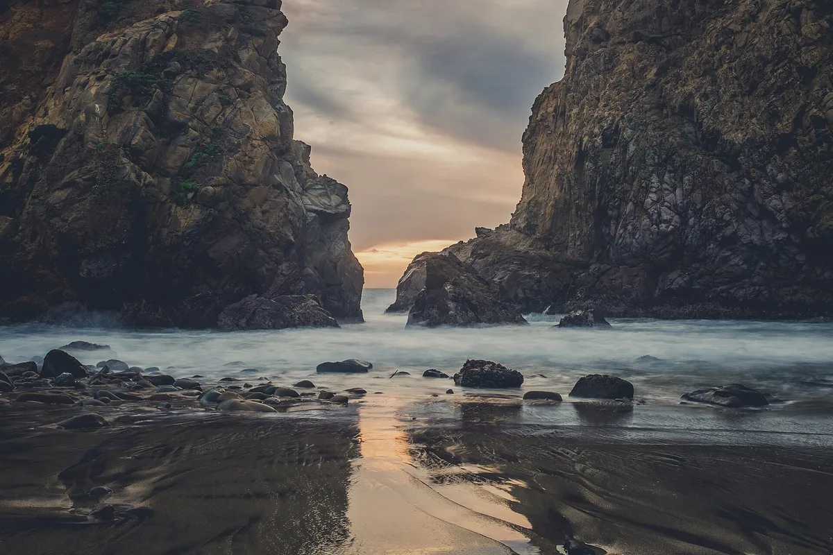
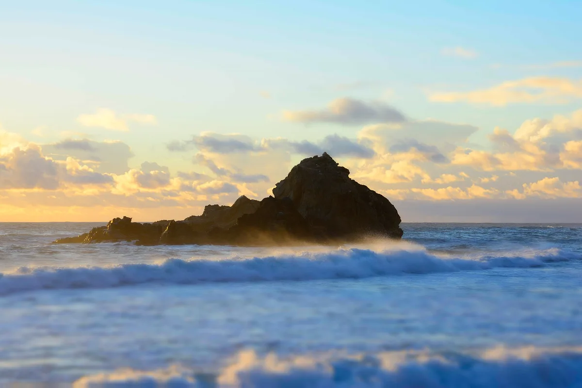
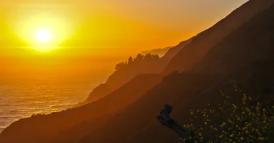
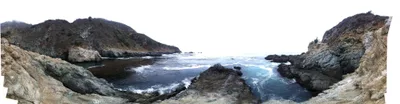
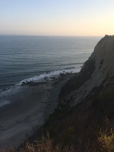
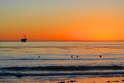
Coastlands Beach is a narrow strip of dark grey sand wedged at the base of Big Sur's coastal cliffs, facing the open blue Pacific. It's small, unmarked, and almost entirely unknown — exactly the kind of place you stumble onto with local knowledge and a willingness to work for it. A freshwater seep weeps down the cliff face, feeding a delicate fern microhabitat that clings to the rock in defiance of the salt air. The sand is dark and fine, the surf rough, and the atmosphere genuinely wild. Above the beach, the historic Coastlands community sits quietly on the headland, lending the cove a sense of layered, unhurried history.
How to get there
From Highway 1, look for a roadside pullout near the Coastlands community gate — parking is free but limited to one or two vehicles. The path down is steep, overgrown in places, and completely unmarked; there is no signage and no maintained trail. Access is rated difficult, and the path borders private land, so stay strictly on the public coastal strip. Allow around 15 minutes from the highway.
Who it's for
For couples
If you and your partner are comfortable with a rough, unmarked approach, the near-certain solitude here is rare on the California coast — you'll likely have the entire dark sand strip to yourselves.
For families
Not suitable for families with young children. The access path is steep and overgrown, swimming is dangerous, there are no facilities, and there is no cell service in an emergency.
Our take
Do not come here expecting a swim, a snack bar, or a signpost — there are none of those things. The surf at Coastlands is rough and swimming is not advised under any circumstances. What you do get is a genuinely uncommon coastal experience: dark sand, a living fern wall fed by a cliff seep, and the kind of quiet that's hard to find on Highway 1 in summer. The access is real work — a steep, unmarked, potentially overgrown path that borders private land — and that's precisely why the beach stays empty. Come between June and September, carry everything in and out, and respect the private land boundary without exception. For photographers and coastal explorers who want something beyond the Pfeiffer Beach car park, this is worth the effort.
What to do
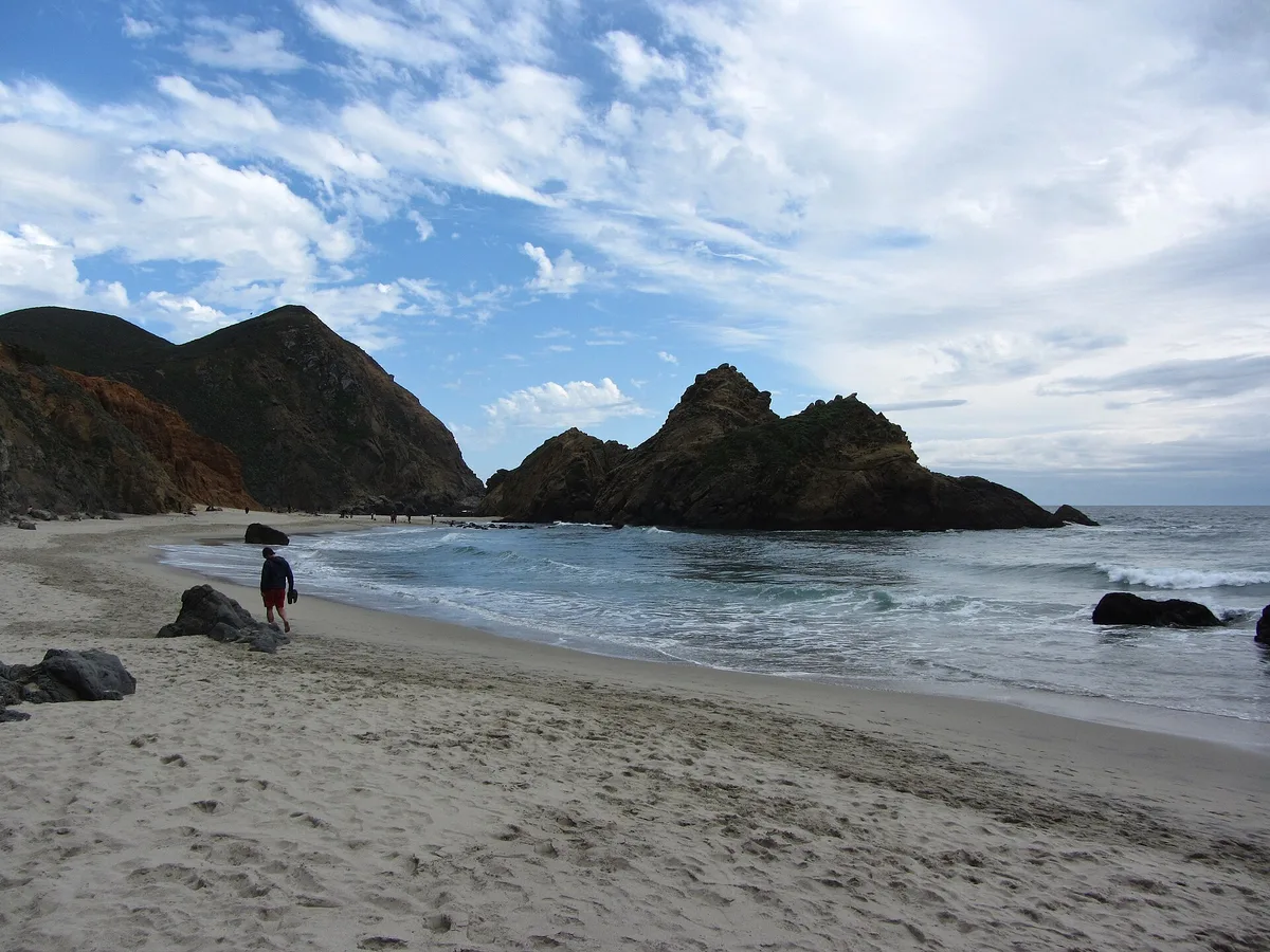
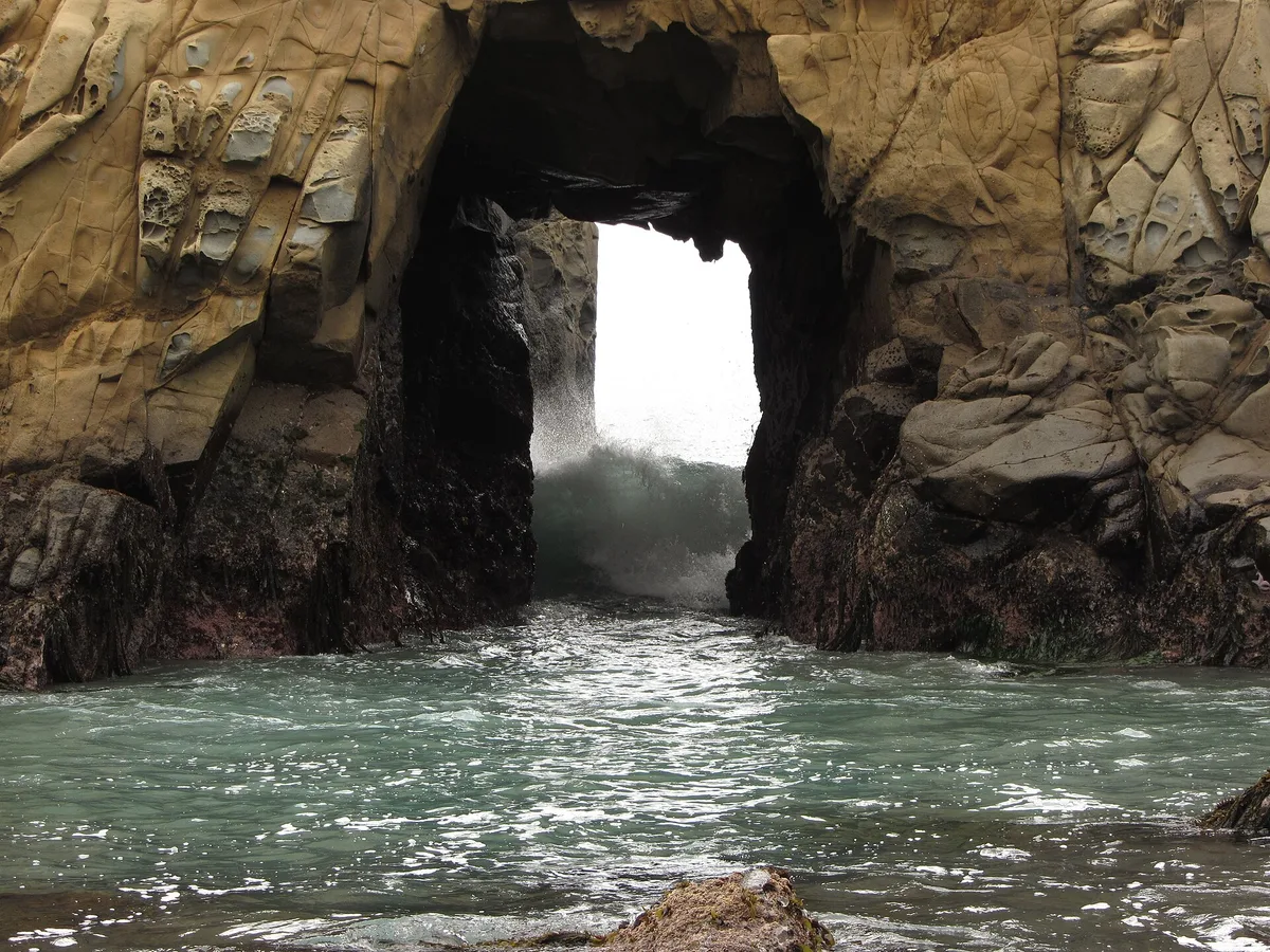
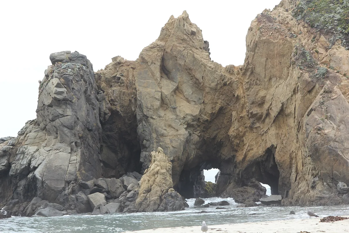
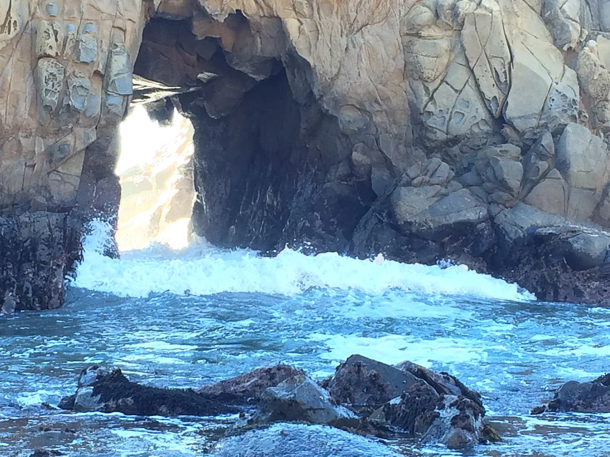
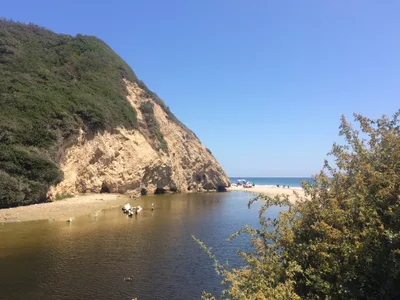
Three kilometres away, Pfeiffer Beach offers a striking contrast: purple-tinged sand and a famous keyhole sea arch that draws photographers from across California. Pfeiffer Big Sur State Park, four kilometres up the road, has redwood groves and river hiking trails worth a half-day. For a short detour on the way back, the Albino Redwood Tree is 3.2 kilometres away — a genuinely rare find on the Big Sur coast.
The fern microhabitat clinging to the cliff beside the freshwater seep is unlike anything else on the Big Sur coast — get close and use the rock texture as your backdrop.
From the sand, a wide shot of the dark grey beach strip framed by the cliff walls with the deep blue ocean beyond captures the raw, compressed drama of the cove.
Where to eat
Big Sur Roadhouse and Ripplewood Cafe are both around 3.2 kilometres away and make a practical stop before or after the hike. Fernwood Grill, 3.3 kilometres out, covers pizza and burgers if you want something casual. For a more scenic meal, Nepenthe sits 47 kilometres south with clifftop views over the coast.
Where to stay
Alila Ventana Big Sur, 5.1 kilometres away, is the closest lodging option to the beach. It's a high-end property set in the Big Sur hills — a comfortable base for exploring this stretch of coast.
Photography
The freshwater seep and fern-covered cliff face make for an unusual close-up subject — shoot in the soft light of early morning when the rock face is shaded. Step back toward the waterline for a wide composition of dark grey sand against the deep blue ocean and the cliff framing the cove.
Good to know
Avoid March through May — the path can be heavily overgrown in spring and winter surf makes the beach actively dangerous. There is no cell service here, so download offline maps before you leave. No fires are permitted, and you must pack out everything you bring in; there are zero facilities. Stay on the public coastal strip at all times — private land sits immediately adjacent and the boundary is not signed.
Map
Nearby places
Alila Ventana Big Sur
Things to see around Big Sur, Monterey County
Pfeiffer Beach
Purple-sand beach with keyhole sea arch, the most photographed beach on the Big Sur coast.
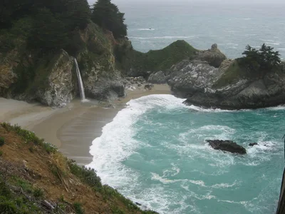
McWay Falls
80-foot waterfall dropping onto an inaccessible cove beach.
Pfeiffer Big Sur State Park
Redwood groves, river swimming, and extensive hiking trails.
Frequently asked
The information on this page is provided for guidance only and may evolve. Access conditions, safety and infrastructure can change without notice. Always check official sources before traveling.
Nearest beaches
Other wild beaches in United States
More beaches in California Coast
Reviews of this beach
- No reviews yet, what a shame — leave yours and share your experience.
Photo credits
Sources and licenses for the photos shown above.