Notleys Landing BeachUnited States Beach Guide
Where Big Sur's industrial past meets the wild Pacific
About
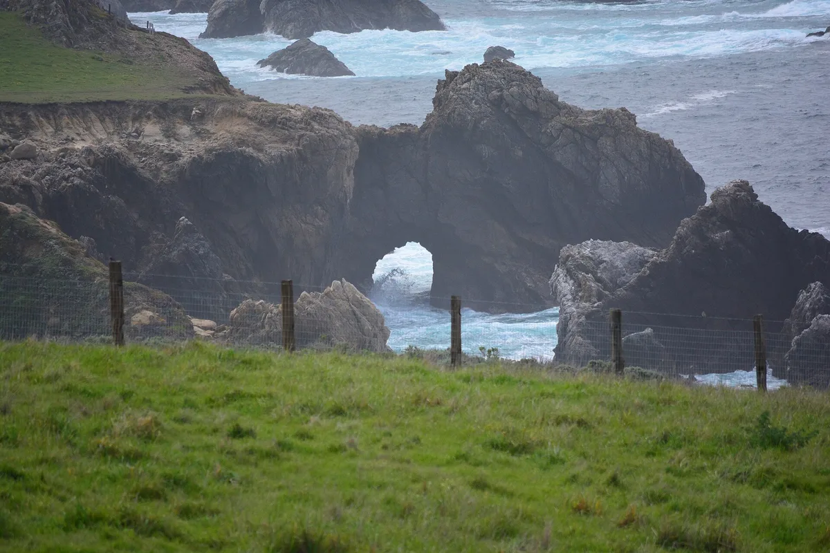
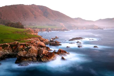
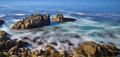
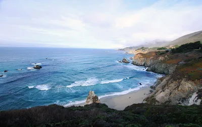
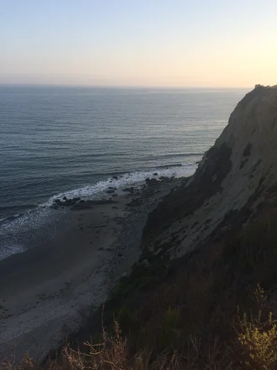
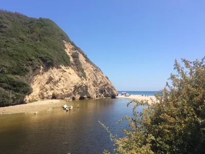
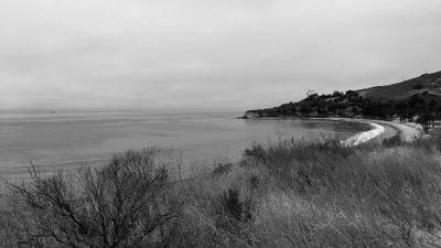
Notleys Landing Beach is a raw, gravel-only pocket of coastline tucked into Garrapata State Park, roughly 12 miles south of Carmel on Highway 1. The grey gravel shore is flanked by dramatic cliffs where rusted cable anchor hardware still clings to the rock — physical remnants of a 19th-century tanbark landing operation that once loaded ships along this stretch of coast. The blue Pacific stretches wide and open before you, uninterrupted and forceful. There are no signs, no facilities, and no other visitors most days — just the sound of surf, the smell of salt, and the weight of industrial history pressed into the cliff face. This is Big Sur stripped of any pretense.
How to get there
Drive Highway 1 to the Notleys Landing area, approximately 12 miles south of Carmel-by-the-Sea — the descent to the beach begins roadside with no trail signage, so go slowly and watch carefully. Roadside pullout parking is free but extremely limited; arrive early or you'll have nowhere to stop. The path down is steep and unmarked, and the beach itself is completely inaccessible to anyone with mobility limitations. There is no entry fee.
Who it's for
For couples
For couples who share a taste for solitude and history, this is one of the few places on the California coast where you'll have a genuinely empty shoreline and a story to tell — the 19th-century tanbark landing ruins make it feel more like a discovery than a day trip.
For families
Notleys Landing Beach is not suitable for families with young children. The steep unmarked descent, complete absence of facilities, dangerous water conditions, and a beach that vanishes at high tide make it an inappropriate choice for anyone traveling with kids.
Our take
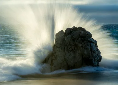
Do not enter the water here. Swimming is dangerous, there are no lifeguards, and the beach can be reduced to nothing at high tide — this is not a swimming beach by any measure. What Notleys Landing offers instead is something rarer on the California coast: a genuinely empty, historically layered site that most Highway 1 drivers pass without ever knowing it exists. The 19th-century tanbark landing remnants and rusted cliff hardware are the draw — industrial archaeology on a wild gravel shore. Come between June and September, check the tide tables, and treat the unmarked descent with respect. Avoid December through February entirely, when winter tides eliminate the beach and rain makes the path treacherous. Worth the detour for history-minded explorers who know what they're looking for.
What to do
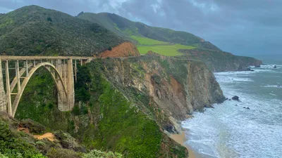
Kasler Point sits just 1.3km away and rewards the short walk with exposed headland views over the open Pacific. A little further, Calla Lily Valley and Rocky Creek Bridge — both around 2.4km out — offer a striking contrast of wildflower-filled canyon and historic highway engineering. For a bigger excursion, Bixby Creek Bridge is 8km up the road, one of the most photographed spans on the California coast, and Point Lobos State Natural Reserve is 14km north, where sea lions, otters, and exceptional tidepools make for a full afternoon.
The rusted cable anchor hardware bolted into the cliff is unlike anything else on the Big Sur coast — get close and shoot upward to show the scale of the ironwork against the rock face.
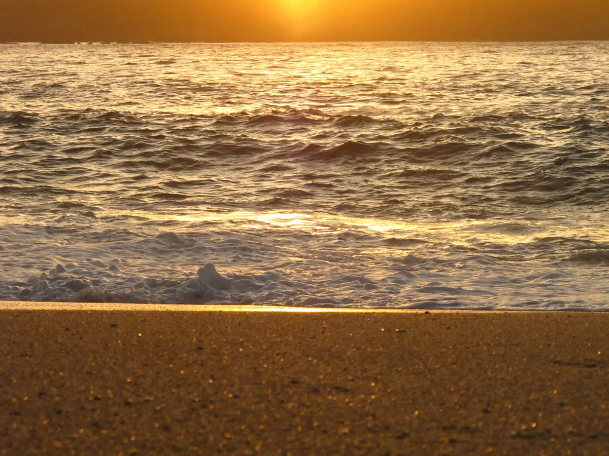
At low tide, the grey gravel shore curving into the blue Pacific makes a stark, moody wide shot with no other visitors in frame.
Where to eat
The nearest dining options require a drive of at least 11km. Pacific's Edge, about 11.5km away, is a well-regarded coastal restaurant with strong reviews and ocean views. The Hacienda at Santa Lucia Preserve, roughly 10.8km out, is a more intimate option with an excellent reputation, while Baja Cantina is a casual alternative around 14.7km from the beach.
Where to stay
Highlands Inn, A Hyatt Residence Club, sits approximately 11.5km from the beach and is the closest lodging option to Notleys Landing. It offers a comfortable base for exploring this stretch of Big Sur coastline.
Photography
The rusted cable anchor hardware embedded in the cliff face is the single most compelling subject on this beach — shoot it in the flat light of early morning to bring out the texture of iron against grey rock. At low tide, step back toward the waterline and frame the gravel shore against the blue Pacific for a composition that captures both the industrial past and the wild coast.
Good to know
No facilities exist here — carry everything in and out, including water and a first-aid kit. Do not disturb or remove the historic cable anchor hardware in the cliff; it is part of the site's protected industrial heritage. The beach shrinks dramatically at high tide and can disappear entirely, so check tide tables before you descend. There are no lifeguards, and the steep unmarked descent is easy to miss — if you reach Garrapata Beach, you've gone too far north.
Map
Nearby places
Highlands Inn, A Hyatt Residence Club
Things to see around Carmel Highlands, Monterey County
Garrapata Beach
Dark-sand pocket beaches with sea otters and kelp beds.
Point Lobos State Natural Reserve
Marine reserve with sea lions, otters, and exceptional tidepools.
Bixby Creek Bridge
Iconic open-spandrel arch bridge on Highway 1.
Frequently asked
The information on this page is provided for guidance only and may evolve. Access conditions, safety and infrastructure can change without notice. Always check official sources before traveling.
Nearest beaches
Other wild beaches in United States
More beaches in California Coast
Reviews of this beach
- No reviews yet, what a shame — leave yours and share your experience.
Photo credits
Sources and licenses for the photos shown above.
- Photo 1 — DeeAshley · source · CC BY 2.0
- Photo 2 — Joe Mabel · source · CC BY-SA 4.0
- Photo 3 — stevelyon · source · CC BY-SA 2.0