Bowling Ball BeachUnited States Beach Guide
California's geological oddity: spheres meet the sea
About
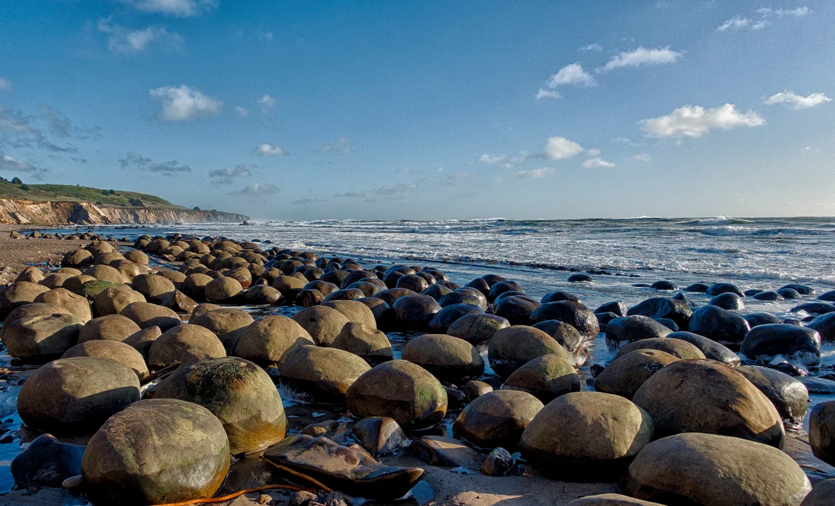
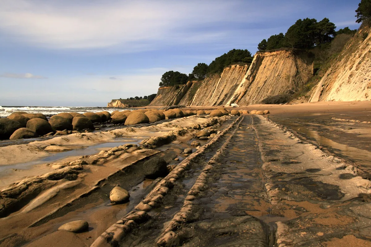
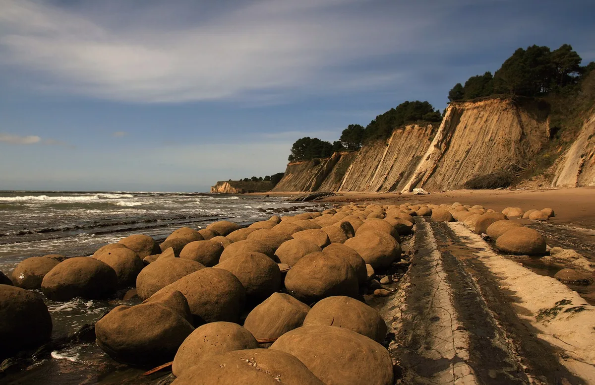
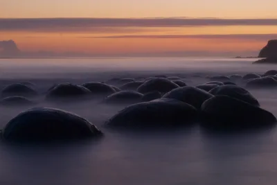
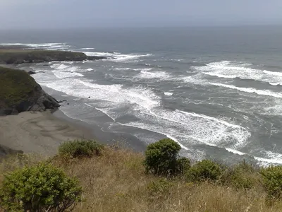
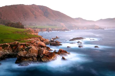
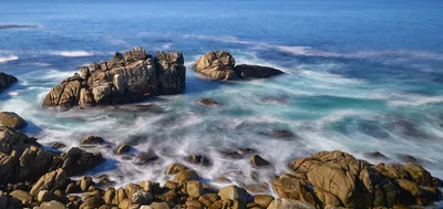
Bowling Ball Beach sits on the Mendocino Coast near Point Arena, a raw stretch of wave-cut rock platform where dozens of near-perfect spherical sandstone concretions emerge from the shoreline like nature's own sculpture garden. The water runs grey and cold, the sky often overcast, and the air carries the sharp salt of the open Pacific — this is wild California, not postcard California. There's no sand to speak of, just ancient rock, the rumble of surf, and those extraordinary stone spheres that have been forming for millions of years. The concretions are only visible at minus tides, which makes every visit feel earned. At roughly 200 metres of accessible platform, it's compact but geologically unlike anywhere else on the California coast.
How to get there
Drive Highway 1 to the Schooner Gulch trailhead, just north of Point Arena. A free roadside pull-off with a small parking area serves two trailheads — no fee, no app required. From the trailhead it's a 20-minute hike down to the beach; access is rated moderate. Before you leave home, check NOAA tide tables — the concretions are only exposed at minus tides, and timing your visit wrong means seeing nothing but water.
Who it's for
For couples
A quiet, unhurried walk down to a beach that feels genuinely remote — the 20-minute trail, the timed tide window, and the eerie beauty of the concretion field give the visit a shared-adventure quality that's hard to manufacture elsewhere on the California coast.
For families
Older children with sturdy shoes and an interest in geology will find this genuinely fascinating, but the steep slippery trail, dangerous water, and tide-dependent access make it unsuitable for toddlers or anyone with limited mobility — plan carefully and check the tide tables well in advance.
Our take
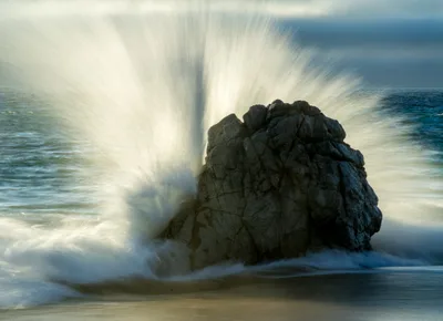
Do not enter the water here — the conditions are dangerous, full stop. That said, Bowling Ball Beach earns its reputation for one very specific reason: those concretions are genuinely extraordinary, and standing among them on a clear minus-tide morning is an experience with no equivalent on the California coast. The 5-minute hike, the tide dependency, and the lack of any facilities keep visitor numbers low, which is exactly the point. Come in summer when the trail is dry and the tides cooperate, wear proper footwear, and time your visit to the minute using NOAA tables. Skip December through February — winter storms make the rock platform actively dangerous and the trail a muddy slide. This is a geology pilgrimage, not a beach day, and it rewards the prepared visitor completely.
What to do
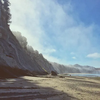
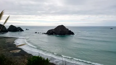
The adjacent Schooner Gulch State Beach, just 0.1km away, offers a sandy cove with sandstone cliffs and a good surf-watch vantage point — worth combining into the same outing. About 10km up the coast, Point Arena Lighthouse is the tallest lighthouse on the US West Coast and open for tours with panoramic Pacific views. The Stornetta Public Lands, roughly 8km away, add coastal bluff walks with sea caves and lava tubes near the lighthouse for those who want a full day on this stretch of coast.
The concretion field at minus tide is the defining shot — position yourself low on the rock platform with the spheres receding toward the grey Pacific horizon.
Schooner Gulch, just 0.1km away, adds sandstone cliff framing for a wider coastal composition when the light is soft in the late afternoon.
Where to eat
Point Arena, about 6.6km away, covers the bases well: The Pier Chowder House and Tap Room and Pier Place both serve seafood, while Point Arena Pizza is the go-to if you want something casual after the hike. River Grill is a short drive further at 8km, and if you're in the mood for something different, Anchor Bay Thai Kitchen is 10.2km south. There's nothing to eat at the beach itself, so fuel up before you head down the trail.
Where to stay
The Wildflower Boutique Motel and Point Arena, both rated 4.9/5 and roughly 5.1km away, are the closest options and clearly well-loved by guests. B Bryan Preserve, 5.2km out with a 4.7/5 from nearly 350 reviews, offers a more distinctive stay. The Wharf Master's Inn in Point Arena, 6.5km away, is a reliable mid-range choice with a strong track record.
Photography
The prime shot is at minus tide during the golden hour before sunset, when low-angle light casts long shadows across the concretion field and the grey Pacific fills the background — arrive early to scout your composition before the tide turns. The wave-cut rock platform itself makes a strong foreground element, and the contrast between the perfectly spherical boulders and the jagged coastal rock is the image you came for.
Good to know
Check NOAA tide tables before every visit — the concretions are only accessible at minus tide, and the window can be short. The trail is steep and becomes seriously slippery when wet, so wear sturdy, non-slip shoes; this is not a flip-flop beach. Do not remove or damage the concretions — they are a geological rarity and protected; leave every sphere exactly where you find it. Dogs are welcome on leash, fires are not permitted anywhere on the beach, and swimming is dangerous — do not enter the water.
Map
Nearby places
The Pier Chowder House and Tap Room
Point Arena Pizza
Pier Place
River Grill
Anchor Bay Thai Kitchen
Wildflower Boutique Motel
Point Arena
B Bryan Preserve
Wharf Master's Inn
GEVC at Lighthouse Pointe
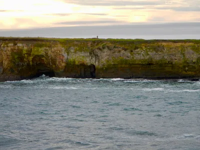
Point Arena-Stornetta Public Lands
Point Arena Lighthouse
Point Arena-Stornetta Unit - California Coastal National Monument
Point Arena Lighthouse
Schooner Gulch State Beach
Stornetta Public Lands
Things to see around Point Arena
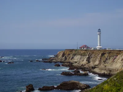
Point Arena Lighthouse
Tallest lighthouse on the US West Coast, open for tours with panoramic Pacific views.
Schooner Gulch State Beach
Sandy cove adjacent to Bowling Ball Beach with sandstone cliffs and surf-watch spot.
Stornetta Public Lands
BLM coastal bluffs with sea caves and lava tubes near Point Arena Lighthouse.
Frequently asked
The information on this page is provided for guidance only and may evolve. Access conditions, safety and infrastructure can change without notice. Always check official sources before traveling.
Nearest beaches
Other wild beaches in United States
More beaches in California Coast
Reviews of this beach
- No reviews yet, what a shame — leave yours and share your experience.
Photo credits
Sources and licenses for the photos shown above.
- Photo 1 — snowpeak · source · CC BY 2.0
- Photo 2 — Peter Alfred Hess · source · CC BY 2.0
- Photo 3 — Peter Alfred Hess · source · CC BY 2.0
- Photo 4 — Brocken Inaglory · source · CC BY-SA 3.0
- Photo 5 — Brocken Inaglory · source · CC BY-SA 3.0