Chadbourne Gulch BeachUnited States Beach Guide
Raw BLM coastline where only the determined arrive
About
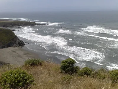
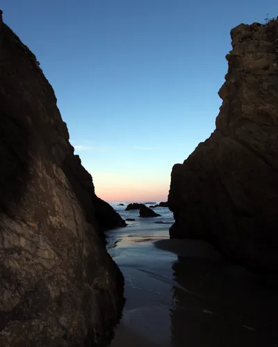
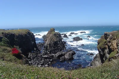
Chadbourne Gulch Beach sits on a wild stretch of the Mendocino Coast north of Westport, California — BLM land with no signage, no facilities, and no apology for either. The shore is a cobble-and-grey-sand mix, rough underfoot, shaped by the same relentless Pacific surge that keeps swimmers away. Grey water meets grey stone in a palette that feels elemental rather than postcard-pretty. At roughly 100 metres long, it's a small pocket of coast that rewards patience and punishes unpreparedness. You'll almost certainly have it to yourself.
How to get there
From Highway 1 north of Westport, pull off roadside — there is no formal parking area, only a narrow shoulder, so use extreme caution when stopping. An unmaintained, unmarked trail leads down to the beach; allow around 20 minutes on foot. There is no signage marking the trailhead, no entry fee, and no BLM infrastructure of any kind. The trail may be completely impassable when overgrown in late summer or waterlogged in winter.
Who it's for
For couples
For couples who prefer solitude over scenery-by-committee, Chadbourne Gulch delivers — you'll almost certainly share the grey-sand cobble shore with no one else, making it a genuinely private stretch of wild California coast.
For families
Not suitable for families with young children — the access trail is steep and unmaintained, there are no facilities, swimming is strictly dangerous, and rattlesnakes are a real possibility in dry season. Leave this one for experienced hikers.
Our take
Do not come here expecting comfort, signage, or a lifeguard. Chadbourne Gulch is BLM land in the truest sense — unmanaged, unmarked, and unforgiving if you're underprepared. The water is off-limits: strong surge on an exposed shore means no swimming, full stop. What you do get is a cobble-and-grey-sand pocket of California coast that almost no one visits, reached by a trail that may or may not be passable depending on the season. Go in June or September, tell someone where you're headed, carry everything you need, and leave nothing behind. It's not a beach for everyone — that's exactly the point.
What to do
Surf fishing is the main draw for those who make the trek, with the cobble shore offering a solid casting platform. About 3 kilometres south, Westport-Union Landing State Beach offers bluff-top camping above a dark-pebble beach with sweeping Pacific views — a worthwhile add-on. Further afield, MacKerricher State Park (30km) has a seal colony and a ten-mile cycling trail, and tide pools are accessible around 14 kilometres away along the coast.
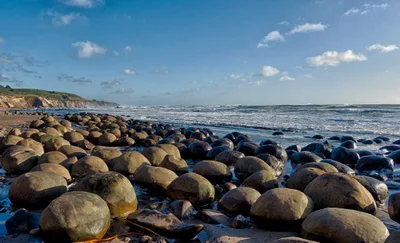
The cobble-and-grey-sand shoreline shot low and wide, with the Pacific horizon filling the frame, captures the elemental mood of this place.
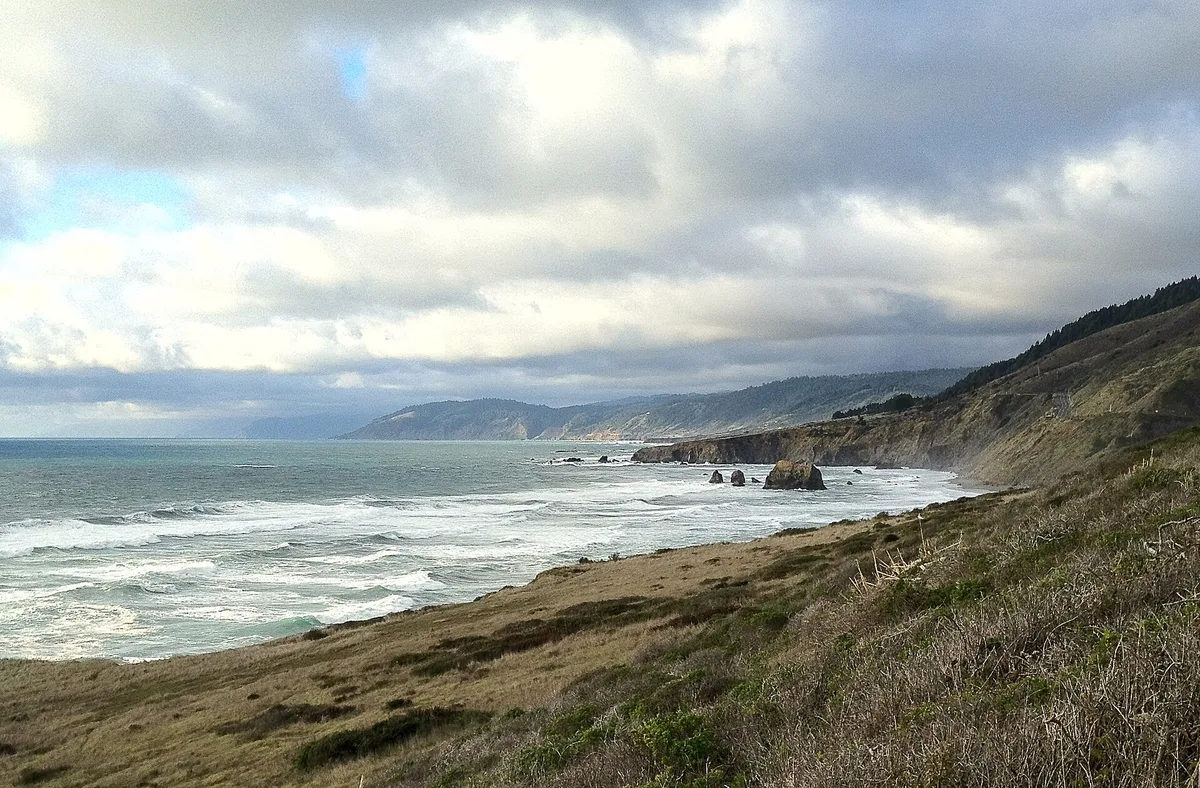
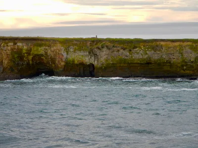
The unmarked bluff trail looking down toward the beach — especially in morning coastal fog — gives a sense of genuine remoteness that no manicured beach can replicate.
Where to eat
There are zero food options at the beach — pack everything in and pack everything out. The Westport Hotel, about 2.3 kilometres away, is the closest option and earns strong local praise. Bring more water than you think you need; the trail back is steep.
Where to stay
The Westport Hotel (2.3km) doubles as the area's best-reviewed place to stay and eat. Lost Coast Inn in Westport (2.9km) is another well-regarded option close to the trailhead area. The Inn at Newport Ranch, roughly 4 kilometres away, offers a more expansive coastal retreat if you want more comfort after a rough day on the trail.
Photography
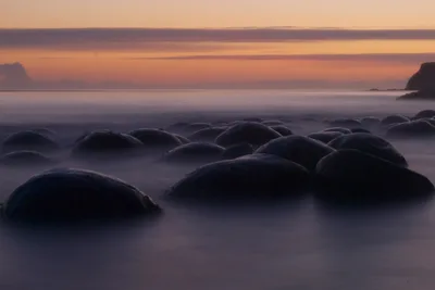
The grey-on-grey palette of cobble, dark sand, and open ocean reads beautifully in overcast morning light — arrive early in June or September when the trail is clear and coastal fog softens the contrast. The shoreline looking back toward the bluff, with the unmarked wild trail above, captures the raw BLM character of this place better than any wide seascape shot.
Good to know
Do not enter the water — this is an exposed shore with powerful surge, and swimming is strictly dangerous. No fires are permitted, there are no facilities whatsoever, and you must pack out all waste you bring in. The trail can be overgrown by late summer and impassable after winter rain; July, August, December, and January are best avoided entirely. There is no cell service on site, and rattlesnakes are possible in dry season — watch where you step and tell someone your plan before you go.
Map
Nearby places
Westport Hotel
Seagate Vacation Rental
Westport Hotel
Lost Coast Inn, Westport
The Inn at Newport Ranch
Verbo sweetcove
Westport-Union Landing State Beach
Usal Beach
MacKerricher State Park
Things to see around Westport
Westport-Union Landing State Beach
Three miles of bluff-top camping above dark-pebble beach with Pacific horizon views.
Usal Beach
Remote grey-sand beach at the Lost Coast gateway, accessible via high-clearance vehicle.
MacKerricher State Park
Ten-mile coastal park with seal colony and cycling trail north of Fort Bragg.
Frequently asked
The information on this page is provided for guidance only and may evolve. Access conditions, safety and infrastructure can change without notice. Always check official sources before traveling.
Nearest beaches
Other wild beaches in United States
More beaches in California Coast
Reviews of this beach
- No reviews yet, what a shame — leave yours and share your experience.
Photo credits
Sources and licenses for the photos shown above.
- Photo 1 — diaper · source · CC BY 2.0
- Photo 2 — Tony Webster from Portland, Oregon · source · CC BY-SA 2.0