Grimes PointUnited States Beach Guide
Raw Big Sur cove for those who know where to look
About
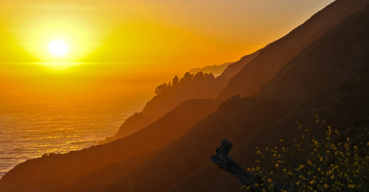
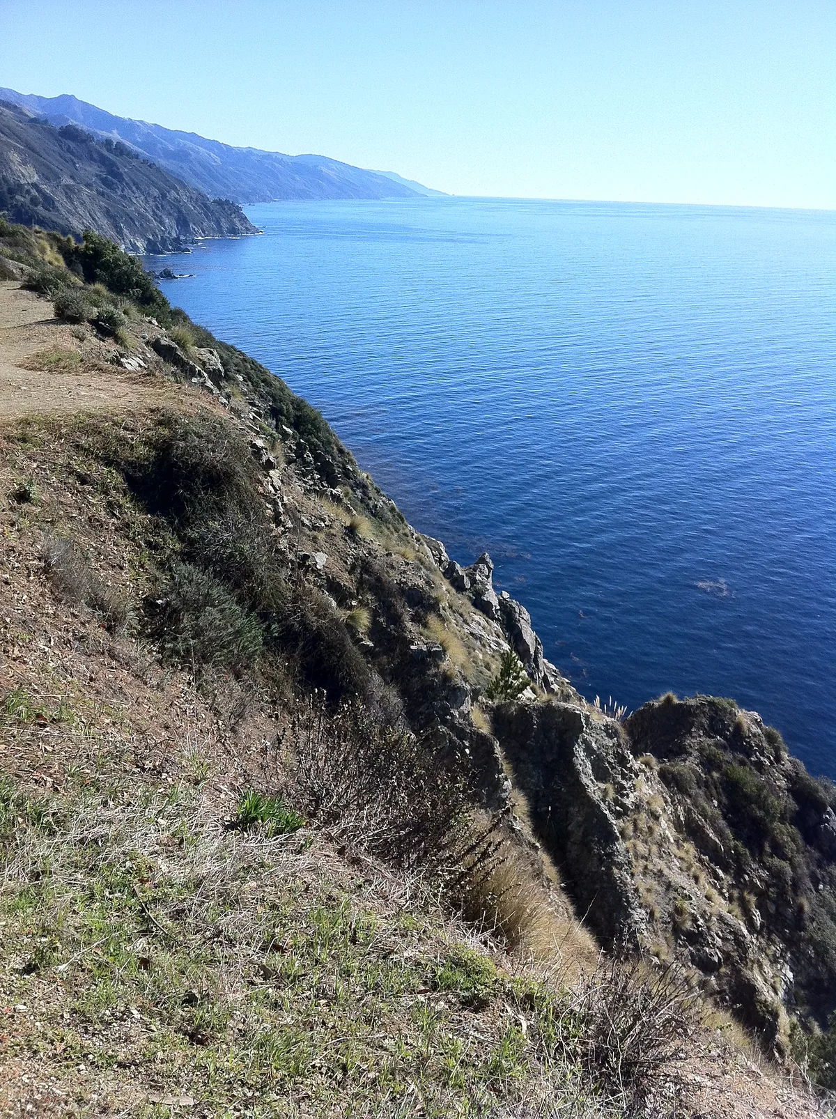
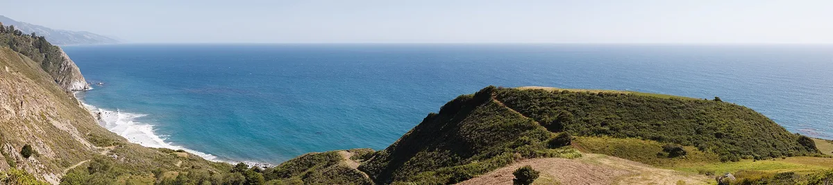
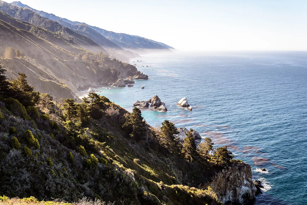
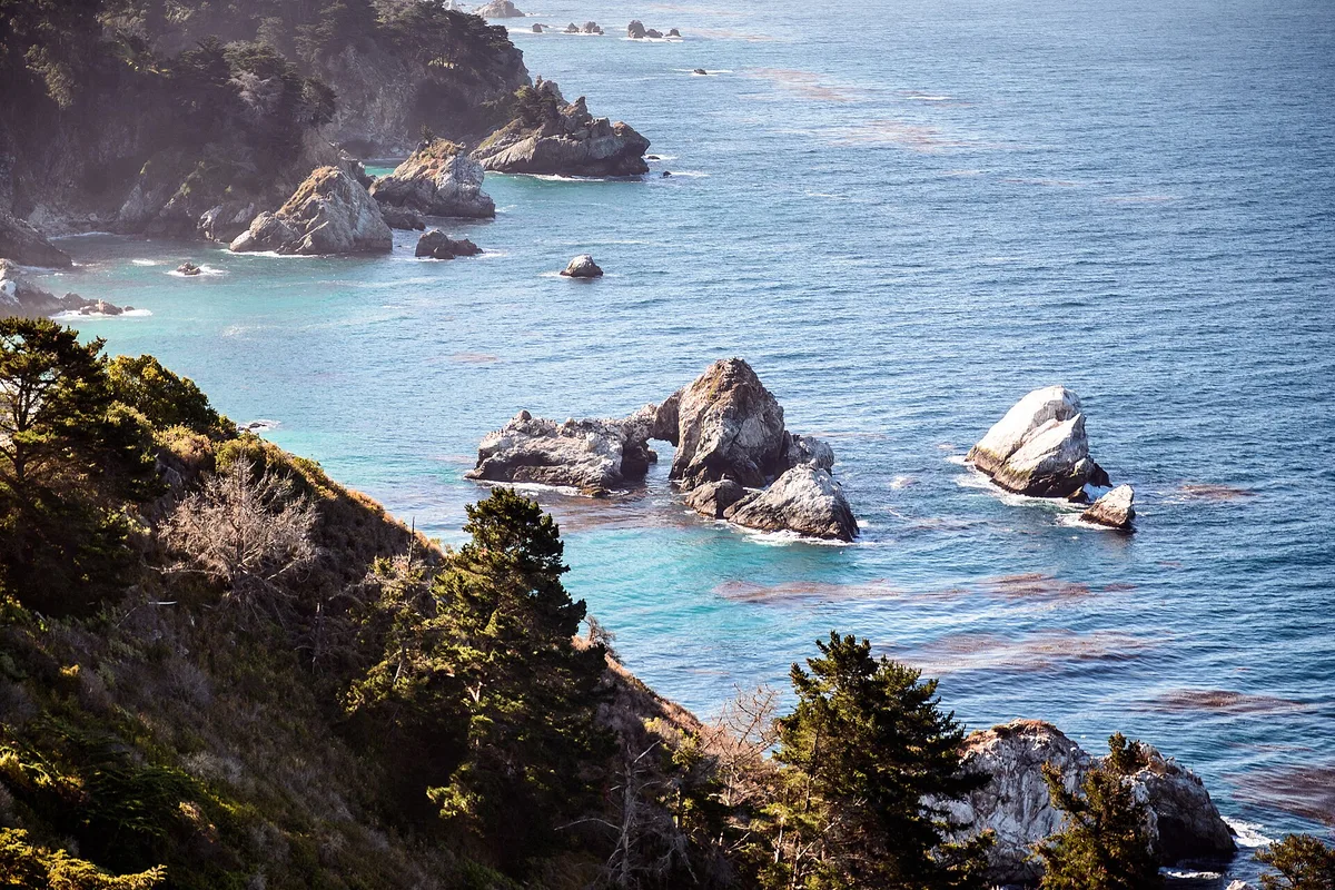
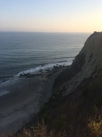
Grimes Point is a rocky, boulder-fringed cove tucked into the chaparral canyon coastline of Big Sur, California. There's no sand here — just dark stone, deep blue Pacific water, and the kind of silence that only comes when a place has no signage and no trail marker to invite the uninitiated. The cove sits within the Garrapata State Park boundary, though you'd never know it from the road. On weekdays, you may have it entirely to yourself. It's wild in the truest sense — raw coast, no facilities, and a descent that demands your full attention.
How to get there
Look for an unsigned roadside pullout on Highway 1 near Grimes Point — it fits just 2 to 3 vehicles and is free. From there, reaching the cove takes roughly 15 minutes on foot, but the descent involves a boulder scramble that requires the use of your hands. There is no trail marker and no signage of any kind, so local knowledge is essential before you attempt this.
Who it's for
For couples
If you and your partner are both comfortable with a hands-on boulder scramble, the complete solitude on weekdays makes Grimes Point an unusually private stretch of Big Sur coast — no other visitors, just open blue water and raw chaparral. Come prepared and treat it as an adventure, not a stroll.
For families
Grimes Point is not suitable for families with children. The boulder scramble descent requires hands, the surf is dangerous, there are no facilities, and there is no cell service in an emergency. Pfeiffer Beach, 10km away, is a far safer and more accessible Big Sur option for families.
Our take
Be honest with yourself before you come here. The descent is loose, requires hands, and is genuinely dangerous in wet conditions — this is not a beach walk, it's a scramble. Do not enter the water; the surf is dangerous and there are no lifeguards, no cell service, and no one coming to help. That said, for experienced hikers who respect those conditions, Grimes Point delivers something increasingly rare on the California coast: complete solitude, raw chaparral scenery, and deep blue open ocean with no one else around. The unsigned pullout, the boulder approach, the absence of any infrastructure — it all filters out casual visitors and leaves the place to those who earned it. Come between June and September, pack out your trash, and treat this cove with the seriousness it demands.
What to do
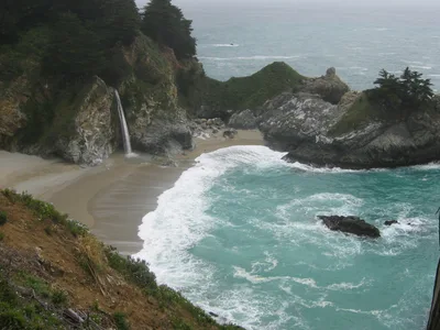
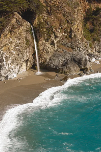
Partington Cove, just 3km away, is a rocky inlet reached through a hand-cut cliff tunnel with its own quiet drama. McWay Falls at 5km offers a viewpoint over an 80-foot waterfall dropping onto an inaccessible cove beach inside Julia Pfeiffer Burns State Park — one of the most photographed scenes on the California coast. Pfeiffer Falls is 6.9km away for a forest hike, and Pfeiffer Beach, with its purple-sand shore and keyhole sea arch, is worth the 10km drive.
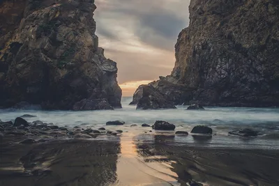
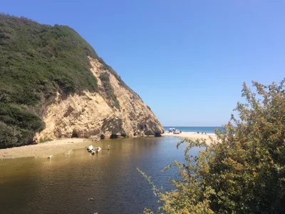
The boulder foreground with deep blue Pacific water and Lafler Rock in the distance is the defining shot at Grimes Point.
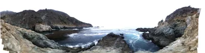
The chaparral canyon walls framing the cove give a second strong composition that conveys just how remote and unmanaged this place really is.
Where to eat
Nepenthe, 7.7km away, is the classic Big Sur stop — perched on a cliff with views to match. Fernwood Grill at 7.9km covers pizza and burgers if you want something casual after the scramble. Big Sur Roadhouse is another option at 8.7km for a more substantial meal on the way back.
Where to stay
Alila Ventana Big Sur, 3.4km from the cove, is the nearest place to stay — a high-end resort that puts you right in the heart of Big Sur's coastal landscape. Booking well in advance is advisable, especially for summer visits.
Photography
Shoot from the boulder field looking out over the deep blue water toward Lafler Rock for the most dramatic composition — early morning light is cleanest before coastal haze builds. The chaparral canyon framing the cove makes for a strong wide shot that captures the isolation of the place.
Good to know
There are zero facilities here — no toilets, no water, no trash cans — so pack out everything you bring in, without exception. The surf is dangerous: do not enter the water. Locals with years of experience here only consider the water in dead-calm summer conditions, and even then the risk is real. The descent path is loose and requires hands; in wet weather it becomes genuinely hazardous. There is no cell service and no lifeguard, so tell someone where you're going before you leave the car.
Map
Nearby places
Alila Ventana Big Sur
Things to see around Big Sur, Monterey County
McWay Falls
80-foot waterfall dropping onto an inaccessible cove beach in Julia Pfeiffer Burns State Park.
Partington Cove
Rocky cove accessed through a hand-cut cliff tunnel with historic landing history.
Pfeiffer Beach
Purple-sand beach with keyhole sea arch.
Frequently asked
The information on this page is provided for guidance only and may evolve. Access conditions, safety and infrastructure can change without notice. Always check official sources before traveling.
Nearest beaches
Other wild beaches in United States
More beaches in California Coast
Reviews of this beach
- No reviews yet, what a shame — leave yours and share your experience.
Photo credits
Sources and licenses for the photos shown above.
- Photo 1 — samiamx · source · CC BY 2.0
- Photo 2 — dwhartwig · source · CC BY 2.0
- Photo 3 — King of Hearts · source · CC BY-SA 3.0
- Photo 4 — dconvertini · source · CC BY-SA 2.0
- Photo 5 — dconvertini · source · CC BY-SA 2.0