Partington Cove BeachUnited States Beach Guide
A hand-cut tunnel leads to Big Sur's wildest secret cove
About
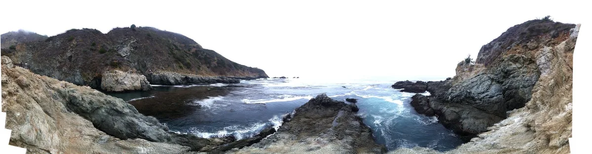
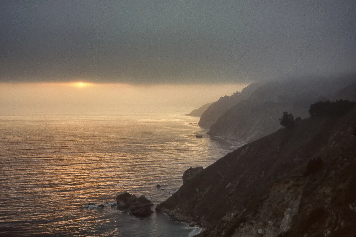
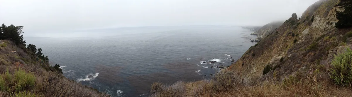
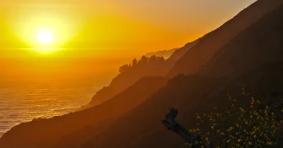
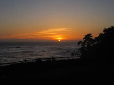
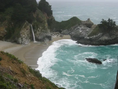
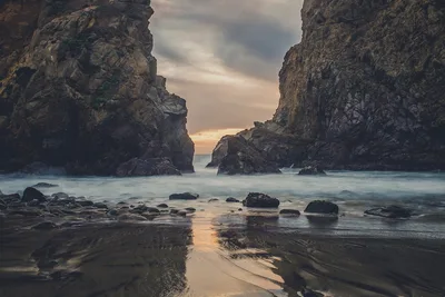
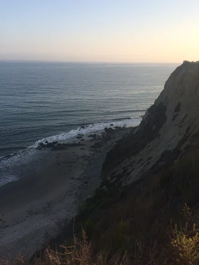
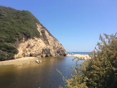
Partington Cove sits on the Big Sur coast of California, a compact rocky inlet where emerald water fills a kelp-draped enclosure carved by geology and human history alike. There is no sand here — just dark, wave-smoothed rock and the smell of salt and wet stone. You reach it through a hand-cut rock tunnel, a passage that feels like stepping into another era. The cove was once a working tanbark landing in the 19th century, and Prohibition-era rumrunners later used its sheltered waters for smuggling. It's wild, quiet, and unlike anything else on this coast.
How to get there
Pull off Highway 1 approximately 2 miles north of the Julia Pfeiffer Burns State Park entrance, or about 6 miles south of Nepenthe Restaurant — look for the roadside pullout. The trail down takes roughly 45 minutes and passes through the historic hand-cut rock tunnel before reaching the cove. Parking is free at the limited roadside pullouts, but spaces fill up quickly, especially on summer weekends — arrive early. The park is open sunrise to sunset daily.
Who it's for
For couples
The tunnel approach and the enclosed, quiet atmosphere of the cove make this a genuinely atmospheric stop for two — remote enough to feel like a discovery, dramatic enough to linger over without needing a beach towel.
For families
Partington Cove is not suitable for young children: the trail is steep, the rocks are slippery, the return climb is strenuous, and the water is dangerous. Families with older, sure-footed teenagers may manage the hike, but keep everyone well back from the water's edge at all times.
Our take
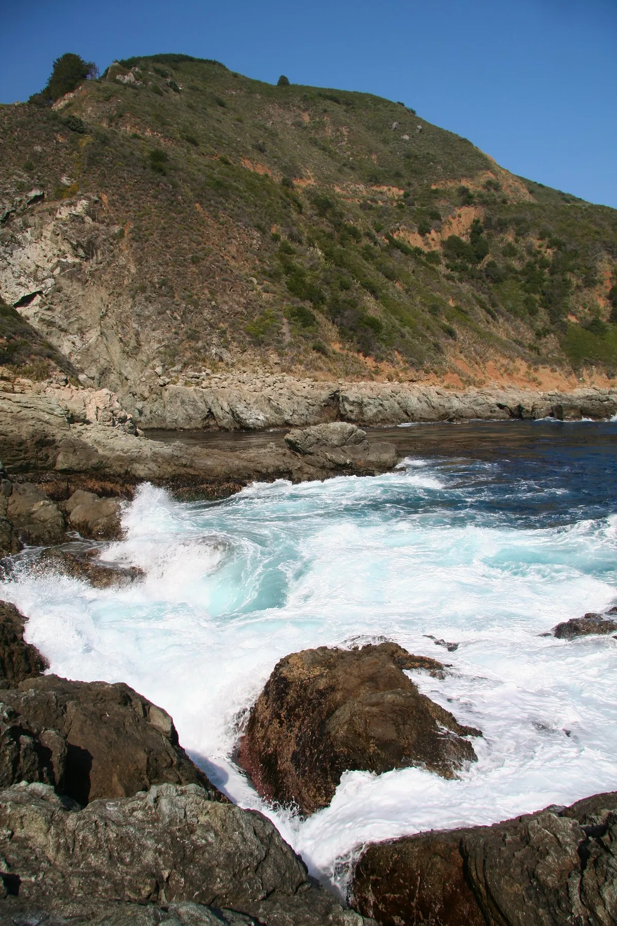
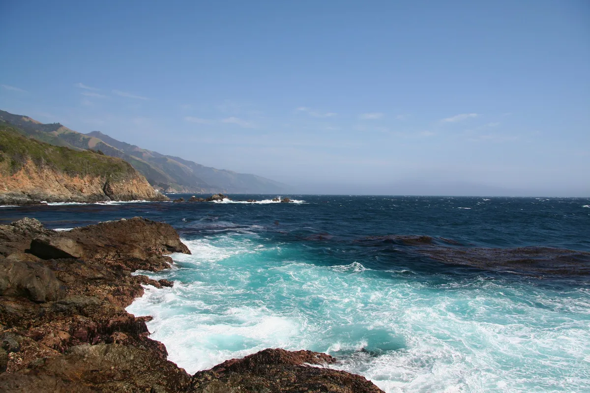
Safety first: the water at Partington Cove is dangerous, full stop — rip currents, surge, and slippery rock mean you come here to look and to snorkel carefully, not to swim. That said, this is one of the most historically layered and visually striking spots on the entire Big Sur coast. The hand-cut tunnel alone justifies the drive. The kelp-filled emerald cove, the remnants of a 19th-century tanbark landing, the Prohibition-era backstory — it all adds up to a place with genuine character rather than just scenery. Come in summer, arrive early before the pullouts fill, wear grippy shoes, and budget real energy for the climb back out. Worth every step.
What to do
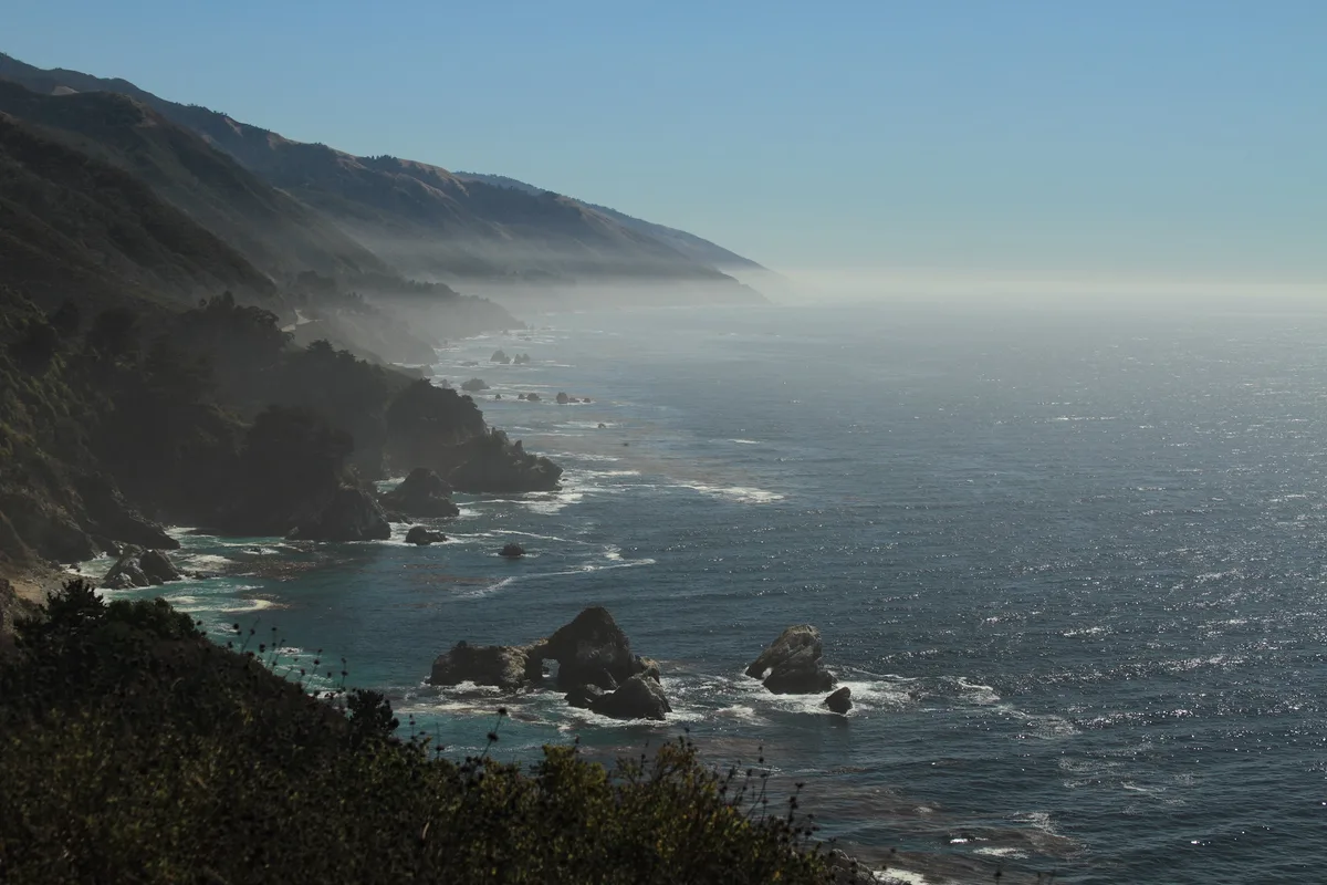
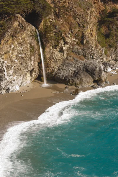
McWay Falls viewpoint is just 1.5km away — an 80-foot waterfall dropping onto an inaccessible cove beach and the defining image of Big Sur, well worth the short detour. The Julia Pfeiffer Burns Vista Point sits only 1.2km from the cove if you want a broader coastal panorama before or after your descent. For something otherworldly in the evening, Esalen Institute Hot Springs is 8km south, offering cliffside natural hot spring pools with midnight public access windows. Pfeiffer Beach, 10km away, rounds out the area with its purple sand and keyhole sea arch.
Stand inside the hand-cut rock tunnel and shoot outward — the circular stone frame around the emerald cove is the signature image of Partington.
From the cove floor, a low angle looking back up at the tunnel entrance against the cliff face gives a second strong composition. McWay Falls viewpoint, just 2.4km away, adds the iconic Big Sur waterfall shot to round out any visit.
Where to eat
Nepenthe, 7.7km away, is the classic Big Sur stop — a clifftop restaurant with sweeping coastal views that has been a landmark on Highway 1 for decades. Fernwood Grill, about 12.9km from the cove, covers the casual end with pizza and burgers. Big Sur Roadhouse is another option at 13.7km if you want something a little more substantial after the climb back up.
Where to stay
Alila Ventana Big Sur, 8.4km from the cove, is the closest place to stay and one of the most celebrated properties on the Big Sur coast. It's a high-end retreat that suits the wild, unhurried character of this stretch of Highway 1.
Photography
The mouth of the hand-cut rock tunnel frames a natural shot looking out toward the emerald water — shoot from inside the tunnel in the morning when light angles in from the ocean side. The cove itself, with its kelp-filled water and enclosing rock walls, photographs best in the soft, diffuse light of an overcast summer afternoon when glare is low.
Good to know
No fires, no camping, and stay on the marked trail at all times — these are firm state park rules. Do not enter the water: strong waves, rip currents, and unexpected surf surges into the cove make swimming genuinely dangerous. The rocks are extremely slippery when wet, so footwear with grip is essential, and the return climb is steep and strenuous — pace yourself. Avoid visiting December through February, when winter swell makes the cove hazardous and rain turns the trail treacherous.
Map
Nearby places
Alila Ventana Big Sur
Things to see around Big Sur, Monterey County
McWay Falls
80-foot waterfall dropping onto an inaccessible cove beach — the defining image of Big Sur.
Esalen Institute Hot Springs
Cliffside natural hot spring pools with midnight public access windows.
Pfeiffer Beach
Purple-sand beach with keyhole sea arch, the most photographed beach on the Big Sur coast.
Frequently asked
The information on this page is provided for guidance only and may evolve. Access conditions, safety and infrastructure can change without notice. Always check official sources before traveling.
Nearest beaches
Other wild beaches in United States
More beaches in California Coast
Reviews of this beach
- No reviews yet, what a shame — leave yours and share your experience.
Photo credits
Sources and licenses for the photos shown above.
- Photo 1 — ben salthouse · source · CC BY-SA 2.0
- Photo 2 — gamillos · source · CC BY-SA 2.0
- Photo 3 — StartAgain · source · CC BY-ND 2.0
- Photo 4 — StartAgain · source · CC BY-ND 2.0
- Photo 5 — Giorgio Galeotti · source · CC BY-SA 4.0
- Photo 6 — Ben Chun · source · CC BY-SA 2.0