Rambla de Castro BeachSpain Beach Guide
Black sand, ancient ruins, and blue Atlantic solitude
About
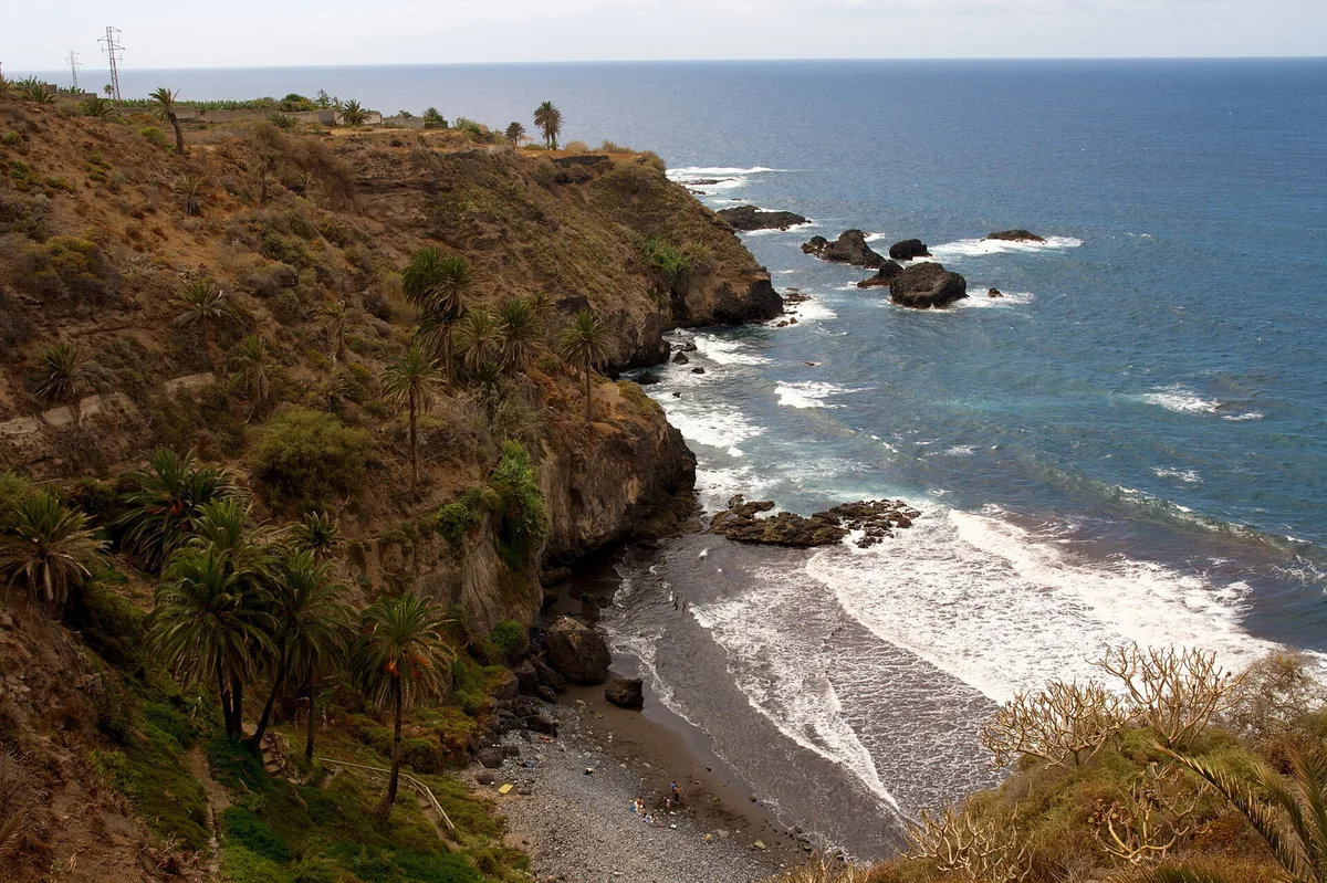
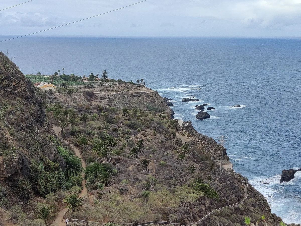
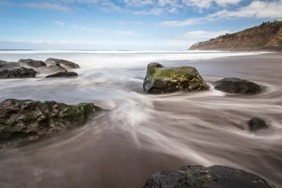
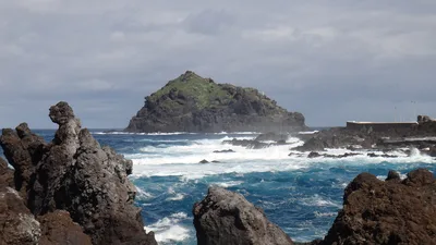
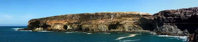
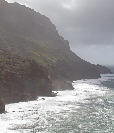
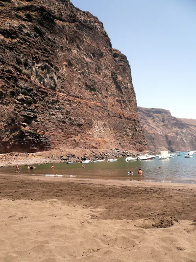
Rambla de Castro is a 180-metre stretch of dark volcanic sand tucked beneath the northern cliffs of Tenerife, where the deep blue Atlantic meets centuries of layered history. The beach sits within a protected landscape, flanked by the ruins of an 1903 hydraulic pumping station, an 18th-century coastal fort, and a 16th-century manor house that still stands as a nature classroom. It's quiet by nature — the hike-only access keeps the daytrippers away, and the black sand shore feels genuinely removed from the resort belt. The surrounding coastal trail winds through dramatic scenery, making the journey as rewarding as the destination.
How to get there
The only way in is on foot: follow the coastal trail from Mirador San Pedro, a 30-minute hike that earns its moderate rating. There's no road access to the beach itself. Free street parking is available at the Mirador San Pedro trailhead — spaces are limited, so arrive early during peak months. The trail is the sole access route, so this beach is not wheelchair accessible.
Who it's for
For couples
The hike-in access, the historic ruins, and the quiet black sand shore create a genuinely romantic atmosphere — this is a place where you'll likely have the beach almost to yourselves, with the Atlantic horizon and centuries of history as your backdrop.
For families
The moderate hike and lack of beach facilities make this a better fit for older children and teenagers with an interest in history or hiking, rather than young families looking for easy beach access and amenities.
Our take
Rambla de Castro earns its reputation as one of Tenerife's most culturally layered beaches, and the 30-minute hike from Mirador San Pedro is a genuine filter — only people who want to be here actually show up. The black volcanic sand, the blue Atlantic, and three distinct historic structures on a single small cove is a combination you won't find anywhere else on the island. That said, the sea is wild and the isolation is real: don't let the beauty override your judgment about swimming conditions. Come between June and September for the best combination of trail conditions and calmer water. Skip December and January entirely. This is a beach for slow walkers, history readers, and anyone who finds meaning in a ruined fort at the edge of the Atlantic.
What to do
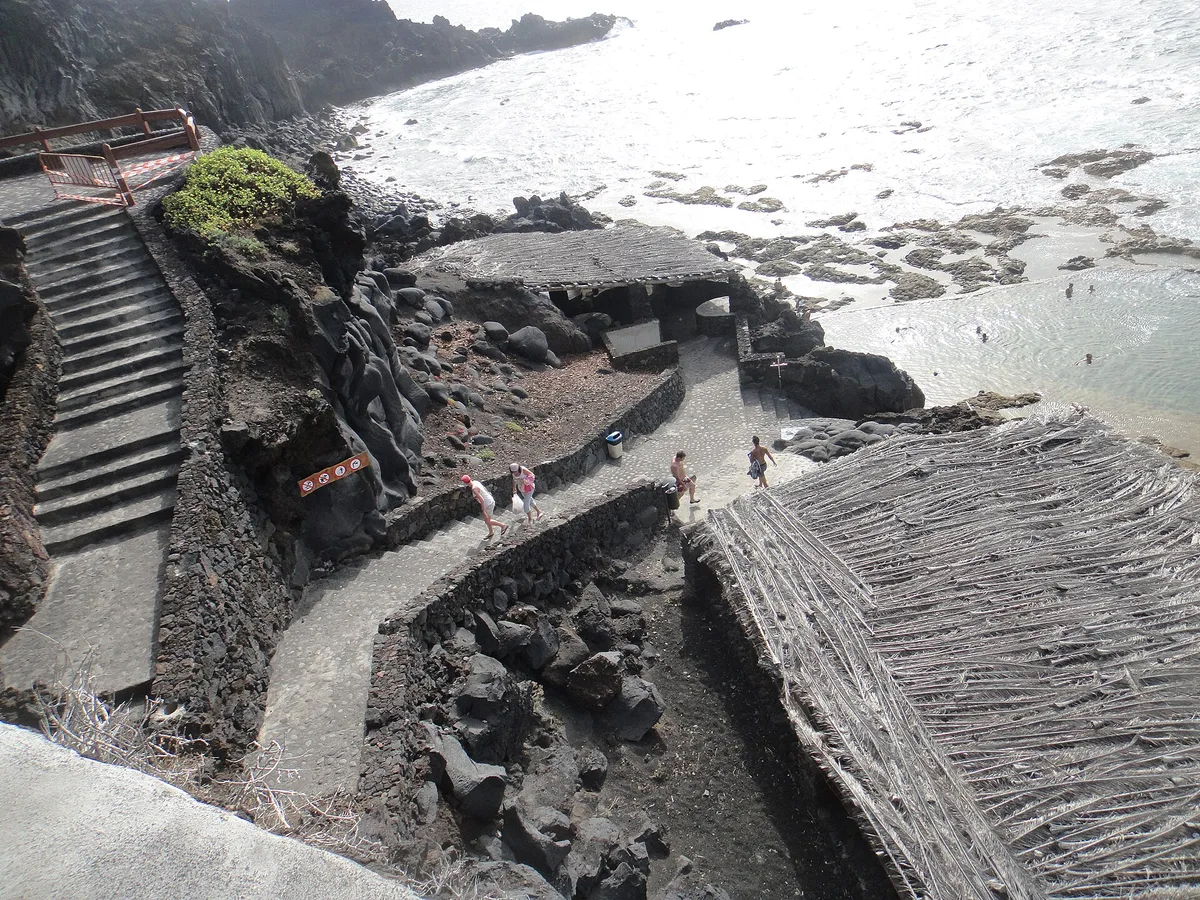
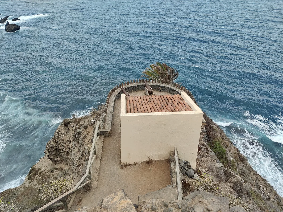
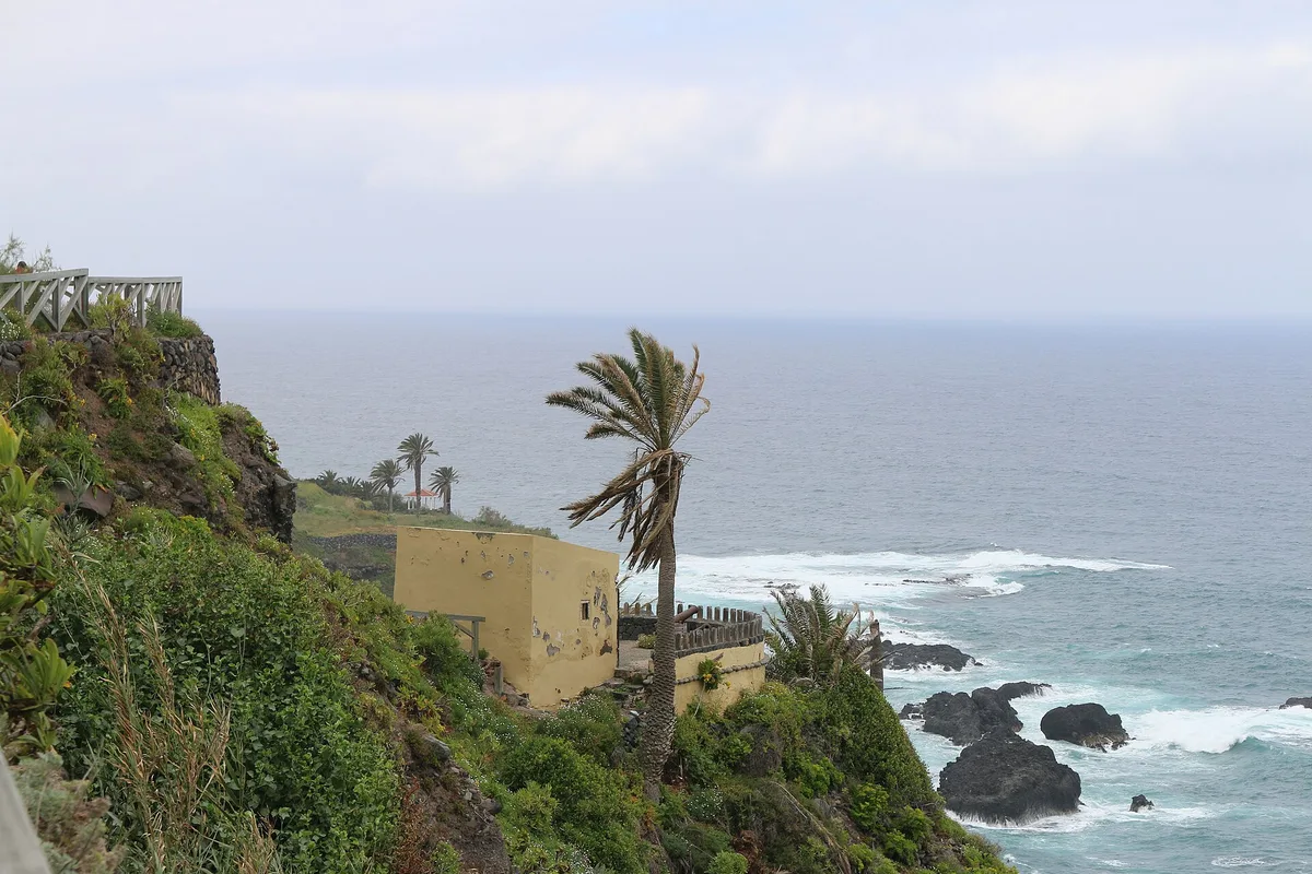
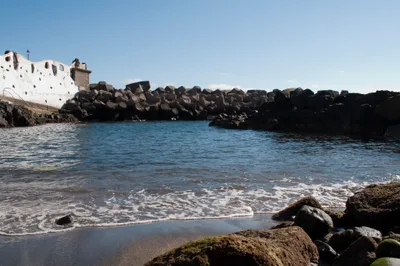
The Paisaje Protegido de la Rambla de Castro, rated 4.7 out of 5, is the natural and cultural frame for everything here — walk the coastal trail and let the landscape do the talking. At beach level, the Fortín de San Fernando is an 18th-century coastal defense fort worth exploring up close, while La Casona de los Castro, the 16th-century manor house, functions as a nature classroom and anchors the site's cultural identity. The ruins of the Elevador de Aguas de Gordejuela — a 1903 hydraulic pumping station — add an industrial-heritage layer that feels surprisingly moving against the black sand and blue sea.
The Fortín de San Fernando framed against the deep blue sea is the standout shot — go in the morning for clean light and no other visitors in frame.
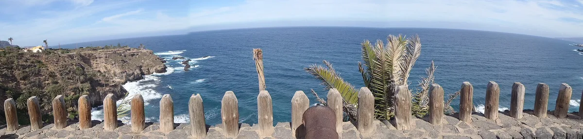
The ruins of the Elevador de Aguas de Gordejuela offer a textured, moody composition with the black sand beach below. From the coastal trail above, the full sweep of the cove — dark sand, blue water, historic structures — makes a wide landscape frame worth the extra minutes on the path.
Where to eat
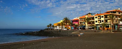
Restaurante Cafetería Mirador San Pedro sits just 0.2km from the trailhead and is the natural stop before or after the hike. For a more substantial meal, Brunelli's is roughly 3km away and carries a strong reputation with over 2,700 reviews. There is nothing to eat at the beach itself — pack accordingly.
Where to stay
Panoramica Garden is the closest option at 1.2km, with over 2,600 reviews to draw from when making your decision. Precise Resort Puerto de la Cruz Tenerife is 2.5km away and holds a 4.1 out of 5 rating across nearly 2,000 reviews — a solid base for exploring the northern coast.
Photography
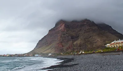
The black volcanic sand against the deep blue Atlantic is most striking in the soft morning light, when the fort and manor house cast long shadows and the sea has a steely, dramatic quality. The ruins of the 1903 pumping station make for a compelling foreground element — frame them against the coastline for a shot that layers industrial history with raw Atlantic scenery.
Good to know
This is a wild, isolated beach — the sea here deserves respect. Swim with caution and stay alert to changing conditions; this is open Atlantic water, not a sheltered resort bay. Avoid visiting in December and January, when winter swells make both swimming and the hiking trail genuinely difficult. The nearest café is Restaurante Cafetería Mirador San Pedro, just 0.2km from the trailhead — stock up on water before you descend, because there are no facilities at the beach.
Map
Nearby places
Restaurante Cafetería Mirador San Pedro
Brunelli's
Precise Resort Puerto de la Cruz Tenerife
Panoramica Garden
Paisaje Protegido de la Rambla de Castro
Elevador de Aguas de Gordejuela
Fortín de San Fernando
La Casona de los Castro
Things to see around Los Realejos
Elevador de Aguas de Gordejuela
1903 hydraulic pumping station ruins
Fortín de San Fernando
18th-century coastal defense fort
La Casona de los Castro
16th-century manor house and nature classroom
Frequently asked
The information on this page is provided for guidance only and may evolve. Access conditions, safety and infrastructure can change without notice. Always check official sources before traveling.
Nearest beaches
More beaches in Canary Islands
Reviews of this beach
- No reviews yet, what a shame — leave yours and share your experience.
Photo credits
Sources and licenses for the photos shown above.
- Photo 1 — Jürgen Schneider · source · CC BY-SA 3.0
- Photo 2 — javiersanp · source · CC BY-SA 3.0
- Photo 3 — Gerardo nuñez · source · CC BY 3.0
- Photo 4 — Schwarzweisz · source · CC0
- Photo 5 — Schwarzweisz · source · CC0
- Photo 6 — Oliver Abels · source · CC BY-SA 4.0