Anse aux Cocos Beach (North La Digue)Seychelles Beach Guide
A forgotten copra shore reached only by sea or sweat
About
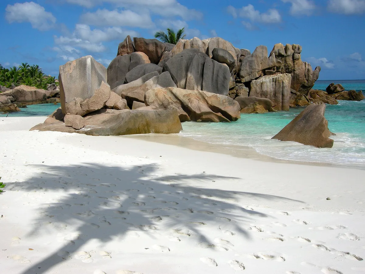
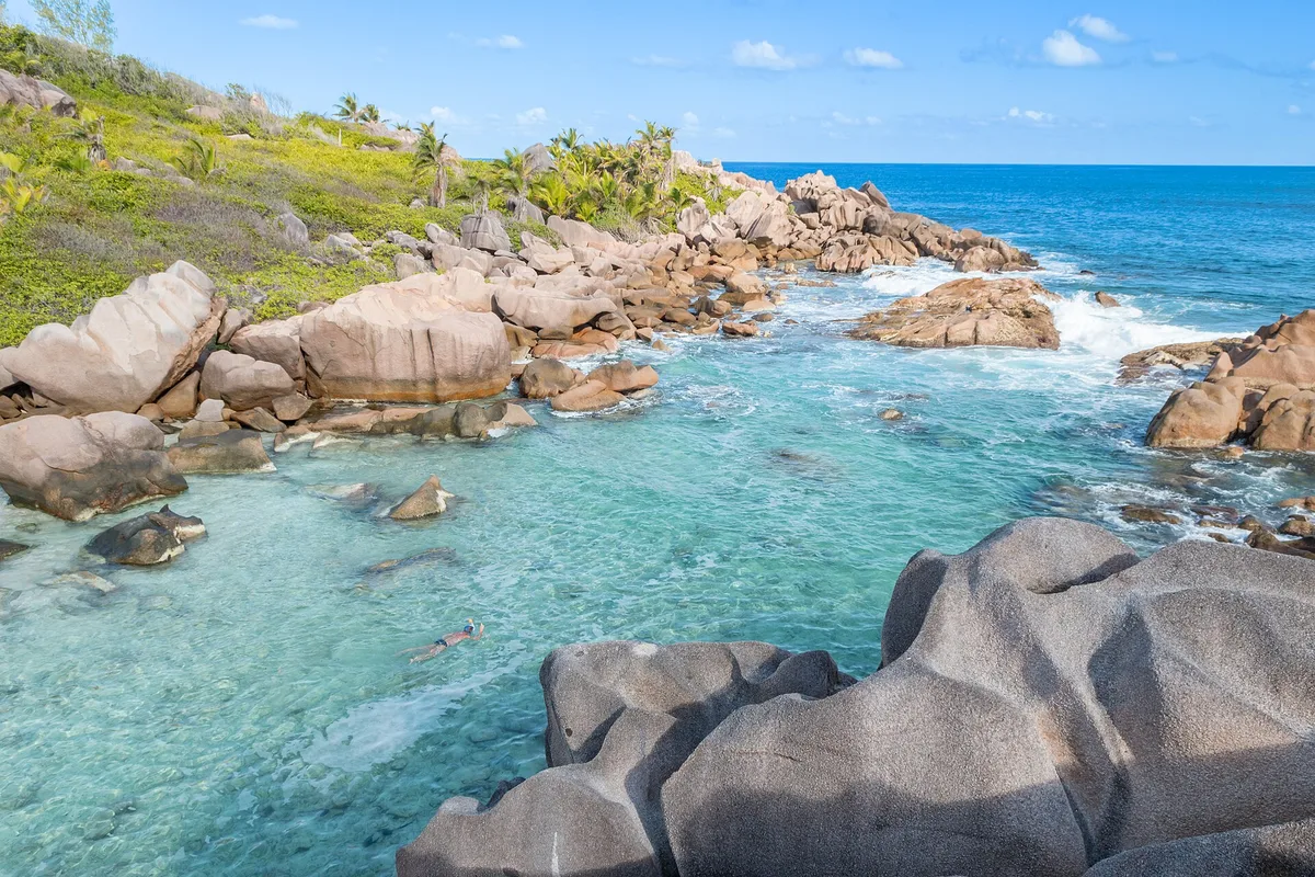
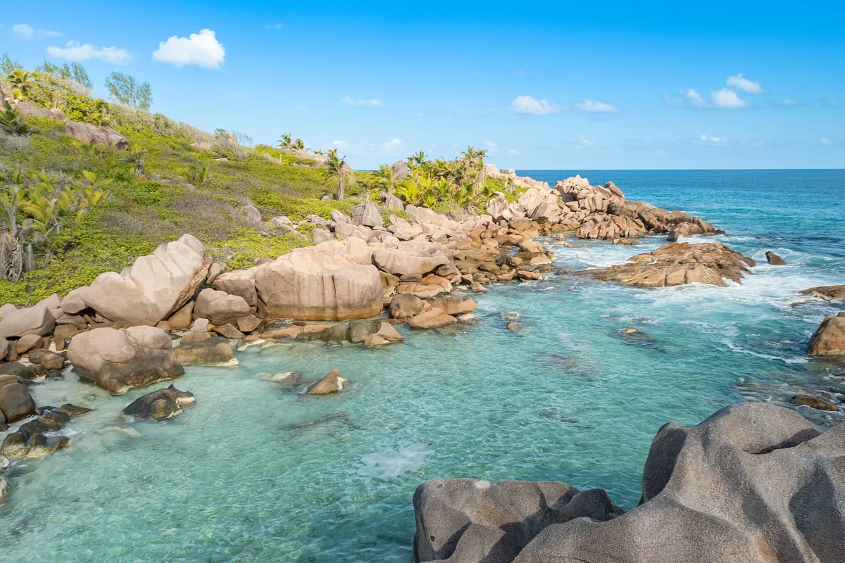
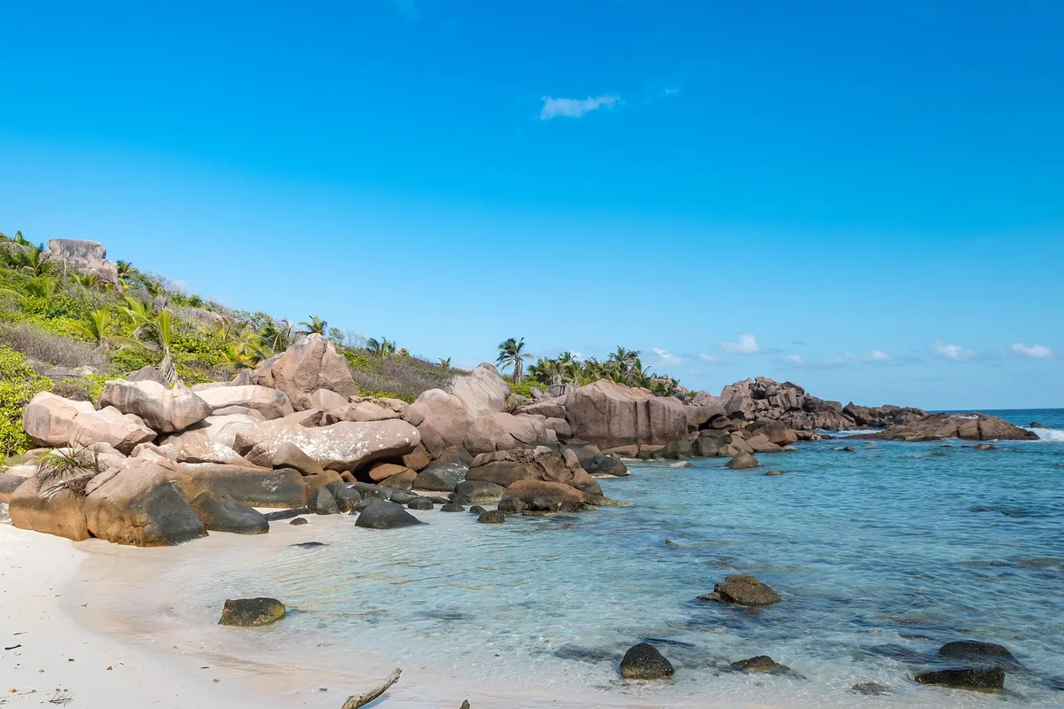
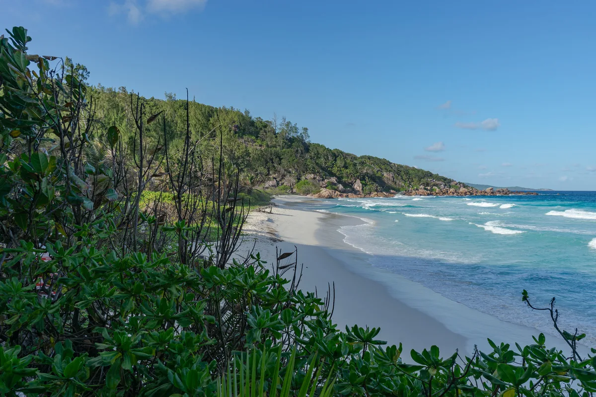
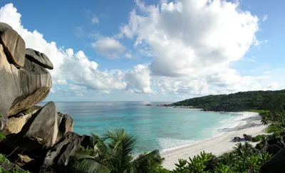
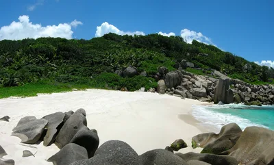
Anse aux Cocos sits on the northeast tip of La Digue, a small arc of white sand backed by coconut palms that lean almost to the waterline. The turquoise water catches the light in a way that feels almost unreal for a beach this empty — on most days, you'll have it entirely to yourself. A collapsed stone wall from a former copra estate runs along the shore, a quiet relic of the island's coconut-oil economy that once defined life here. The northeast exposure keeps the trade winds honest and the swell unpredictable, so the wildness you feel isn't just atmosphere — it's real. This is one of La Digue's most remote stretches, and it earns that label.
How to get there
Anse aux Cocos has no road access — La Digue has no cars, and this beach sits well beyond the island's track network. The easiest route is by kayak or charter boat from La Passe, a journey of around 20 minutes on demand. Alternatively, an unmarked hiking trail from the northeast coast takes roughly 45 minutes — expect rough, unshaded terrain with no signage. There is no entry fee, no facilities, and no parking of any kind.
Who it's for
For couples
If you're after genuine solitude — no other visitors, no noise, no infrastructure — this is as close as La Digue gets. The combination of white sand, turquoise water, and crumbling copra history gives it a mood that's hard to manufacture.
For families
The lack of facilities, difficult access, no mobile signal, and moderate swimming conditions make this a poor fit for families with young children. Stick to more accessible La Digue beaches if you're travelling with kids.
Our take
Anse aux Cocos is not a beach you stumble onto — you have to want it. The boat ride from La Passe or the unmarked 45-minute hike both demand a degree of commitment, and the beach gives nothing back in the way of comfort: no shade, no signal, no facilities. What it does give you is white sand, turquoise water, and a collapsed copra wall that most visitors to Seychelles will never see. The northeast exposure is a genuine variable — swell can make swimming inadvisable, and June through August should be avoided entirely. But arrive on a calm morning between May and October's shoulder months, and you'll find one of the most atmospherically complete beaches in the inner islands. Go prepared, go informed, and go early.
What to do
The collapsed copra estate wall is worth a slow walk — it's one of the few physical traces of La Digue's copra economy still visible in the landscape. Just 0.8km away, Anse aux Cèdres offers a casuarina-shaded cove that makes a natural companion stop on the same northeast-coast circuit. Anse Fourmis, about 1km along the coast, adds another raw dimension with its rusted anchor and granite slab field. For a cultural anchor to all of this, L'Union Estate — a historic coconut and vanilla plantation — sits about 4km away and puts the copra history you're standing in into full context.
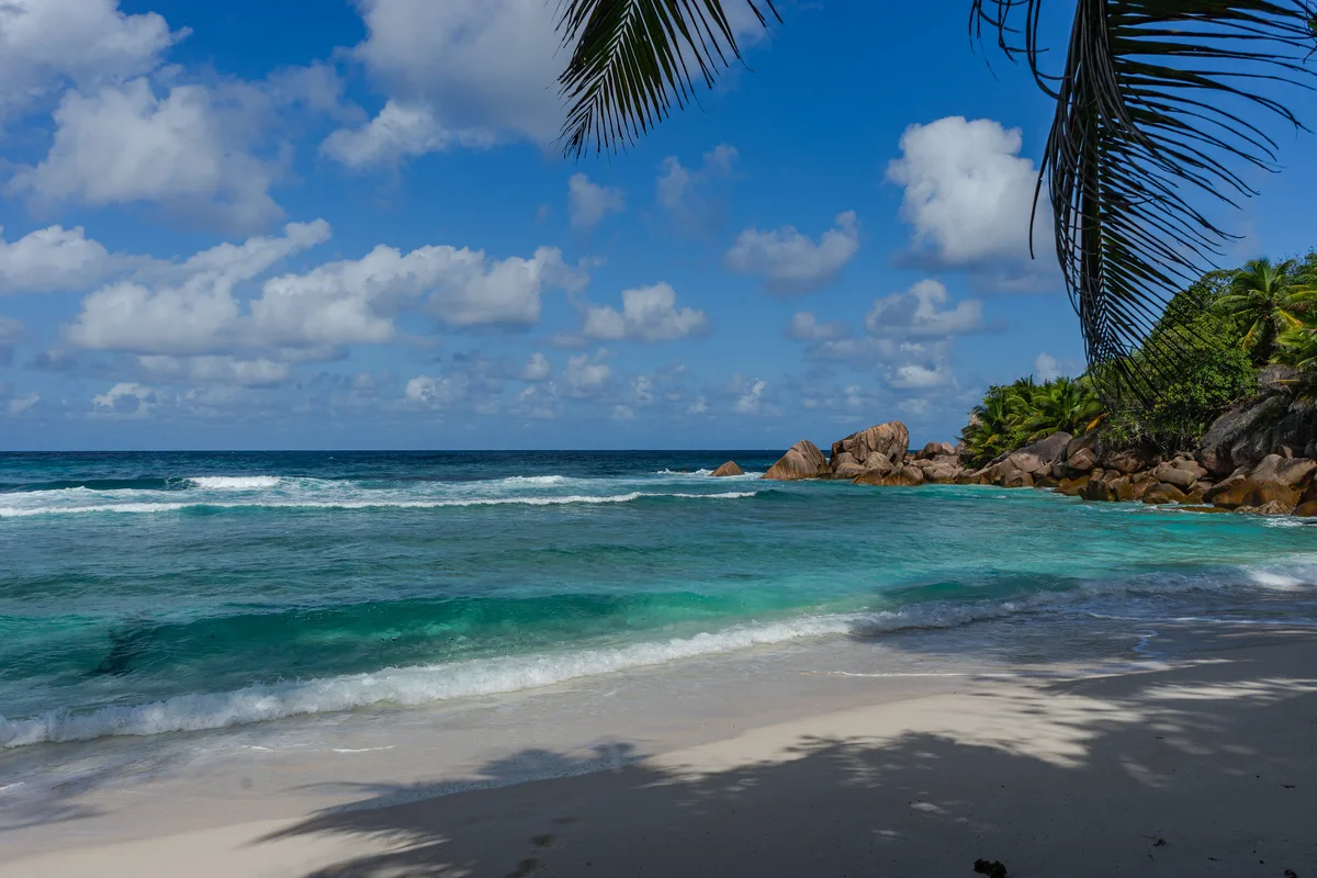
The coconut palms leaning over the white sand with turquoise water behind them are the defining shot — frame tight to cut out the sky and let the colour contrast do the work.
The collapsed copra estate wall offers a rare relic-landscape composition that sets this beach apart from every other postcard on La Digue. Arrive early for clean light and an empty frame.
Where to eat
There are no food or drink facilities at Anse aux Cocos — bring everything you need from the village. Loutier Coco, about 1.3km away, is the closest option with a regional menu suited to the island pace. Chez Jules, at 1.7km, covers Creole and cajun cooking alongside fresh juices — a solid choice before or after the trek.
Where to stay
Chloe's Cottage and Chateau St. Cloud both sit around 2.4km from the beach and offer a comfortable base for exploring the northeast coast. For something a little further out, Ylang Ylang at 2.7km and Diguoise Guesthouse at 2.9km round out the options on this quiet end of La Digue.
Photography
Shoot in the early morning when the light hits the turquoise water at a low angle and the coconut palms cast long shadows across the white sand — the beach faces northeast, so sunrise is your golden hour. The collapsed copra estate wall framed against the palms and sea makes for one of the more unusual compositions on La Digue.
Good to know
Check swell conditions before you go — the northeast exposure means the sea can build quickly, and swimming is rated moderate at best even on calm days. There is no mobile signal at the beach, no shade structures, and no facilities whatsoever, so carry all water and supplies you'll need. Avoid visiting in June, July, and August, when the southeast trades push swell directly onto this coast. If you're hiking in, tell someone your plan — the trail is unmarked and the beach is genuinely isolated.
Map
Nearby places
Loutier Coco
Belle Vue Café
Chez Jules
Zerof
Lanbousir
Chloe's Cottage
Chateau St. Cloud
Pension Michel-Villa Roche Bois
Ylang Ylang
Diguoise Guesthouse
Things to see around La Digue
Anse Fourmis
Raw northeast-coast beach with rusted anchor and granite slab field
Anse aux Cèdres
Hidden casuarina-shaded cove on the northeast coast
L'Union Estate
Historic coconut and vanilla plantation — context for the copra history visible at this beach
Frequently asked
The information on this page is provided for guidance only and may evolve. Access conditions, safety and infrastructure can change without notice. Always check official sources before traveling.
Nearest beaches


Reviews of this beach
- No reviews yet, what a shame — leave yours and share your experience.
Photo credits
Sources and licenses for the photos shown above.