Playuela BeachPuerto Rico Beach Guide
Wild white sand, red cliffs, and real remoteness
About
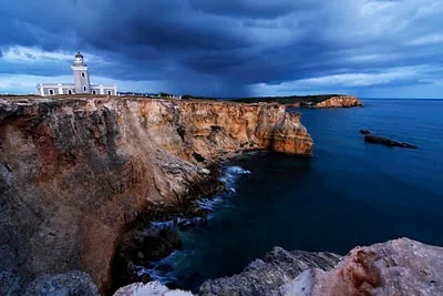
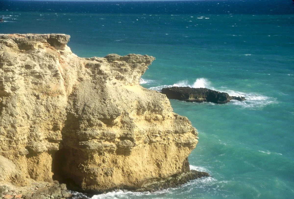
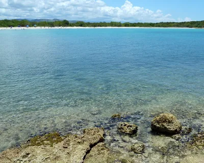
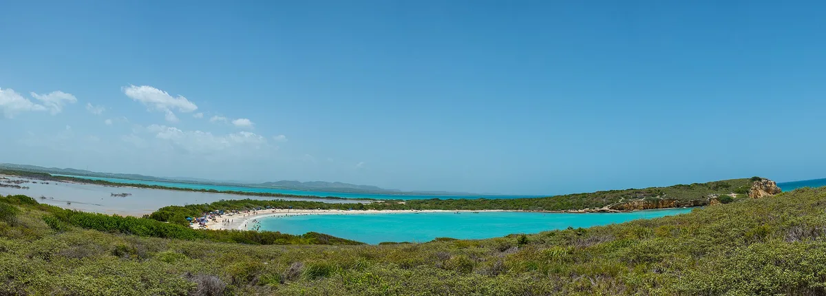
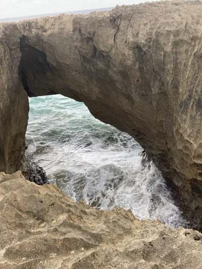
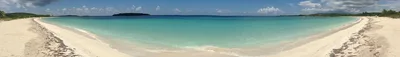
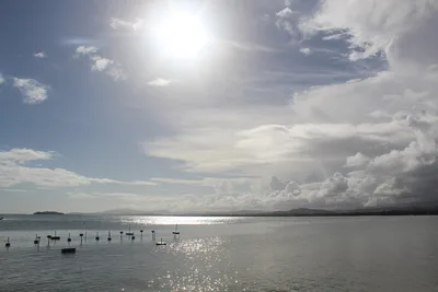
Playa Sucia sits at the southwestern tip of Puerto Rico in Cabo Rojo, where roughly 600 metres of white sand meet turquoise water against a backdrop of ancient red limestone cliffs. The beach sits inside a U.S. Fish & Wildlife Service refuge, which keeps development — and visitor numbers — in check. Adjacent salt flats shimmer in the heat, and the 19th-century Faro Los Morrillos lighthouse crowns the cliffs just a kilometre away, making the scenery unlike anything else on the island. The vibe is raw and unhurried: no vendors, no sunbed rentals, no facilities of any kind.
How to get there
From Cabo Rojo town, the drive and walk combination takes roughly 60 minutes. A free unpaved parking lot exists, but vehicle access to the immediate beach area is frequently closed — expect a 20-to-40-minute walk on a rough, unpaved path from wherever you can park. There is no entry fee, but the refuge is open during daylight hours only. Road conditions deteriorate badly after rain, so check conditions before you go.
Who it's for
For couples
The remote walk in, the lighthouse on the cliffs, and the absence of any commercial noise make this a genuinely quiet escape for two — bring a picnic and stay until the light goes golden.
For families
The difficult unpaved access, lack of any facilities, unstable cliff edges, and rip current risk make this a poor choice for young children; families with older, confident kids who can handle a 20-to-40-minute rough trail and bring all their own supplies may enjoy the wildlife refuge setting.
Our take
Rip currents are present in deeper waters at Playa Sucia — no lifeguards are on duty, and you swim entirely at your own risk. Get that safety reality clear before anything else. Beyond it, this is one of Puerto Rico's most visually striking beaches: white sand, turquoise water, red limestone geology, a colonial lighthouse, and pink salt flats all within two kilometres of each other. The difficult access is not a marketing line — the road is genuinely rough, frequently closed to vehicles, and floods in storm season. Come in the dry months between November and April, carry everything you need, and give yourself enough daylight to walk in and out comfortably. Skip August through October entirely.
What to do
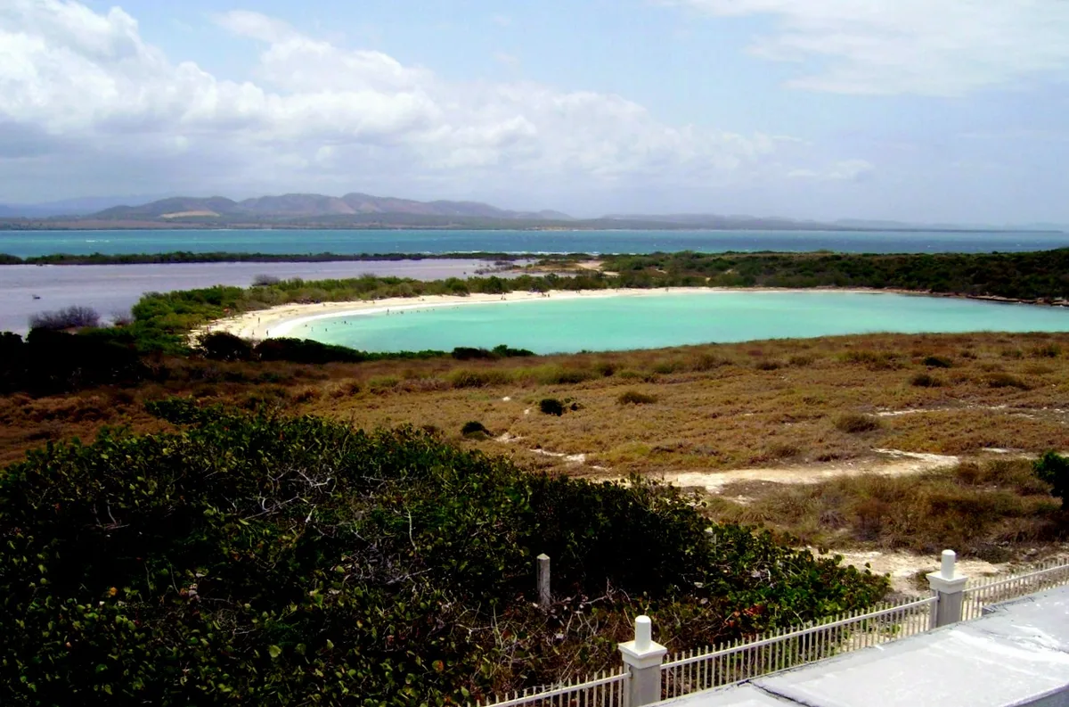
The Cabo Rojo Lighthouse (Faro Los Morrillos), just one kilometre away, is a 19th-century Spanish colonial structure perched on dramatic red limestone cliffs — the walk up is worth every step. Two kilometres from the beach, the Cabo Rojo Salt Flats turn a soft pink and attract migratory shorebirds, including flamingos in season. The Mirador de las Salinas, 2.5 kilometres out, gives a sweeping elevated view over the flats, and the Cabo Rojo National Wildlife Refuge Visitor Center at 5.5 kilometres is a good first stop for maps and current trail conditions.
The red limestone cliffs with Faro Los Morrillos rising above the turquoise water are the iconic frame — shoot from the beach looking northeast in the late afternoon.
The pink-hued salt flats at Cabo Rojo, two kilometres away, offer a completely different palette and are best photographed in the early morning when the water is still and shorebirds are active.
Where to eat
There are no restaurants at the beach, so pack a full picnic. The closest options are a few kilometres back toward town: Sunsets 3301, about 5.2 kilometres away, covers seafood, grilled meats, and tapas, while Annie's Place and Luichis are both around 5.4 kilometres out. For Caribbean cooking, Los Remos is worth the 10-kilometre drive.
Where to stay
Parador Combate Beach, roughly 5.2 kilometres from the beach, is the most convenient base and puts you close to the salt flats and lighthouse trail. Parador Boquemar is a further option at about 10 kilometres, near the livelier Boquerón area.
Photography
The golden-hour light on the red limestone cliffs with the lighthouse silhouetted above the turquoise water is the defining shot — arrive early morning or stay until late afternoon. The salt flats at Mirador de las Salinas, 2.5 kilometres away, offer wide-angle reflections and birdlife that reward a longer lens.
Good to know
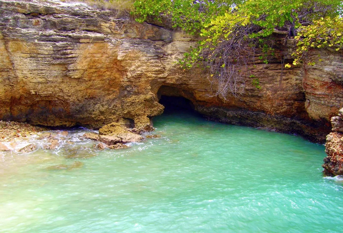
No camping is permitted on the beach, and all wildlife refuge regulations apply — stay on marked paths near the cliffs, as the limestone edges are unstable and must not be climbed. There are zero facilities on site: bring all your water and food. No lifeguards are on duty, and rip currents are possible in deeper waters — swim with caution and never alone. Avoid August, September, and October: hurricane season makes the unpaved access road prone to flooding and the drive genuinely dangerous.
Map
Nearby places
Rest.Chino Génesis
Sunsets 3301
Annie's Place
Luichis
Los Remos
Parador Combate Beach
Parador Boquemar
Puente de Piedra
Mirador de las Salinas
Cabo Rojo National Wildlife Refuge Visitor Center
Cabo Rojo Lighthouse (Faro Los Morrillos)
Cabo Rojo Salt Flats
Balneario de Boquerón
Things to see around Cabo Rojo
Cabo Rojo Lighthouse (Faro Los Morrillos)
19th-century Spanish colonial lighthouse on dramatic red limestone cliffs above the sea.
Cabo Rojo Salt Flats
Pink-hued salt flats that attract migratory shorebirds including flamingos seasonally.
Balneario de Boquerón
Government public beach with calm water and the lively Boquerón village behind it.
Frequently asked
The information on this page is provided for guidance only and may evolve. Access conditions, safety and infrastructure can change without notice. Always check official sources before traveling.
Other beaches in the region
Other wild beaches in Puerto Rico
More beaches in Greater Antilles
Reviews of this beach
- No reviews yet, what a shame — leave yours and share your experience.
Photo credits
Sources and licenses for the photos shown above.
- Photo 1 — Josué Zayas · source · CC BY 3.0
- Photo 2 — Norma Arbelo Irizarry · source · CC BY-SA 3.0
- Photo 3 — Jon Gudorf Photography · source · CC BY-SA 2.0
- Photo 4 — Norma Arbelo Irizarry · source · CC BY-SA 3.0
- Photo 5 — jthoel · source · CC BY 2.0
- Photo 6 — Jorge Gonzalez · source · CC BY-SA 2.0