
Miyara Bay Beach
White sand, blue water, mangroves, and almost no one
About
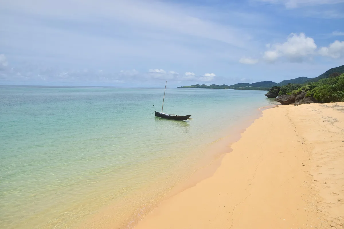
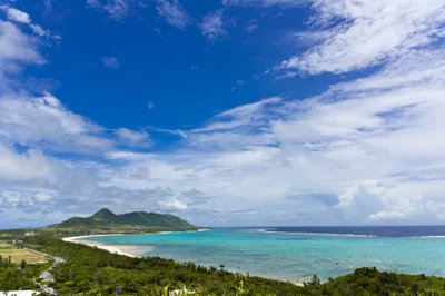
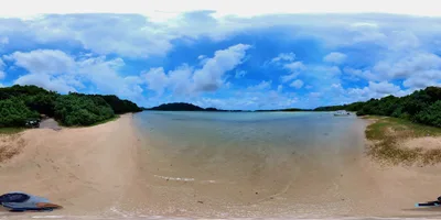
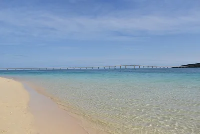
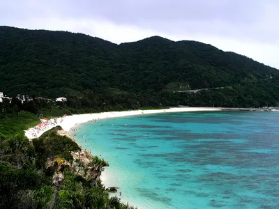
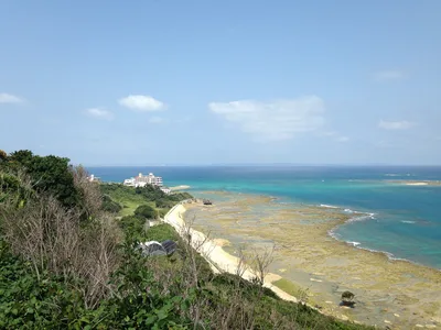
Miyara Bay Beach stretches along Ishigaki's southeast coast — a long sweep of white sand backed by calm blue water and the quiet hum of the Miyara River estuary. Two distinct zones define the experience: an open bay section ideal for a gentle swim, and a mangrove-edged estuary where kayakers slip between tangled roots at the river mouth. Across the water, Kuroshima Island sits on the horizon, small and unhurried, a constant backdrop to an already peaceful scene. This is one of Ishigaki's least-visited stretches of coast, and it shows — in the best possible way.
How to get there
From Ishigaki City, it's a straightforward 15-minute drive to the beach — easy going by car on daily-accessible roads. Free dedicated parking is available on-site, though spaces are limited; if the lot is full, paid parking at nearby Sunset Beach costs 500 yen per day. New Ishigaki Airport (ISG) is 19 km away, making this a viable first or last stop on an island itinerary. Note that the beach has no paved access path, so the final approach is flat but unpaved sand.
Who it's for
For couples
The near-empty beach and slow pace make this an easy choice for couples who want space to themselves — kayak the estuary together in the morning, then settle on the white sand with Kuroshima Island on the horizon for the afternoon.
For families
The flat, easy-access beach and calm open bay section suit families with older children who can follow the swimming zone rule and stay clear of the estuary mouth; younger children will enjoy the wide open sand, but parents should note there is no lifeguard on duty.
Our take
Feet in the sand, eyes on the screen
Miyara Bay Beach won't appear on most Ishigaki itineraries, and that's precisely its value. The white sand is wide, the blue water is calm in the open bay, and on most days you'll share it with almost no one. That said, safety comes first here: no lifeguard, box jellyfish in summer, and an estuary that turns murky fast after rain — this is not a beach to treat casually. Swim only in the designated open bay section and respect the estuary boundary. The mangrove kayaking is the real draw, pairing well with a visit to Miyara Dunchi or a ferry day-trip to Kuroshima Island. Avoid July through September if typhoons or murky water concern you; the shoulder months of June and October hit the sweet spot. Worth the detour — just go in with clear eyes.
What to do
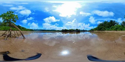
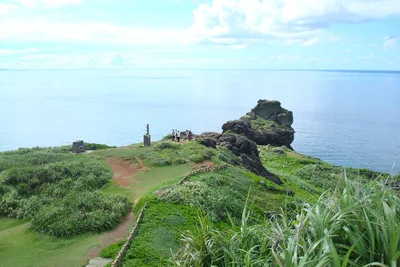
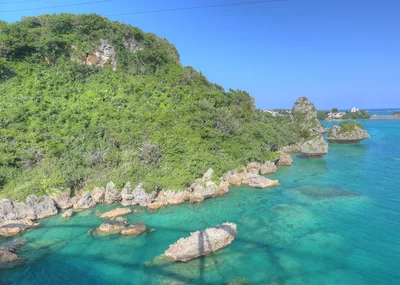
Mangrove kayaking along the Miyara River estuary is the headline activity — paddling into the green tangle of roots with Kuroshima Island visible in the distance is a rare combination. A short drive away, Shiraho Coast (6 km) protects Japan's largest blue coral reef system and rewards snorkelers willing to make the trip. History is close too: Miyara Dunchi, a preserved Ryukyuan aristocratic residence just 3 km away, is an Important Cultural Property and one of the few surviving examples of its kind on Ishigaki. For a scenic viewpoint, Hirakubozaki is 6.1 km north.
Frame the long white sand shoreline from the waterline looking southeast — the empty beach and blue water with Kuroshima Island on the horizon give you natural depth without a filter.
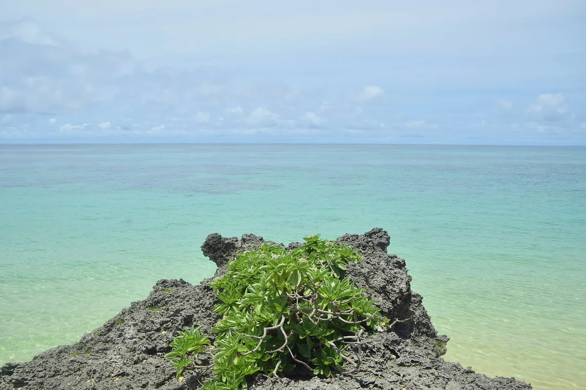
The mangrove estuary edge is a second strong shot: paddle in close and turn back toward the river mouth where green roots meet open sky.
Where to eat
The closest option is a beef burger joint just 0.7 km from the beach — a convenient stop before or after a morning on the water. Tamatorizaki Gateway, 8 km away, offers another option if you're heading further up the coast. Pack a picnic if you want to eat with your feet in the sand; there's nothing on the beach itself.
Where to stay
Ishigaki Sunset Cove Hotel, 10.6 km from the beach, is the nearest listed accommodation and a reasonable base for exploring the southeast coast. Ishigaki City's broader range of hotels and guesthouses is also within easy reach by car.
Photography
The long unbroken line of white sand with Kuroshima Island floating on the blue horizon is the shot — best captured in the soft light of early morning before any haze builds. The mangrove estuary edge at the river mouth offers a contrasting frame: dense green roots against calm water, particularly atmospheric at low tide.
Good to know
Stick to the open bay section for swimming — the estuary mouth has murky, unpredictable water and is not suitable for a dip. After heavy rain, estuary water becomes particularly opaque and should be avoided entirely. There is no lifeguard service here, so swim within your own limits and never alone. Box jellyfish are present in summer months — wear a full-body rash guard or lycra suit if you're entering the water between June and September.
Map
Nearby places
beef burger
Tamatorizaki Gateway
Ishigaki Sunset Cove Hotel
Hirakubozaki
Things to see around Ishigaki
Kuroshima Island
Small island known for cattle farming and heart-shaped reef; accessible by ferry.
Miyara Dunchi
Historic Ryukyuan aristocratic residence in Miyara village; Important Cultural Property.
Shiraho Coast
Japan's largest blue coral reef system.
Frequently asked
The information on this page is provided for guidance only and may evolve. Access conditions, safety and infrastructure can change without notice. Always check official sources before traveling.
Nearest beaches
Other relaxed beaches in Japan
More beaches in Ryukyu Islands
Reviews of this beach
- No reviews yet, what a shame — leave yours and share your experience.