Point Road BeachAustralia Beach Guide
Margaret River's unmarked secret: golden sand, sea cave, zero tourists

About
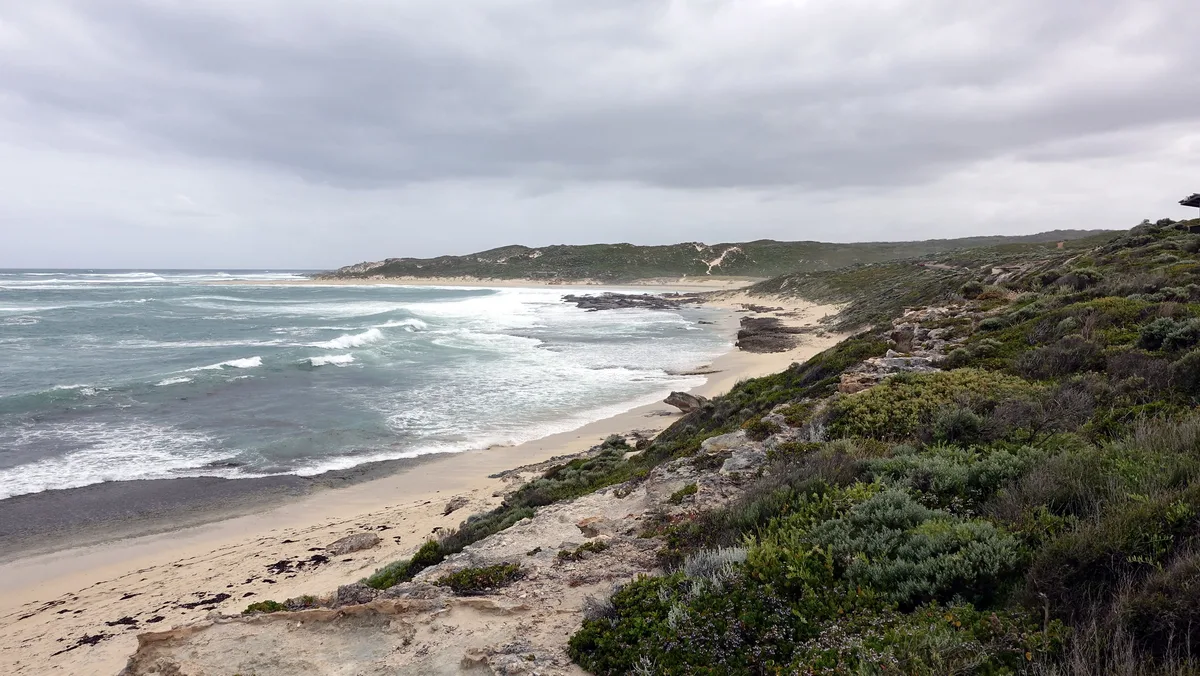
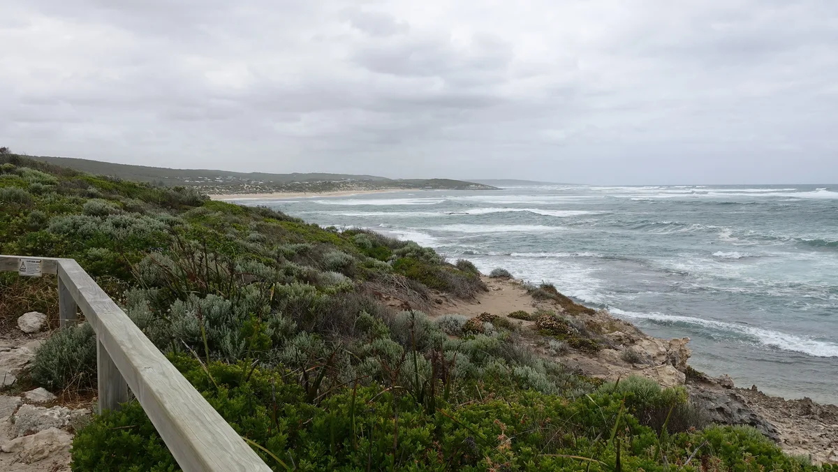
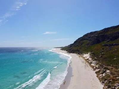
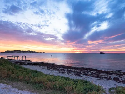
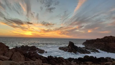
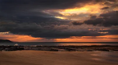
Point Road Beach sits at the end of a dirt track outside Prevelly, enclosed by limestone headlands that cut it off from the world. The golden sand stretches roughly 200 metres, lapped by open blue water with no lifeguard tower, no signage, no ice-cream cart — nothing to signal a beach is even here. A sea cave opens at the south point, carved into the limestone, dark and salt-scoured. Local surfers know it; almost nobody else does. The wild, exposed vibe is the whole point.
How to get there
From Prevelly, follow the dirt track — the drive takes around five minutes by car. There's no formal parking; vehicles pull up informally at the end of the track. No entry fee, no signage at the trailhead, so navigate carefully and confirm your route before you leave phone reception. The dirt track becomes impassable after heavy rain, and the beach is completely inaccessible for wheelchairs due to the rough track and soft sand.
Who it's for
For couples
Point Road Beach rewards couples who want genuine solitude — no other visitors, no infrastructure, just golden sand backed by limestone and the sound of the Southern Ocean. The sea cave at low tide is a rare, private discovery worth sharing.
For families
The unpatrolled water, rough dirt track, and sea cave flooding risk make this a poor choice for young children or families expecting safe, easy beach access. Prevelly Beach, one kilometre away, is a far better family option.
Our take
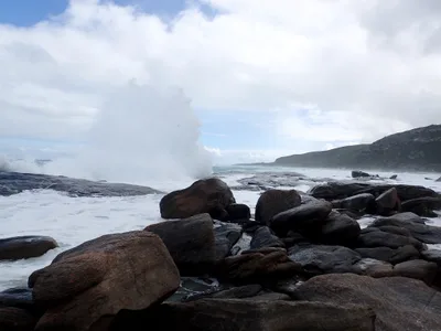
Point Road Beach is genuinely off the map — no sign, no patrol, no path worn smooth by daytrippers. That's the appeal, and it comes with real responsibilities. The sea cave floods at high tide and the dirt track closes after rain, so this is a beach that punishes lazy planning and rewards people who check tide tables and weather before they leave Prevelly. Swimming is moderate at best on an unpatrolled open coast; don't push it. Come for the limestone scenery, the sea cave at low tide, and the rare experience of 200 metres of golden sand entirely to yourself. Skip it in winter. Time it right in summer and it's one of the most quietly extraordinary beaches on the Margaret River coast.
What to do
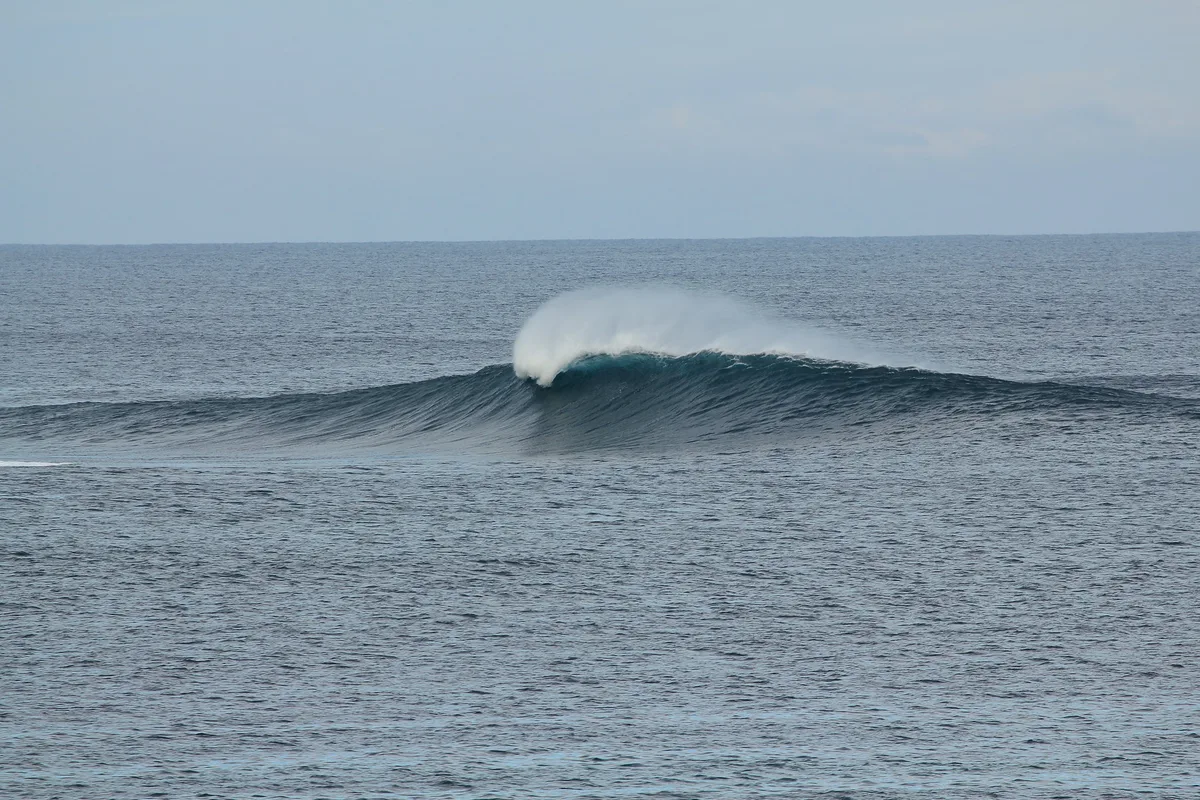
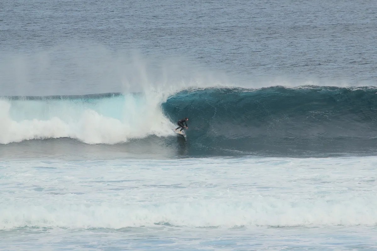
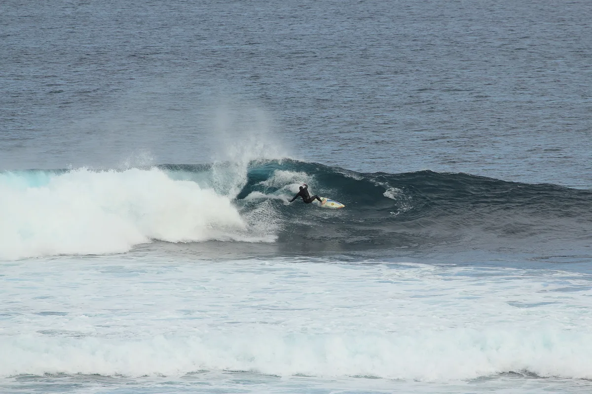
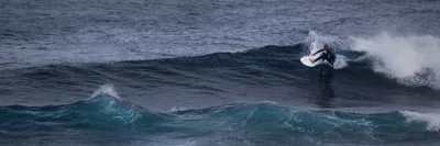
Surfers Point, just 0.6 km away, is a WSL Championship Tour venue and one of the most respected reef breaks in the world — worth watching even if you're not paddling out. Prevelly Beach, a kilometre up the coast, is the area's main river-mouth beach for swimming and surfing. If you want to extend the day inland, Redgate Wines is 6.2 km away and Meekadarribee is 6.8 km, offering a change of pace from salt and sand.
The limestone headland framing the golden sand at the north end of the beach makes a clean, dramatic wide shot with no human infrastructure in frame.
The sea cave entrance at the south point — best at low tide with blue water visible behind you — is the single most photogenic feature on the beach. Shoot both before 10 a.m. when the light is low and the beach is at its emptiest.
Where to eat
The closest option is The Common, 2.4 km away — a practical first stop after the beach. Blue Ginger is 7.8 km out, and for seafood specifically, Katch Up is 8.2 km from the beach. Bring your own water and snacks; there's nothing on-site.
Where to stay
Motel Margaret River is the nearest base, 7.7 km away. Edge of the Forest sits at 8.8 km, and Marri Lodge is 10.4 km out for those who want a quieter, more bush-adjacent stay.
Photography
Shoot the limestone headland framing the golden sand from the north end of the beach — early morning light hits the rock face cleanly before the sun climbs too high. The sea cave at the south point is the most dramatic subject: low tide at midday lets you get inside and shoot back toward the blue water and open sky.
Good to know
There is no signage anywhere — double-check your route and save offline maps before you go. The sea cave at the south point is the highlight, but it floods at high tide: check tide tables before you enter, and never linger inside when the tide is turning. This beach is unpatrolled, so swim with caution and never enter the water alone. Avoid June, July, and August entirely — the dirt track turns to mud and conditions are cold and exposed.
Map
Nearby places
Things to see around Shire of Augusta-Margaret River
Prevelly Beach
Iconic river mouth beach, the main surf and swimming beach for the Margaret River area.
Surfers Point
WSL Championship Tour venue and world-class reef break.
Gracetown Beach
Small township beach at the base of red-orange limestone cliffs with a boat ramp.
Frequently asked
The information on this page is provided for guidance only and may evolve. Access conditions, safety and infrastructure can change without notice. Always check official sources before traveling.
Nearest beaches
Other wild beaches in Australia
Reviews of this beach
- No reviews yet, what a shame — leave yours and share your experience.
Photo credits
Sources and licenses for the photos shown above.
- Photo 1 — Julien Carnot · source · CC BY-SA 2.0
- Photo 2 — Julien Carnot · source · CC BY-SA 2.0
- Photo 3 — Julien Carnot · source · CC BY-SA 2.0
- Photo 4 — sabarber · source · CC BY-SA 2.0
- Photo 5 — David Jones · source · CC BY 2.0
- Photo 6 — David Jones · source · CC BY 2.0