Parsons LandingUnited States Beach Guide
Catalina's wild western edge — earn every step
About
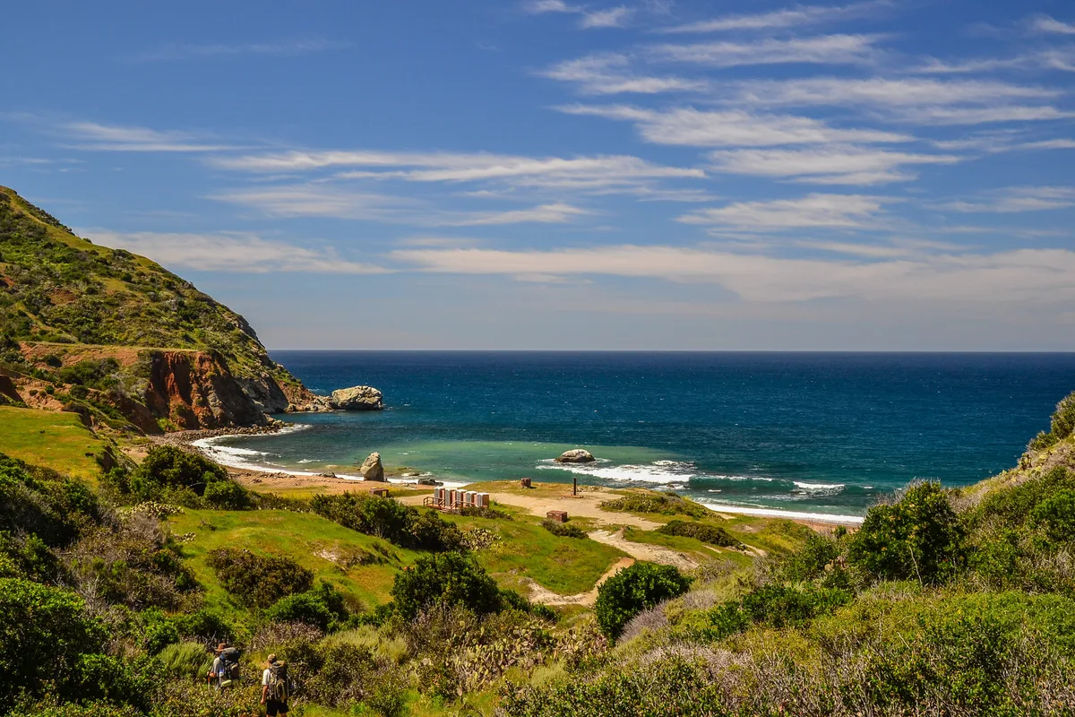
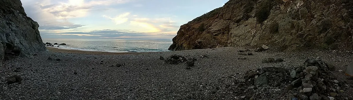
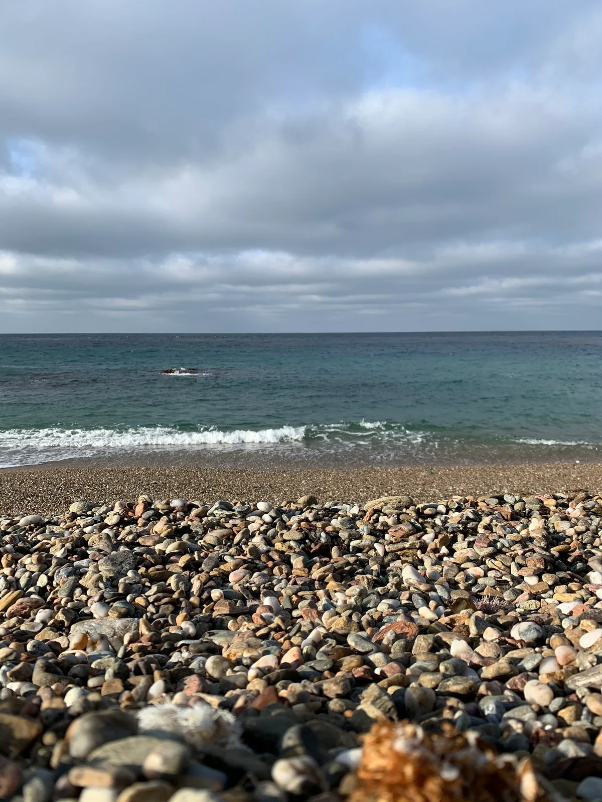
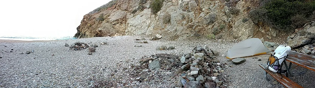
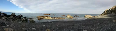
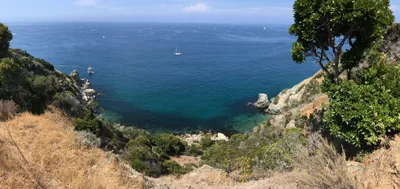
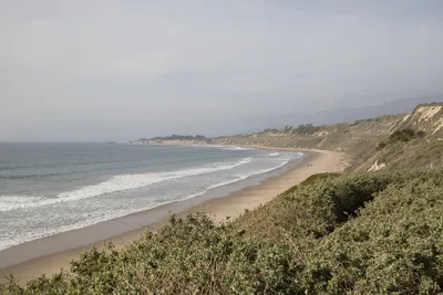
Parsons Landing sits at the remote northwestern tip of Santa Catalina Island, a cobble-and-sand shore where the blue Pacific stretches unbroken toward the Southern California mainland. On clear days you can pick out the mainland skyline across the water — a rare reward for the effort it takes to get here. The beach is short, the stones underfoot are real, and the lean-to shelters that dot the campsite are as close to luxury as this place gets. It's northwest-facing, which means the wind can bite and the swell can build without warning. Empty on most days, it draws hikers finishing the Trans-Catalina Trail and campers who want the island stripped of everything unnecessary.
How to get there
There is no road to Parsons Landing — none. Reach it by hiking from Two Harbors (roughly three hours on the Trans-Catalina Trail), by kayak from Two Harbors (about one hour on the water), or by private boat or on-demand charter from the Southern California mainland (approximately two and a half hours). Your campsite reservation, booked in advance through the Catalina Island Conservancy, covers your water and firewood locker allocation — without it, you arrive to find both locked. Entry cost varies with the reservation fee structure set by the Conservancy.
Who it's for
For couples
Couples who want genuine solitude — not the performed kind — will find it here: an empty cobble-and-sand shore, a shared lean-to shelter, and a mainland view that appears only when the sky cooperates. It rewards patience and preparation over spontaneity.
For families
Parsons Landing is not a practical choice for families with young children: the access is physically demanding, swimming is dangerous, there are no rescue services on site, and the entire experience depends on advance logistical planning. Older, trail-experienced teenagers who can handle a three-hour hike and self-sufficient camping are the exception.
Our take
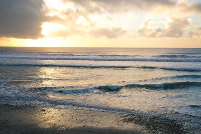
Do not come to Parsons Landing without a reservation, a satellite communicator, and a clear-eyed understanding of what remote actually means. Shark attacks have occurred in these waters — do not enter the sea, full stop. The northwest-facing shore can turn hostile fast, and there is no one coming to help if things go wrong. What you get in exchange for that preparation is one of the emptiest, most genuinely wild campsites on the California coast: a cobble-and-sand shore, a lean-to shelter, pre-stocked water and firewood if you've booked correctly, and a mainland view that earns its place. The Trans-Catalina Trail terminus gives the whole experience a narrative spine — you're not just camping, you're finishing something. Avoid November through February when the exposed shore and muddy trail make the journey miserable. Come between June and September, plan every detail in advance, and leave nothing behind.
What to do
Parsons Landing is the western terminus of the Trans-Catalina Trail, a 38.5-mile end-to-end route — completing that final stretch into camp is the main event for most visitors. Five kilometres further west lies Starlight Beach, the most isolated shore on the island, reachable only on foot along the trail's far end. The nearby activity at Doctor's Cove, rated a perfect five stars by visitors, offers a change of scene just 1.7 kilometres away. Two Harbors, the island's second settlement and the trailhead for this western section, sits about 11 kilometres back along the trail and serves as the logical staging point for the whole adventure.
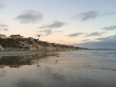
The cobble-and-sand shoreline at dawn, with blue water behind and the mainland faintly visible on the horizon, is the defining shot.
The Trans-Catalina Trail terminus marker gives hikers their proof-of-completion frame. The lean-to shelters at dusk, lit by the last warm light with the open Pacific behind them, round out the three strongest compositions on this stretch of coast.
Where to eat
The Camp Emerald Bay Dining Hall, 1.7 kilometres from the beach, is the closest food option in the area. Beyond that, plan to be self-sufficient — Parsons Landing is remote enough that you should carry everything you need for your stay. Pack enough food for the full duration; resupply is not a realistic option once you're out here.
Where to stay
The Parsons Landing campsite itself holds a 4.7 out of 5 rating across 119 reviews — the primitive lean-to shelters and pre-stocked lockers make it the only lodging option directly at the beach. Camp Emerald Bay, 1.7 kilometres away and rated 4.5 out of 5 by 42 reviewers, offers an alternative base if you want slightly more infrastructure. Both options require advance planning; neither is walk-up friendly.
Photography
Shoot from the cobble shoreline at dawn when the blue water catches low-angle light and the mainland silhouette is sharpest on the horizon — clear mornings give you the best chance of that mainland-view shot. The lean-to shelters framed against the open Pacific make a strong late-afternoon composition, and the Trans-Catalina Trail sign at the terminus is the obvious landmark shot for hikers documenting the route.
Good to know
Book your campsite through the Catalina Island Conservancy before you leave the mainland — water and firewood lockers are pre-assigned to reservations, and there is no water source on site if you show up without one. Pack out every piece of trash; fires are permitted only inside the designated fire rings. Do not enter the water: shark attacks have occurred in these waters, swimming is dangerous, and the northwest exposure can push choppy, unpredictable conditions onto the shore with little notice. Carry a satellite communicator — there are no rescue services at this location. True digital-detox territory: cell signal fades fast and there is nowhere to plug anything in, so bring offline books and a paper map of the trail.
Map
Nearby places
Camp Emerald Bay Dining Hall
Parsons Landing
Camp Emerald Bay
Doctor’s Cove
Things to see around Two Harbors
Starlight Beach
The most isolated beach on the island, at the far west end, the Trans-Catalina Trail terminus.
Trans-Catalina Trail
38.5-mile end-to-end trail with Parsons Landing as the first-day campsite from Two Harbors.
Two Harbors
The island's second settlement and trailhead for the west-end Trans-Catalina Trail section.
Frequently asked
The information on this page is provided for guidance only and may evolve. Access conditions, safety and infrastructure can change without notice. Always check official sources before traveling.
Nearest beaches

Other wild beaches in United States
Reviews of this beach
- No reviews yet, what a shame — leave yours and share your experience.
Photo credits
Sources and licenses for the photos shown above.
- Photo 1 — ilya_ktsn · source · CC BY 2.0
- Photo 2 — Chris Hunkeler from Carlsbad, California, USA · source · CC BY-SA 2.0
- Photo 3 — Chris Sammis · source · CC BY-SA 2.0
- Photo 4 — Chris Hunkeler from Carlsbad, California, USA · source · CC BY-SA 2.0