Calanque d'En-vau BeachFrance Beach Guide
Wild limestone calanque earned only by boat or boot
About
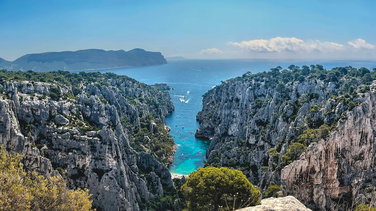
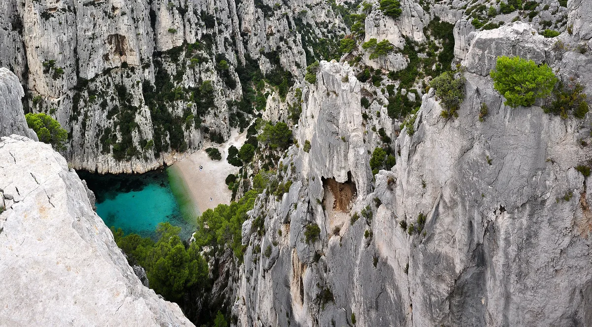
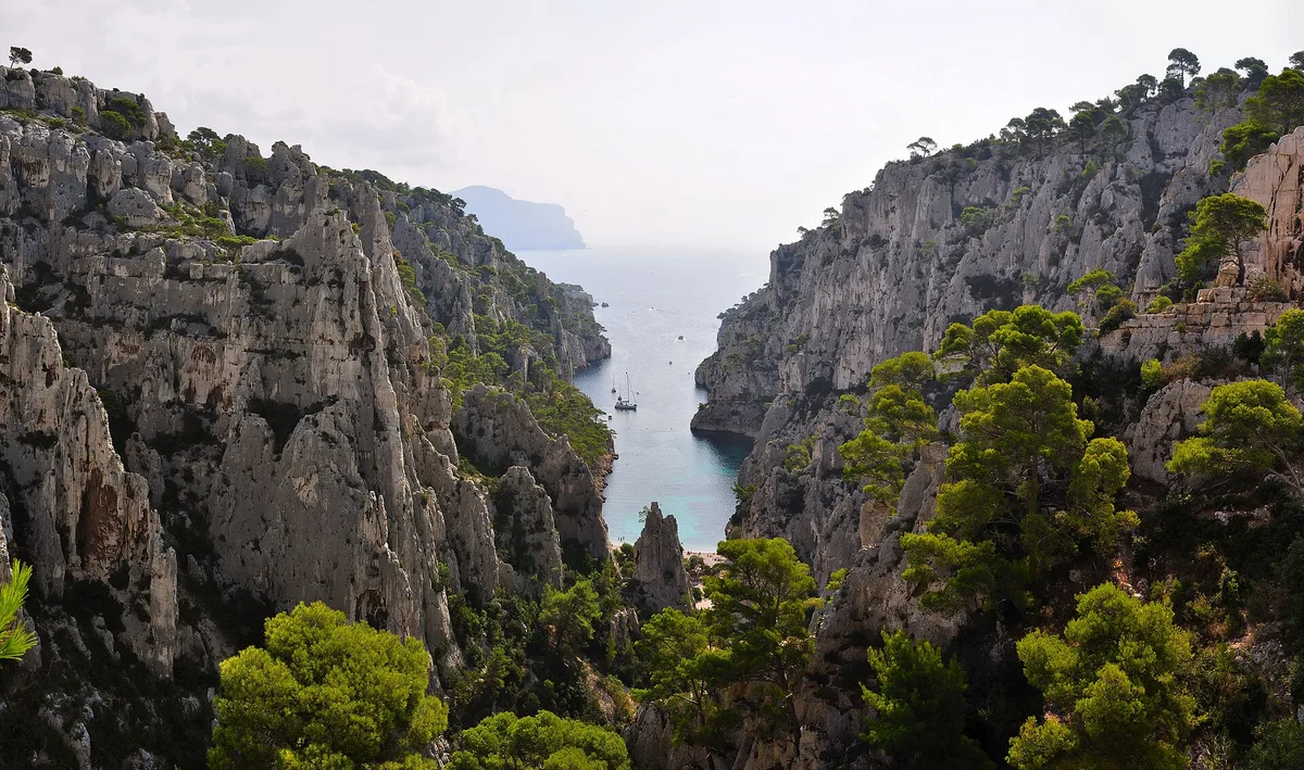
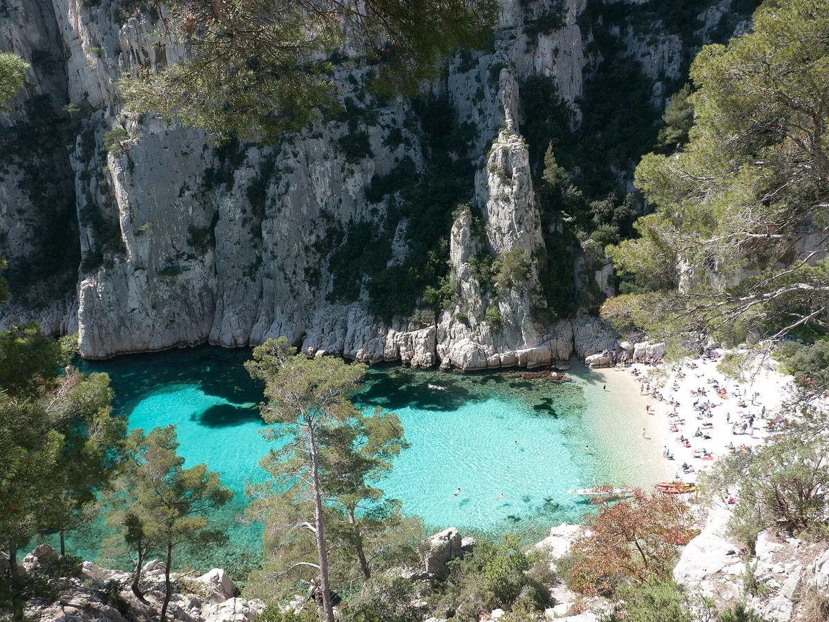
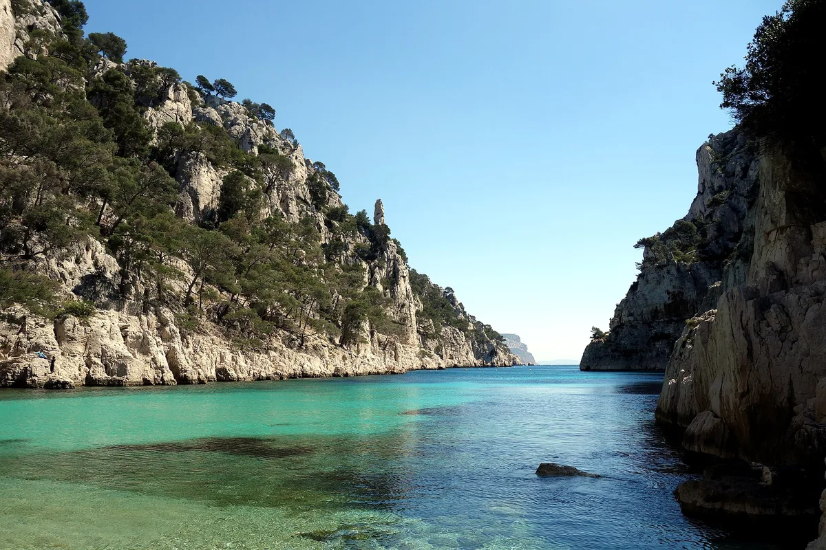
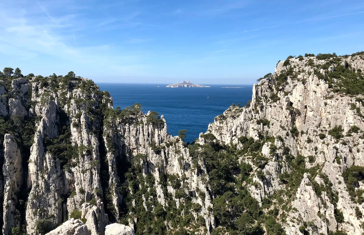
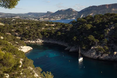
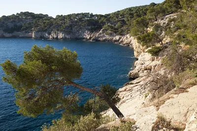
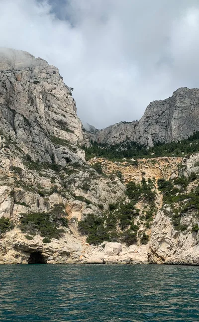
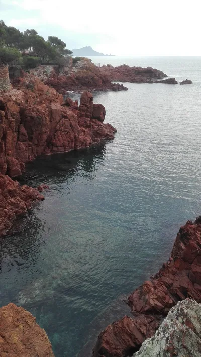
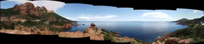
Calanque d'En-vau cuts a narrow slot into the Calanques de Marseille, its 170-metre limestone walls dropping sheer to a small pebble shore barely 60 metres long. The water is a vivid turquoise — the kind that makes you stop mid-stride on the trail above. There is no sand, no road, no café, and no easy way in: that's the point. The Belvédère d'En-Vau viewpoint hangs above the cove, offering a panoramic sweep over the calanque, Cap Canaille, and the Riou archipelago. This is one of the most dramatic coastal landscapes in France, and it demands respect.
How to get there
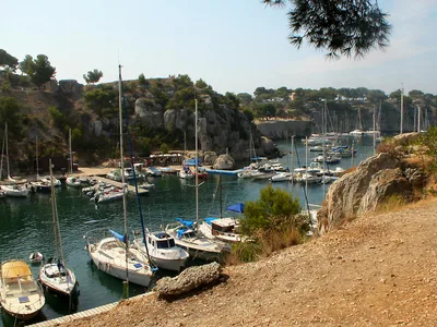
Calanque d'En-vau is boat-or-boots only — there is no road access. From Cassis harbour, you can reach it by boat in around 20 minutes (on demand) or on foot via a demanding hike of approximately 120 minutes each way. No motorized vehicles are permitted inside the national park zone. The hike is rated difficult and is suitable for experienced hikers only — cliff exposure on the trail is real.
Who it's for
For couples
The long approach — whether you hike the 120-minute trail or take the 20-minute boat from Cassis — makes arrival feel genuinely earned, and the small, wild pebble shore with its turquoise water is as close to a private cove as southern France gets on a weekday in June.
For families
The extremely steep trail with cliff exposure and the absence of a lifeguard make this a poor choice for young children or non-swimmers. Families with older, experienced hikers and strong swimmers can manage it, but the 120-minute hike each way in summer heat is a serious undertaking — the boat option from Cassis is the more sensible route in.
Our take
Calanque d'En-vau is not a beach you stumble upon — it takes real effort to reach, and that effort is the whole story. The 170-metre limestone walls, the turquoise water, the near-total absence of infrastructure: it's a place that still feels genuinely wild because the national park rules keep it that way. No motorized vehicles, no road, no lifeguard, no café. The safety picture is serious: the trail carries real cliff exposure, the water has no supervision, and you need to check conditions before you go. Come in June or September, take the boat if the hike feels like a stretch, and treat the rules as features rather than inconveniences. Skip July and August — the small pebble shore simply cannot absorb peak summer numbers with any grace.
What to do
The beach sits inside Calanques National Park, a vast protected area of limestone cliffs, hidden coves, hiking routes, climbing walls, and water activities — the park itself begins the moment you leave Cassis. Half a kilometre above the cove, the Belvédère d'En-Vau viewpoint at 170 metres delivers one of the most striking coastal panoramas in Provence, taking in Cap Canaille and the Riou archipelago. If you want a longer day, Cap Canaille — the highest sea cliff in France — is about 17 kilometres away and worth the extra effort. For a gentler swim after the hike, Plage du Bestouan is roughly 2.9 kilometres from the calanque and rated 4.5 out of 5.
The Belvédère d'En-Vau viewpoint is the signature shot: 170 metres above sea level, the full calanque unfolds below you in a wedge of turquoise between white limestone cliffs.
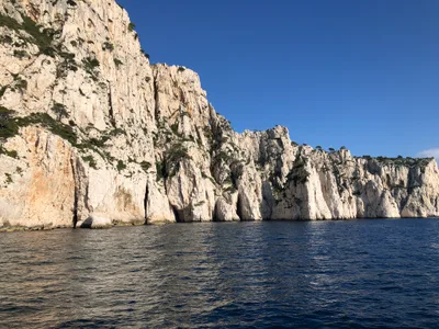
From the pebble shore, a wide-angle looking straight up at the cliff walls captures the sheer scale that no telephoto can fake. The boat approach from Cassis also gives a rare sea-level perspective of the calanque mouth opening up as you motor in.
Where to eat
There are no restaurants, snack bars, or food vendors at Calanque d'En-vau. Bring everything you need from Cassis before you set off — water, food, and more water than you think you'll need for a 120-minute hike each way in Mediterranean heat.
Where to stay
There is no accommodation at or near the calanque itself. Cassis, the nearest departure point for both the hike and the boat, is your logical base for the night.
Photography
The Belvédère d'En-Vau viewpoint, 0.5 kilometres above the beach, gives you the classic top-down shot of turquoise water framed by white limestone walls — arrive early morning before the light goes flat. From the pebble shore itself, shoot upward toward the cliff tops at midday when the sun reaches the bottom of the calanque.
Good to know
No motorized vehicles are allowed; access is strictly by hike or boat from Cassis, and that rule is enforced. The terrain is extremely steep with cliff exposure — this trail is for experienced hikers only, not a casual stroll. There is no lifeguard on the beach: only strong, confident swimmers should enter the water, and you should check daily water quality and access conditions before you go, especially in summer. Avoid July and August if you can — access restrictions tighten, the trail gets packed, and the small pebble shore fills fast. True digital-detox territory: cell signal fades out here and there is nowhere to plug in a laptop, so bring an offline book.
Map
Nearby places
Plage du Bestouan
Things to see around Marseille
Calanques National Park
Vast natural area with limestone cliffs, coves, hiking, climbing, water activities.
Belvédère d'En-Vau
Viewpoint 170m above sea level; panoramic views of calanque, Cap Canaille, Riou archipelago.
Cap Canaille
Highest sea cliff in France; dramatic coastal scenery.
Frequently asked
The information on this page is provided for guidance only and may evolve. Access conditions, safety and infrastructure can change without notice. Always check official sources before traveling.
Nearest beaches
Other wild beaches in France
More beaches in Provence-Alpes-Côte d'Azur
Reviews of this beach
- No reviews yet, what a shame — leave yours and share your experience.
Photo credits
Sources and licenses for the photos shown above.
- Photo 1 — Mmullie (WMF) · source · CC BY-SA 4.0
- Photo 2 — Tobi 87 · source · CC BY-SA 3.0
- Photo 3 — Tobi 87 · source · CC BY-SA 3.0
- Photo 4 — Andrew Wilson · source · CC BY-SA 4.0
- Photo 5 — Bastien Guigue · source · CC BY-SA 4.0
- Photo 6 — Nrocks75 · source · CC BY-SA 4.0