Anse à Prunes BeachFrance Beach Guide
Wild, rocky and raw at Martinique's southern edge
About
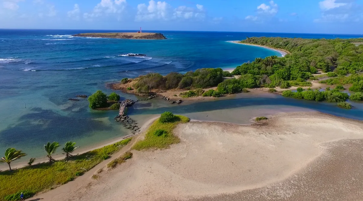
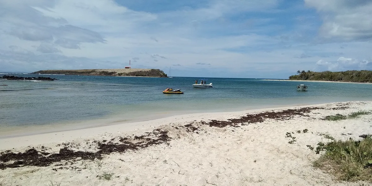
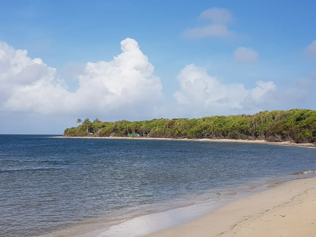
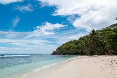
Anse à Prunes stretches roughly 300 metres along the southern coast of Martinique, on the wild Îlet Cabrits near Sainte-Anne. The shore is mixed sand and rock, and the water runs a genuine turquoise — vivid against the rough, untamed landscape. It's quiet here, sometimes strikingly so, with few visitors making the effort to reach it. The Savane des Pétrifications lies practically on the doorstep, lending the whole area an otherworldly, geological character. This is a beach that rewards curiosity, not comfort-seeking.
How to get there
Reach Anse à Prunes by car via the D9 track — a rough, unpaved road in poor condition that takes about 10 minutes from the main road. Parking is available in an unregulated lot or roadside, but it can be difficult to find a spot during peak hours. Alternatively, ferry services run to the area, including Les Vedettes Tropicales. There is no entry fee, but the access road demands a vehicle with decent clearance and patience.
Who it's for
For couples
The quiet, wild atmosphere and the short hike to the Savane des Pétrifications make this a rewarding half-day escape for couples who prefer raw scenery over resort polish. It's the kind of place where you'll likely have the shoreline mostly to yourselves.
For families
The difficult access track, rocky shore, and possible strong currents make Anse à Prunes a challenging choice for families with young children. Those with older, confident kids who enjoy hiking and geology will find the Savane des Pétrifications a genuine highlight.
Our take
Anse à Prunes is not a beach you stumble onto — you earn it. The D9 track is rough, the shore is rocky, and the currents demand respect; do not treat the water casually. That said, for travellers who want Martinique without the resort gloss, this southern stretch delivers something genuinely different. The proximity to the Savane des Pétrifications and the Trace des Caps trail means a visit here can anchor a full half-day of exploration. Come in the dry season, between November and April, for the best conditions. Skip September and October entirely. Worth the detour — if you go in with clear eyes about what it is.
What to do
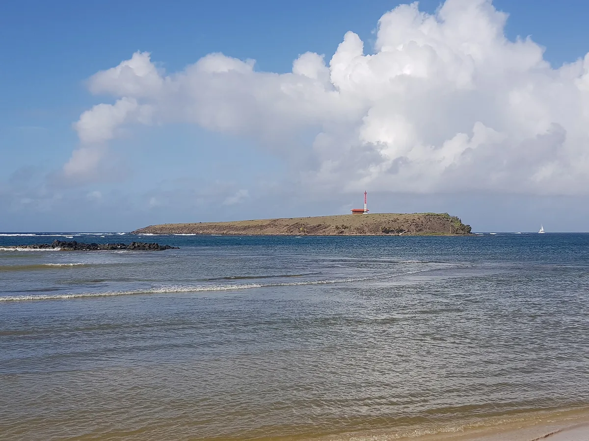
The Savane des Pétrifications, just 1.1 km away, is a geological site where ancient petrified wood emerges from the landscape — accessible via a path directly from the beach and rated 4.6/5 by visitors. The Trace des Caps hiking trail runs right through this area, connecting beaches and natural sites along the coast for those who want to explore further on foot. Ilet Cabrits and its lighthouse mark the southern tip and offer a striking viewpoint, with the surrounding waters known as a snorkeling and diving spot.
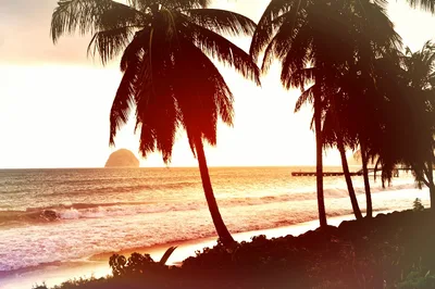
The Ilet Cabrits lighthouse framed against the turquoise water is the standout shot — arrive early for clean light and no other visitors in frame.
The petrified wood of the Savane des Pétrifications offers a completely different visual, with ancient timber textures set against a stark, open landscape. The mixed sand-and-rock shoreline itself, shot from the high ground of the Trace des Caps trail, gives a dramatic wide-angle view of the wild coastline.
Where to eat
Le M, about 4.5 km away, is a solid choice with over 1,700 reviews behind it. For something with a higher rating, Restaurant Snack Boubou Bokits has been serving since 2006 and sits just 4.6 km from the beach. There are no food vendors at Anse à Prunes itself, so bring water and snacks for the day.
Where to stay
Club Med Les Boucaniers is the closest option at 6 km, with a well-established reputation and over 10,922 reviews. Further along, Les Cayalines Résidence hôtelière offers a quieter, residential-style stay about 12.3 km away and is rated 4.5/5. Pierre et Vacances Resort Sainte-Luce at 10.5 km is a practical mid-range base for exploring the southern coast.
Photography
The lighthouse on Ilet Cabrits makes a strong compositional anchor, especially in the low golden light of early morning when the turquoise water catches the sun. The petrified wood formations of the Savane des Pétrifications, reachable via the beach path, offer genuinely unusual textures and shapes that photograph well at any time of day.
Good to know
The road in is genuinely rough — drive slowly and expect a bumpy approach. Once at the beach, watch out for rocks underfoot and be aware that strong currents are possible in the water; swim with real caution and stay alert to conditions. Avoid visiting in September and October, when hurricane season peaks and conditions can turn dangerous fast. The dry season from November to April gives you the most reliable weather and the calmest sea.
Map
Nearby places
Le M
La Kabananou
Case Coco
Restaurant SNACK BOUBOU BOKITS -depuis 2006-
Poivre et Sel
Club Med Les Boucaniers - Martinique
Pierre et Vacances Resort Sainte-Luce
Karibea Sainte-Luce Hotel
ILOMA - Hotel Corail Résidence
Les Cayalines Résidence hôtelière
Savane des Pétrifications
Ilet Cabrits and its lighthouse
Trace des Caps hiking trail
Things to see around Sainte-Anne
Savane des Pétrifications
Geological site with petrified wood; accessible via path from beach.
Ilet Cabrits and its lighthouse
Islet with lighthouse marking southern tip; snorkeling and diving spot.
Trace des Caps hiking trail
Coastal hiking trail connecting beaches and natural sites.
Frequently asked
The information on this page is provided for guidance only and may evolve. Access conditions, safety and infrastructure can change without notice. Always check official sources before traveling.
Nearest beaches
Reviews of this beach
- No reviews yet, what a shame — leave yours and share your experience.
Photo credits
Sources and licenses for the photos shown above.
- Photo 1 — Hervé NICOLAS · source · CC BY-SA 4.0
- Photo 2 — Patrice78500 · source · CC BY-SA 4.0
- Photo 3 — Enrevseluj · source · CC BY-SA 4.0
- Photo 4 — Enrevseluj · source · CC BY-SA 4.0
- Photo 5 — Enrevseluj · source · CC BY-SA 4.0