Urupukapuka Island BeachNew Zealand Beach Guide
Golden sands, turquoise water, island isolation done right
About
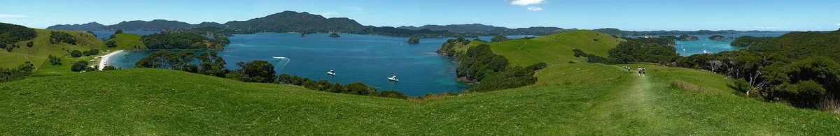
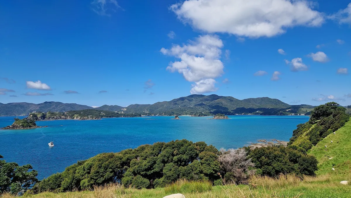
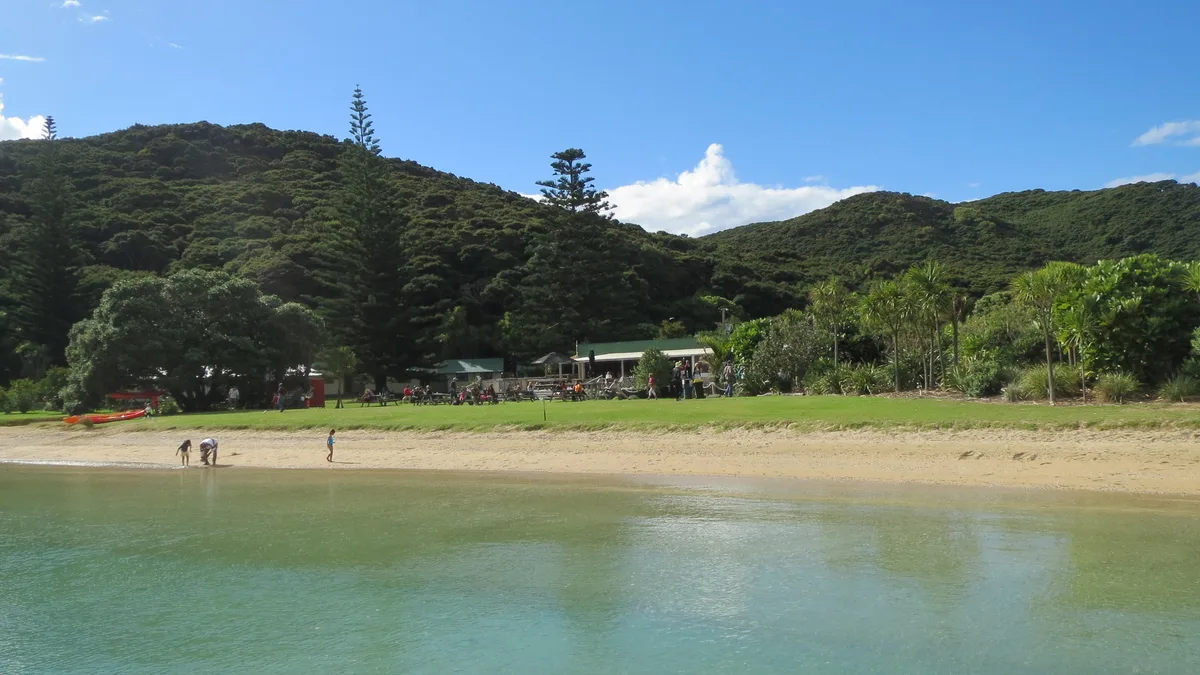
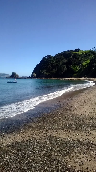
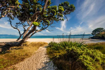
Urupukapuka Island Beach sits in the heart of the Bay of Islands, a quiet stretch of golden sand lapped by turquoise water within a protected marine reserve. The island is DOC-managed, which means the environment stays clean, the fish stay wild, and the pace stays slow. At around 300 metres long, the beach is intimate rather than expansive — you'll share it with snorkellers, campers, and the occasional curious bird. The surrounding marine reserve keeps the water exceptionally clear, making every dip feel like swimming inside an aquarium. It's the kind of place that earns its reputation simply by being left alone.
How to get there
Urupukapuka Island has no road access whatsoever — the only way in is by water. Catch a ferry from Paihia (roughly 40 minutes) or arrange a boat from Paihia or Russell (around 30 minutes on demand). Ferry frequency varies by season, so confirm your schedule before you go — services can be reduced or suspended in the winter months. Leave your car at Paihia and travel light.
Who it's for
For couples
The island's quiet atmosphere and marine reserve setting make it an easy choice for couples who want a full day of snorkelling, walking, and doing very little — without the noise of a popular mainland beach. Pack a picnic, book the ferry, and treat it as a proper escape.
For families
Swimming is safe, the water is clear and calm, and the marine reserve means kids can snorkel over a living seabed rather than bare sand. Just note that the beach and DOC tracks are not wheelchair accessible, and there are no medical facilities on the island — come prepared.
Our take
Urupukapuka Island Beach is safe to swim, genuinely quiet, and protected by one of New Zealand's marine reserves — that combination is rarer than it sounds. The ferry-only access is not an inconvenience; it's the filter that keeps the place worth visiting. The marine reserve rules are non-negotiable, and DOC enforces them — respect that or don't come. True digital-detox territory: cell signal fades, there's nowhere to plug in a laptop, and that's entirely the point. Skip June through August — ferry services thin out and the temperatures drop enough to make the whole trip feel like an effort. Come between December and March, book your DOC campsite early if you're staying overnight, and let the turquoise water do the rest. Worth the ferry ride.
What to do
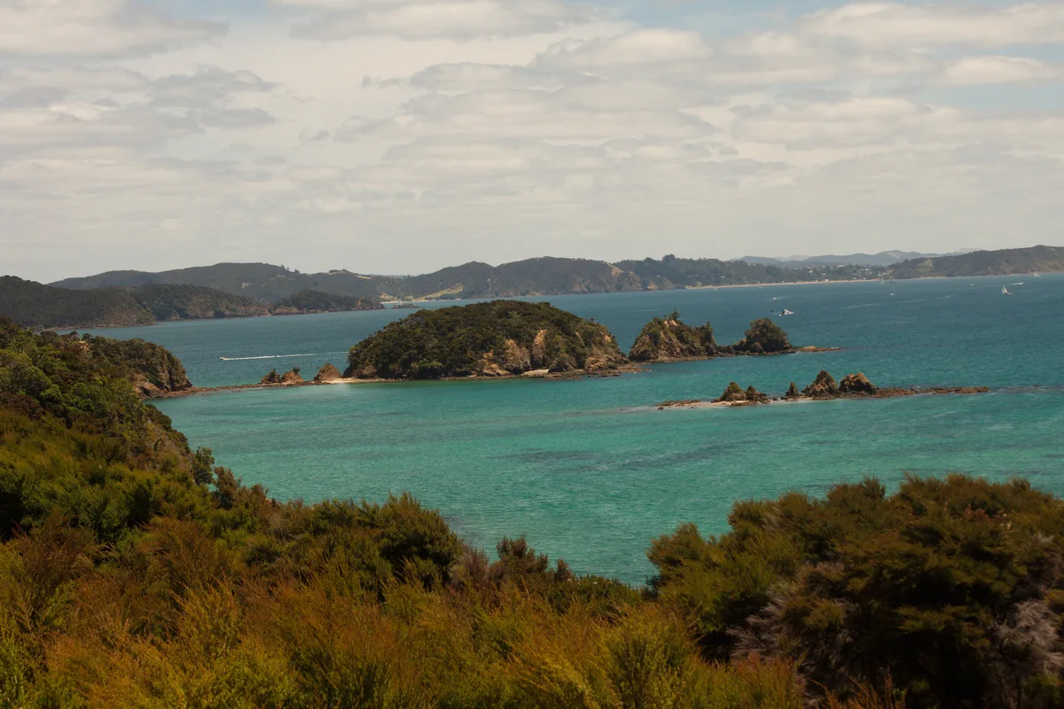
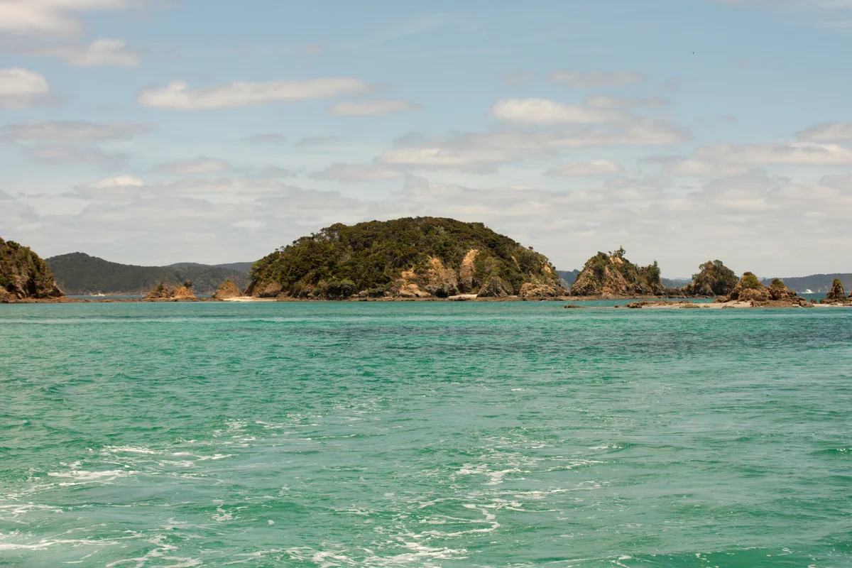
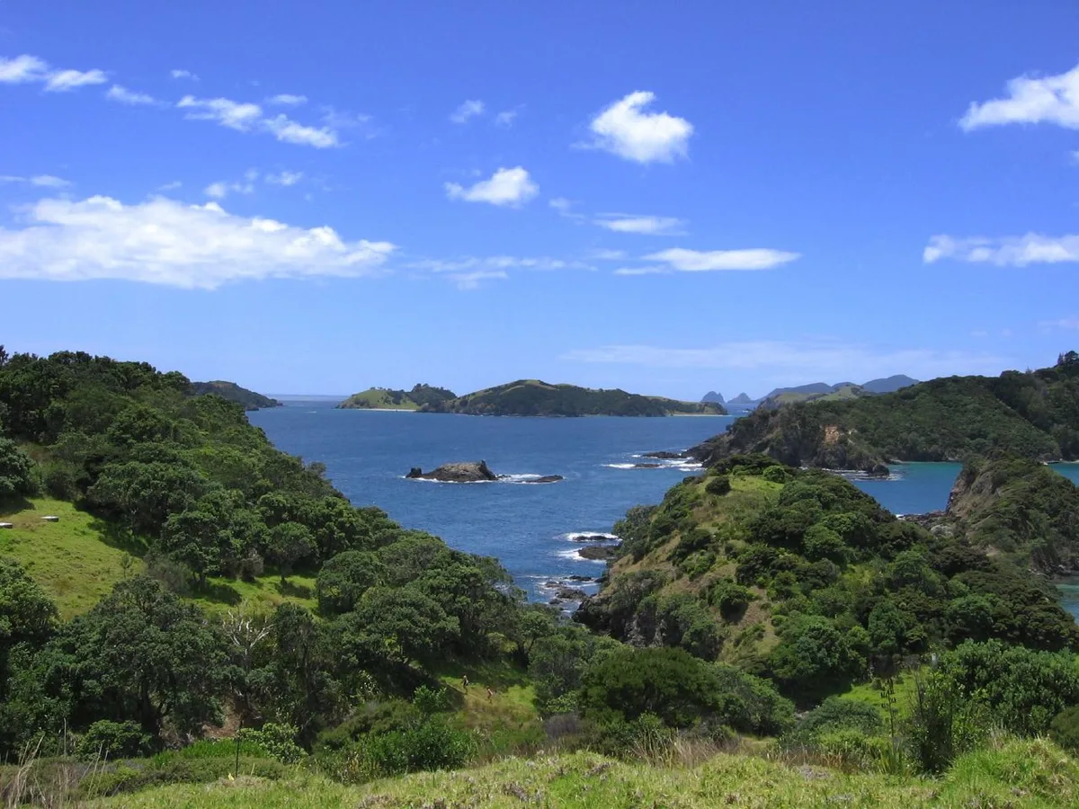
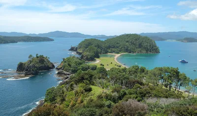
The Bay of Islands Marine Reserve surrounds the island, offering some of the clearest snorkelling in Northland — the sandy bottom and calm turquoise water make it accessible even for beginners. If you have more time on the water, Roberton Island (Motuarohia) is about 6 kilometres away, famous for its figure-eight shape and double sandbar lagoon. Further out, Cape Brett Lighthouse marks the tip of the Cape Brett Peninsula, with the Hole in the Rock sea arch nearby — a classic Bay of Islands boat excursion. The DOC tracks on the island are worth exploring between swims.
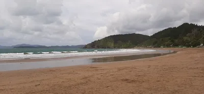
The waterline at low tide gives you the classic shot: golden sand curving into turquoise water with the Bay of Islands stretching behind.
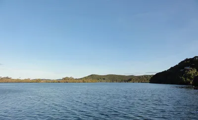
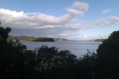
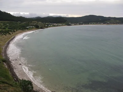
Climb the DOC track above the beach for an elevated frame that shows the island's isolation against the open bay — best light is early morning before the ferry traffic begins.
Where to eat
The Otehei Bay Restaurant is the one dining option on the island, rated 4.5 stars across nearly a thousand reviews — a strong result for a remote island spot. It's just 0.5 kilometres from the beach, making it a natural stop after a morning in the water. That said, bring backup snacks; island supply chains are what they are.
Where to stay
DOC camping is available on the island for those who want to wake up to the Bay of Islands at its quietest. Advance booking through DOC is mandatory — walk-up camping is not permitted. For more comfortable stays, base yourself in Paihia on the mainland and ferry across for the day.
Photography
Shoot from the waterline in the early morning when the turquoise water is glassy and the golden sand catches the low angle of the southern sun. The elevated DOC tracks above the beach offer a wider perspective across the Bay of Islands — worth the short climb for a shot that puts the island in context.
Good to know
The marine reserve rules are strictly enforced: no fishing, no collecting shells or marine life — not even a pebble. DOC camping on the island requires advance booking, so don't show up hoping to pitch a tent on a whim. No dogs are permitted anywhere on the island, and fires are only allowed in designated areas. There are no medical facilities on the island, so bring a first-aid kit and any medication you need — and confirm your return ferry before you head ashore.
Map
Nearby places
Otehei Bay Restaurant
Bay of Islands Marine Reserve
Roberton Island (Motuarohia)
Cape Brett Lighthouse
Things to see around Bay of Islands
Bay of Islands Marine Reserve
Marine reserve surrounding Urupukapuka Island protecting diverse marine life and clear waters.
Roberton Island (Motuarohia)
Famous figure-eight island with double sandbar and lagoon snorkelling.
Cape Brett Lighthouse
Historic lighthouse at the tip of Cape Brett Peninsula with Hole in the Rock sea arch nearby.
Frequently asked
The information on this page is provided for guidance only and may evolve. Access conditions, safety and infrastructure can change without notice. Always check official sources before traveling.
Nearest beaches
Other relaxed beaches in New Zealand

Reviews of this beach
- No reviews yet, what a shame — leave yours and share your experience.
Photo credits
Sources and licenses for the photos shown above.
- Photo 1 — Brownfish · source · CC BY-SA 3.0
- Photo 2 — Petersmeter · source · CC BY-SA 4.0
- Photo 3 — cobaltfish · source · CC BY-SA 2.0
- Photo 4 — cobaltfish · source · CC BY-SA 2.0
- Photo 5 — sheilaellen · source · CC BY 2.0
- Photo 6 — Fuadounet · source · CC BY-SA 2.0