Roberton Island BeachNew Zealand Beach Guide
White sand, turquoise lagoon, boat-only Bay of Islands escape
About
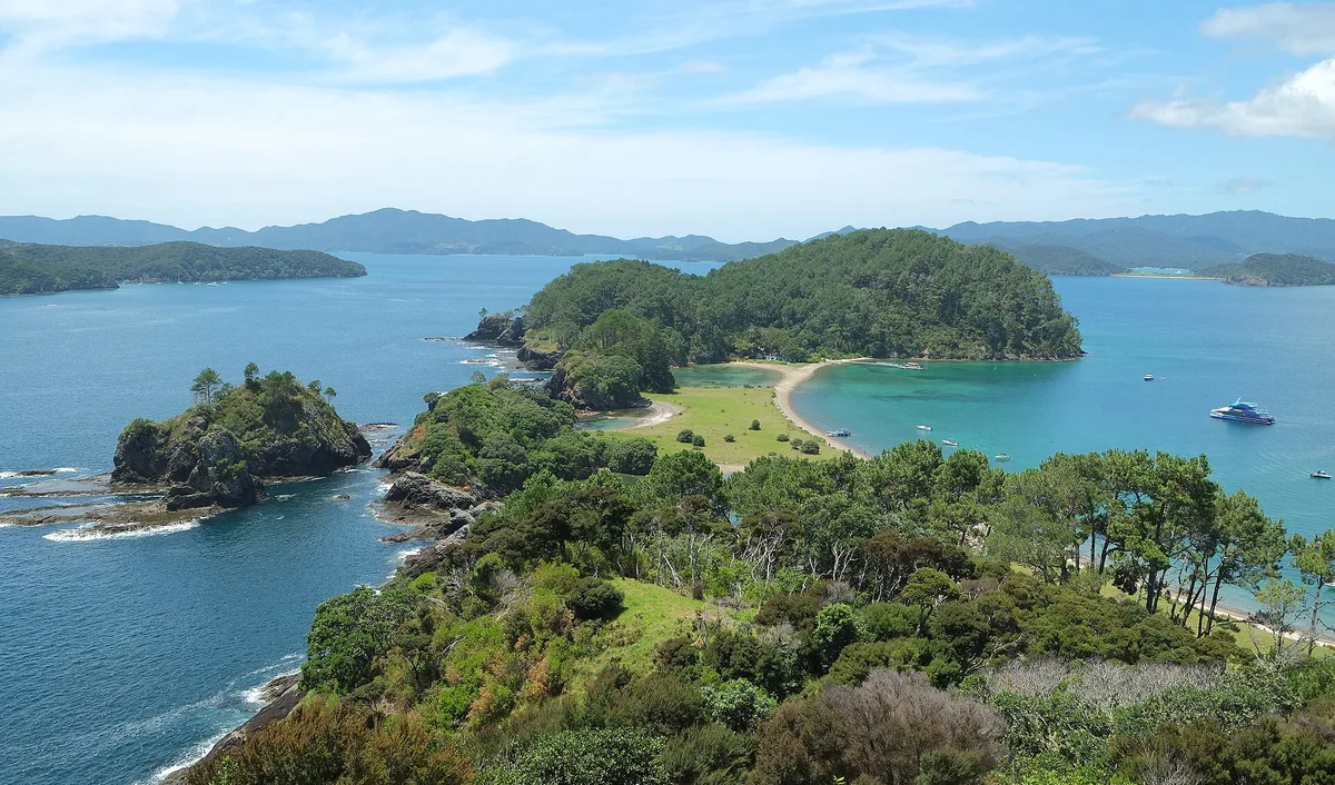
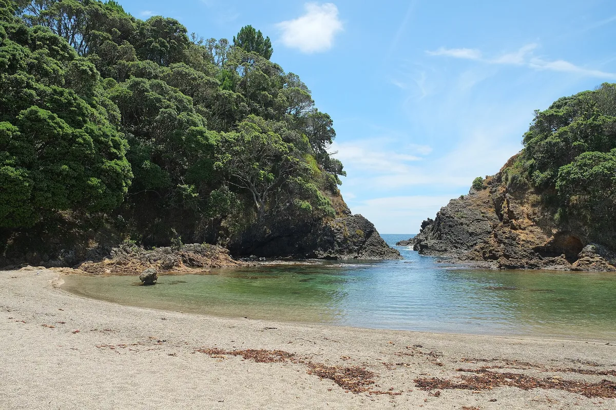
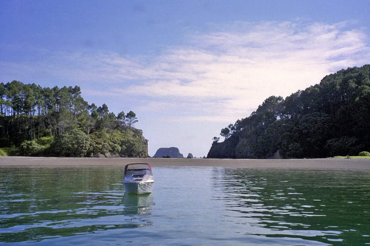
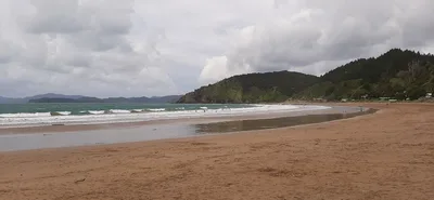
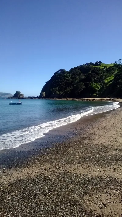
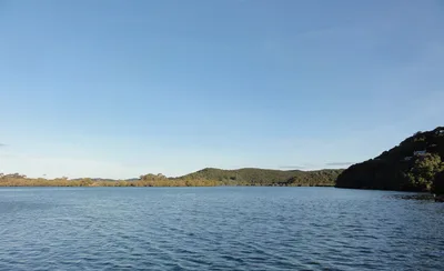
Roberton Island sits in the Bay of Islands, Northland, New Zealand — a figure-eight-shaped island whose double sandbar creates a sheltered tidal lagoon of turquoise water. The white sand stretches roughly 200 metres, soft underfoot and framed by calm, clear water that shifts colour as the tide moves. That distinctive geology is the whole show: two sandbars connect the island's lobes, and at low tide the lagoon becomes a snorkeller's playground. It's a moderate-traffic spot — day-trippers arrive by boat from Paihia and Russell — but the island's remoteness keeps the vibe unhurried and genuinely romantic. No roads, no facilities, no noise beyond the water.
How to get there
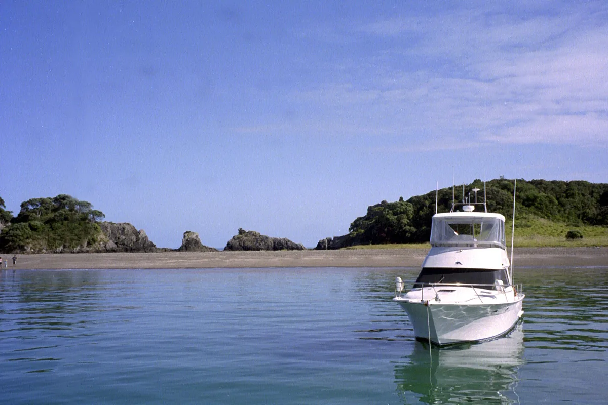
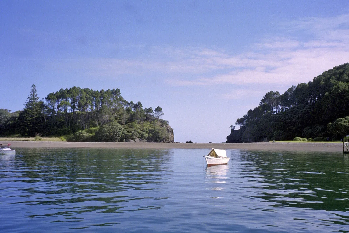
Reach Roberton Island by boat only — there is no road access and no vehicle landing of any kind. From Paihia the crossing takes around 30 minutes on seasonal departures; from Russell it's roughly 20 minutes, with on-demand options available. Boats land directly on the sand, so wear footwear you're happy to get wet. Depart from Paihia or Russell and check departure schedules in advance, especially outside peak season when cruise-boat frequency drops.
Who it's for
For couples
The boat-only access and lack of facilities naturally filter out the casual day-tripper, leaving a quiet, romantic stretch of white sand and turquoise lagoon that feels genuinely private — especially on a morning arrival before the peak-season boats pull in.
For families
Swimming is safe and the sheltered tidal lagoon is shallow enough for confident young snorkellers, but come prepared: there are no toilets, no shade structures, and no food on the island, so families need to pack everything and keep a close eye on tide times to avoid the sandbar disappearing underfoot.
Our take
Roberton Island is one of those places that earns its reputation without overselling itself. The double-sandbar geology is legitimately striking — white sand, turquoise lagoon, a figure-eight island you can walk the perimeter of at low tide. Swimming is safe, snorkelling is the highlight, and the marine reserve status means the water stays clean and the fish stay put. The catch is real: no facilities whatsoever, the sandbar vanishes at high tide, and midday in peak season brings cruise-boat arrivals that change the atmosphere fast. Go early, check the tides, bring everything you need, and you'll have one of the Bay of Islands' most distinctive beaches largely to yourself. Skip the winter months of June through August — fewer boats run and the cooler water takes the edge off snorkelling. True digital-detox territory — bring offline books, the cell signal fades and there's nowhere to plug in a laptop.
What to do
Snorkelling the tidal lagoon is the main event: turquoise, sheltered water over a sandbar makes for easy, rewarding exploration within the Bay of Islands Marine Mammal Sanctuary. Walk the figure-eight perimeter of the island at low tide to appreciate the double-sandbar geology — it's genuinely unusual and worth the lap. Further afield, Urupukapuka Island sits about 6.6 km away with DOC camping and walking tracks, while the famous Hole in the Rock sea arch at Cape Brett is a 25 km cruise destination that many boat operators combine with a Roberton Island stop.
Stand on the exposed sandbar at low tide and shoot along its length toward the island — white sand curving into turquoise water with no horizon clutter.
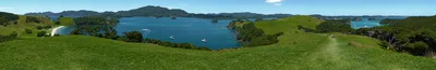
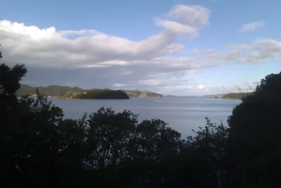
The aerial-style view of the figure-eight island shape is best captured from the high point of the island itself, giving a rare perspective on both lagoon and open bay simultaneously.
Where to eat
There are no cafés, kiosks, or restaurants on Roberton Island — none. Pack a full picnic before you leave Paihia or Russell, bring more water than you think you need, and plan to take all rubbish back to the mainland with you.
Where to stay
There is no accommodation on Roberton Island itself. Paihia and Russell, your embarkation points, are the natural bases for an overnight stay before or after your visit to the island.
Photography
Shoot from the sandbar at low tide looking back toward the island's figure-eight silhouette — the white sand against turquoise water is the defining frame. Early morning light before the cruise boats arrive gives you clean reflections in the lagoon and uncluttered compositions.
Good to know
This is a DOC-managed marine reserve: no fishing, no collecting shells or marine life, no fires, and no dogs — leave them at home. The sandbar is the island's star feature but it submerges at high tide, so check a tide chart before you go or you'll find open water where you expected a walk. Peak-season midday sees cruise-boat arrivals that can make the beach feel packed; aim for an early morning departure from Russell or Paihia to get the lagoon to yourself. There are zero facilities on the island — bring all food, water, and sun protection, and carry everything back out with you.
Map
Nearby places
Bay of Islands Marine Reserve
Urupukapuka Island
Cape Brett and Hole in the Rock
Things to see around Far North District
Bay of Islands Marine Reserve
Marine reserve protecting the waters around Roberton Island.
Urupukapuka Island
Largest island in the Bay with DOC camping and walking tracks.
Cape Brett and Hole in the Rock
Sea arch at Cape Brett tip, a classic Bay of Islands cruise destination.
Frequently asked
The information on this page is provided for guidance only and may evolve. Access conditions, safety and infrastructure can change without notice. Always check official sources before traveling.
Nearest beaches
Reviews of this beach
- No reviews yet, what a shame — leave yours and share your experience.
Photo credits
Sources and licenses for the photos shown above.