Talisker BayUnited Kingdom Beach Guide
Wild volcanic shore earned by a 45-minute hike
About
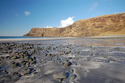
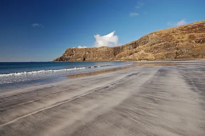
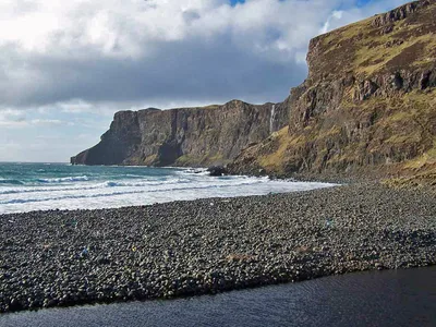
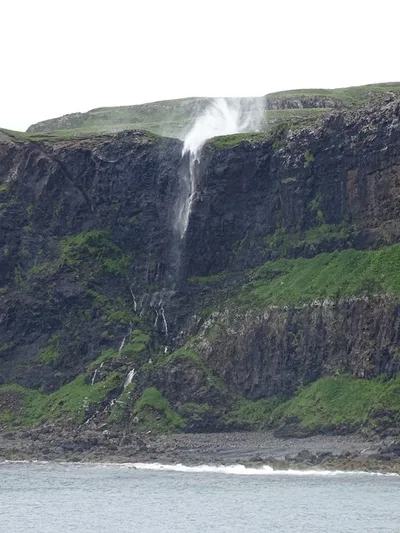
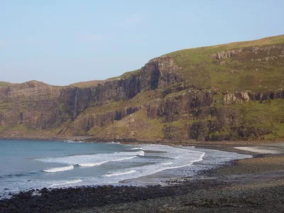
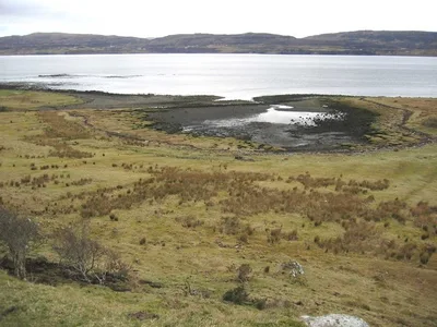
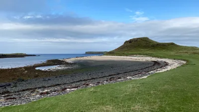
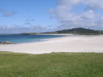
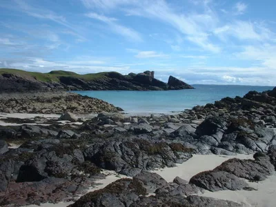
Talisker Bay sits on the exposed west coast of the Isle of Skye, backed by towering columnar basalt cliffs that drop sheer to a dark, mixed volcanic pebble shore. A waterfall tumbles directly onto the beach, and a river mouth cuts across the approach — both reminders that this place runs on its own terms. The water is grey and cold year-round, the Atlantic wind is rarely absent, and the scale of the cliffs makes the whole scene feel genuinely raw. No road reaches here, no café waits at the end — just the sound of surf, falling water, and the occasional cry of a seabird.
How to get there
There is no road to Talisker Bay — the only way in is on foot. Drive to the end of the public road to Talisker village, where a small informal free parking layby marks the trailhead; it fills up quickly on fine summer days, so arrive early. From there, a 45-minute hike on a rough path brings you to the beach. The path is walkable daily but becomes very muddy in winter, and the beach is not accessible for wheelchairs.
Who it's for
For couples
The 45-minute hike filters out casual visitors, so couples who make the effort often find the beach surprisingly quiet — the waterfall and cliff backdrop make it one of the most dramatic settings on Skye for those willing to earn it.
For families
Older children who are confident hikers will find the waterfall and volcanic pebble shore genuinely exciting, but the rough path, river crossing, and cold water make Talisker Bay unsuitable for toddlers or young children. Dogs are welcome on a lead near the waterfall area.
Our take
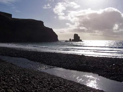
Rip currents are present at Talisker Bay and the Atlantic swell is strong year-round — this is not a swimming beach, and you should not enter the water. Set that expectation before you lace up your boots. What Talisker Bay actually delivers is one of the most visually striking coastal landscapes in Scotland: dark volcanic pebbles, a waterfall landing directly on the shore, and basalt cliffs that look like they were stacked by hand. The hike-only access keeps numbers manageable, but the small parking layby fills fast on good-weather days in July and August — go early or go in June. Avoid November through February entirely; Atlantic storms are severe, daylight is short, and the path turns to mud. Dunvegan Castle and Talisker Distillery are both within 25 km, so a full day on this part of Skye is easy to build. Worth every step of that 45-minute walk.
What to do
The hike in is itself the main event, but once you arrive, the waterfall and basalt cliffs reward slow exploration and photography. Nearby, the Fairy Pools — 13 km away — offer another dramatic Skye landscape if you have energy for a second walk. Talisker Distillery, just 5 km from the trailhead, is Skye's only single-malt distillery and offers guided tours and tastings — a logical stop on the way back. For bigger views, Neist Point Lighthouse (22 km) sits at the westernmost tip of Skye with cliff walks and the chance of sea-eagle sightings.
The waterfall cascading onto the dark volcanic pebble shore with basalt columns rising behind it is the defining shot — get there at low tide for the widest foreground.
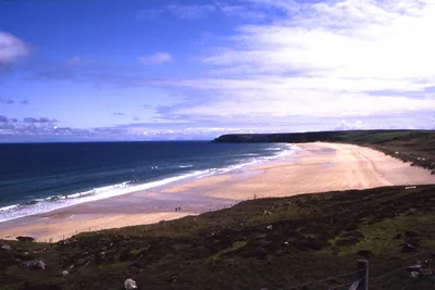
From the southern end of the beach, looking north along the cliff line captures the full scale of the columnar basalt in a single frame, especially in the long golden light of a June or July evening.
Where to eat
There are no food or drink facilities at Talisker Bay — bring everything you need from home or from a shop before you set out. The nearest laptop-friendly café is Caora Dhubh, about 6.6 km away, which makes a reasonable stop before or after the hike.
Where to stay
No accommodation information is available for the immediate area — plan your base in advance, as Talisker village is small and facilities are limited.
Photography
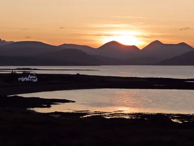
The best shot on the beach is the waterfall framed against the dark basalt columns — position yourself at mid-beach and shoot in the soft light of a summer evening when the low Atlantic sun catches the cliff face. Early morning arrivals get the beach to themselves and avoid the haze that can flatten midday light on overcast Skye days.
Good to know
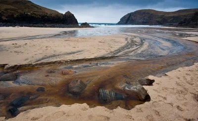
No fires are permitted on or near the beach, and a strict leave-no-trace ethic applies — pack out everything you bring in. Rip currents are present and strong westerly swells run year-round; do not enter the water without a clear understanding of the conditions, and treat the sea here with real caution. The river crossing at the beach approach can be deep and fast after rain, so check conditions before you go; waterfall spray also makes the rocks around it slippery, so watch your footing. Cold water temperatures are a constant regardless of season — even in July, immersion without a wetsuit carries serious risk.
Map
Nearby places
Fairy Pools
Things to see around Carbost
Talisker Distillery
Skye's only single-malt distillery offering guided tours and tastings.
Neist Point Lighthouse
Westernmost point of Skye with dramatic cliff walks and sea-eagle sightings.
Dunvegan Castle
Seat of Clan MacLeod, the oldest continuously inhabited castle in Scotland.
Frequently asked
The information on this page is provided for guidance only and may evolve. Access conditions, safety and infrastructure can change without notice. Always check official sources before traveling.
Nearest beaches
Other wild beaches in United Kingdom
More beaches in Scottish Islands
Reviews of this beach
- No reviews yet, what a shame — leave yours and share your experience.
Photo credits
Sources and licenses for the photos shown above.
- Photo 1 — John Allan · source · CC BY-SA 2.0
- Photo 2 — John Allan · source · CC BY-SA 2.0
- Photo 3 — Richard Dorrell · source · CC BY-SA 2.0
- Photo 4 — Richard Dorrell · source · CC BY-SA 2.0
- Photo 5 — Matthew Chadwick · source · CC BY-SA 2.0
- Photo 6 — Richard Webb · source · CC BY-SA 2.0