Sapphire BeachUnited States Virgin Islands Beach Guide
White sand, turquoise water, and trade winds that deliver
About
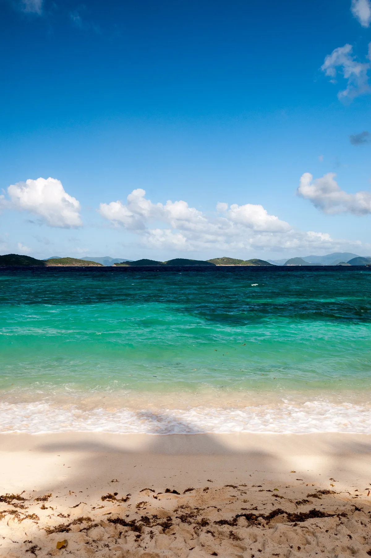
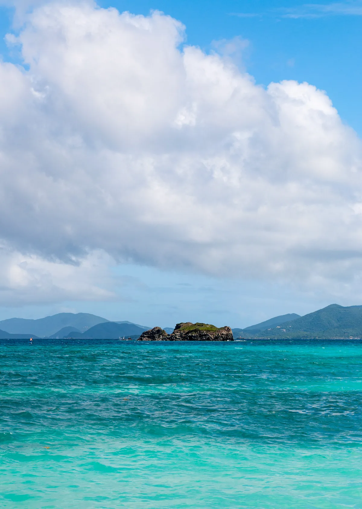
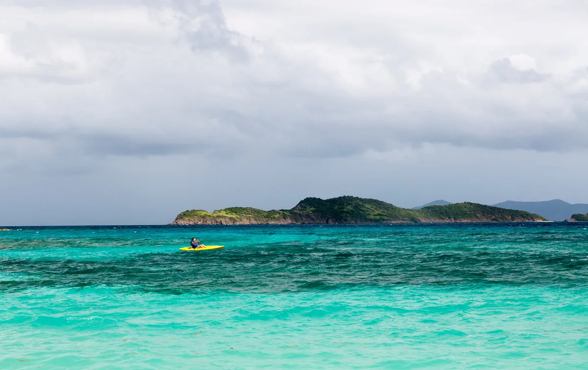
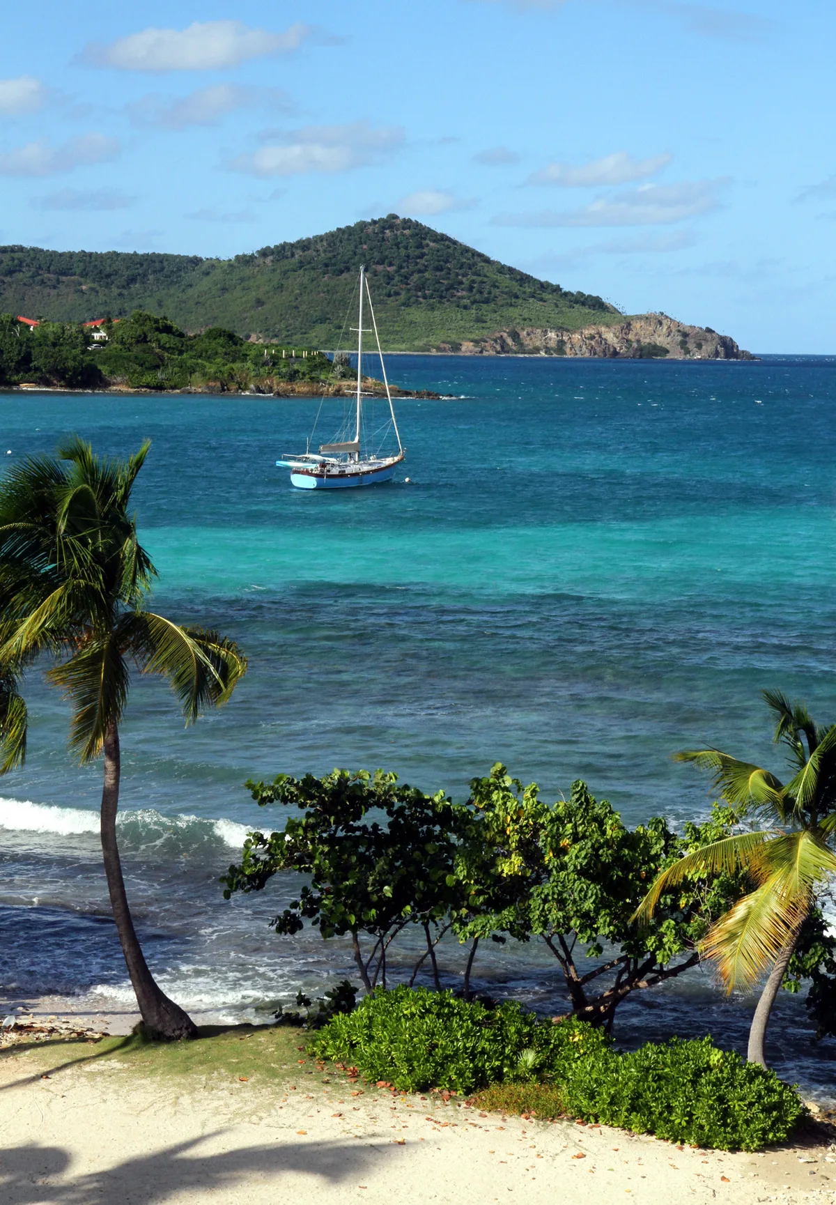
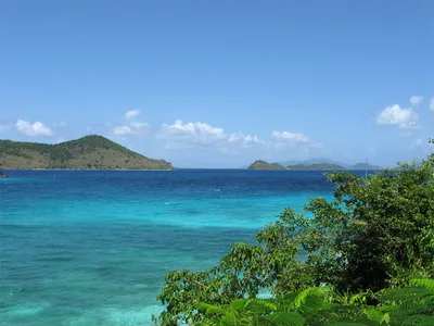
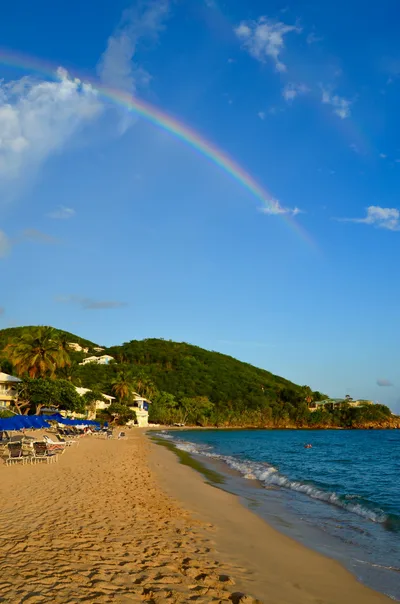
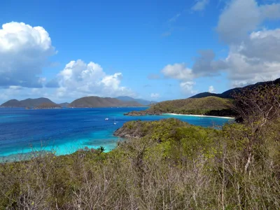
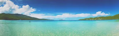
Sapphire Beach stretches roughly 343 metres of white sand along the shores of Saint Thomas, US Virgin Islands, with turquoise water that shifts from glassy calm at the northern end to wind-chopped swells near the marina to the south. Consistent trade wind exposure defines the beach's character — this is a place that hums with energy, kite lines and windsurf sails cutting across the channel views toward St. John. The beach splits naturally into two zones: a calmer northern swim section where the water settles enough for snorkeling, and a southern watersports zone near the marina where the action concentrates. Vibe is lively, access is easy, and the St. John channel panorama gives every afternoon a cinematic backdrop.
How to get there
From Charlotte Amalie, the drive takes around 30 minutes by car, with free parking available at the resort — public beach access is confirmed. Ferry connections add flexibility: the Red Hook to Cruz Bay crossing takes 20 minutes, and the Water Island Ferry runs a 10-minute hop from Saint Thomas. The Marriott Frenchman's Cove ferry links Frenchman's Cove to Charlotte Amalie Waterfront in 15 minutes, and seaplane access is also an option. Cyril E. King Airport (STT) sits about 13.3 km away, making this a straightforward first-day beach stop.
Who it's for
For couples
The St. John channel views from the waterline make for a genuinely romantic late-afternoon stretch — find a quiet patch in the northern swim zone, away from the watersports action, and the beach earns its keep.
For families
The calmer northern swim section gives families a workable buffer from the watersports zone, and easy car access with free parking removes the logistical headache — though note that dogs are not permitted and there is no formal accessibility infrastructure on the sand.
Our take
Sapphire Beach is not a place to come for solitude — it's lively, wind-driven, and built around activity. The trade winds are the defining fact here: they make the southern end a genuine watersports hub and the northern end a refuge for swimmers who know to stay in their lane. Safety first: respect the designated zones, keep clear of launch areas, and don't underestimate the chop that builds December through March. The St. John channel views are the real visual payoff, and the easy access plus free parking make this one of the more practical beaches on Saint Thomas. Come between November and April for the driest weather, but be aware that winds can make the water rough for casual swimmers from December through March. Skip August through October without hesitation.
What to do
Coral World Ocean Park, about 2.5 km along the coast, pairs well with a beach day — it offers an underwater observatory and snorkel trails that complement what you'll see in the water here. The Red Hook Ferry Terminal, 4 km away, is your departure point for day trips to St. John and the British Virgin Islands. For something inland, Drake's Seat sits 8.3 km out and rewards the detour with elevated island views, while the Pirate Treasure Museum at 7.2 km makes a fun half-day diversion.
The northern end of the beach frames the St.
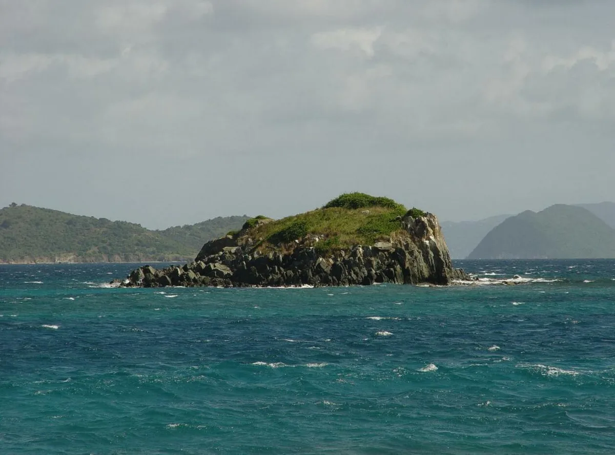
John channel between white sand and turquoise water — shoot wide at golden hour for the full effect. The southern marina area, with kite and windsurf gear against open water, gives you action and colour in a single frame. For a quieter composition, the channel view looking east from mid-beach captures the scale of the crossing without the watersports clutter.
Where to eat
Lattes in Paradise is within about a kilometre, covering coffee without much of a drive. Sushi Thai is also close by, along with XO Bistro and Melt at 1.1 km each, and East End Cafe brings Italian to the mix at 1.2 km — enough variety that you won't need to go far. Sunset Grille at 1.9 km rounds out the options if you want to watch the light fade over a proper meal.
Where to stay
Point Pleasant Resort and The Ritz-Carlton, Saint Thomas are both 1.9 km from the beach and equally convenient. Elysian Beach Resort at 2 km keeps you close to the water. If you're willing to travel a little further, Gallows Point Resort and Grande Bay Resort offer a quieter base a short drive away.
Photography
The northern swim zone at golden hour delivers the cleanest shot — white sand foreground, turquoise water mid-frame, and the St. John channel receding into the distance. For something with more drama, position yourself near the southern marina end in the morning when kite and windsurf sails are rigging up against the open channel backdrop.
Good to know
A designated watersports zone occupies the southern end of the beach — swimmers and snorkelers must use the northern section to stay clear of kite and windsurf equipment in the water. Maintain real distance from launch zones; gear moving at speed leaves little margin for error. Easterly trade winds pick up between December and March, making conditions choppy and uncomfortable for casual swimmers — plan accordingly. August, September, and October fall squarely in hurricane season, so avoid those months entirely.
Map
Nearby places
Sushi Thai
XO Bistro
Melt
East End Cafe
Sunset Grille
Point Pleasant Resort
The Ritz-Carlton, Saint Thomas
Elysian Beach Resort
Gallows Point Resort
Grande Bay Resort
Coral World Ocean Park
Red Hook Ferry Terminal
Charlotte Amalie Historic District
Things to see around Smith Bay
Coral World Ocean Park
Marine park with underwater observatory and snorkel trails, just west along the coast.
Red Hook Ferry Terminal
Departure point for frequent ferries to St. John and the British Virgin Islands.
Charlotte Amalie Historic District
Danish colonial town with Fort Christian and duty-free shopping.
Frequently asked
The information on this page is provided for guidance only and may evolve. Access conditions, safety and infrastructure can change without notice. Always check official sources before traveling.
Nearest beaches
Reviews of this beach
- No reviews yet, what a shame — leave yours and share your experience.
Photo credits
Sources and licenses for the photos shown above.
- Photo 1 — rtclauss · source · CC BY-SA 2.0
- Photo 2 — rtclauss · source · CC BY-SA 2.0
- Photo 3 — rtclauss · source · CC BY-SA 2.0
- Photo 4 — Skellig2008 · source · CC BY 2.0
- Photo 5 — anoldent · source · CC BY-SA 2.0
- Photo 6 — Serge Melki from Indianapolis, USA · source · CC BY 2.0