Benguerra BeachMozambique Beach Guide
White sand, turquoise shallows, and dhows to the archipelago
About
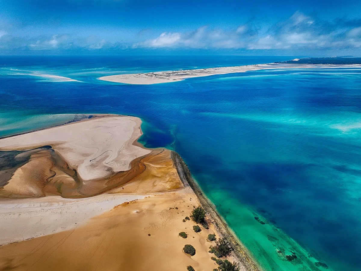
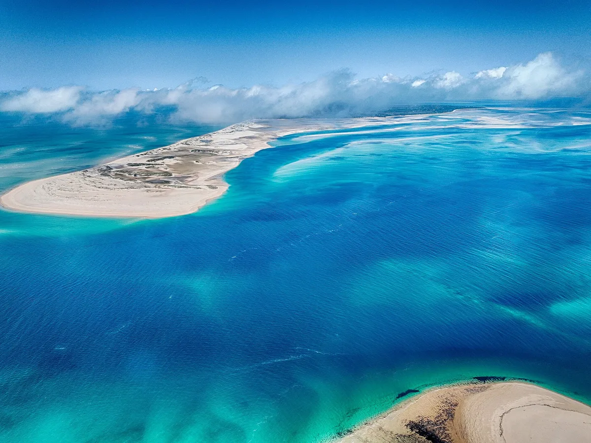
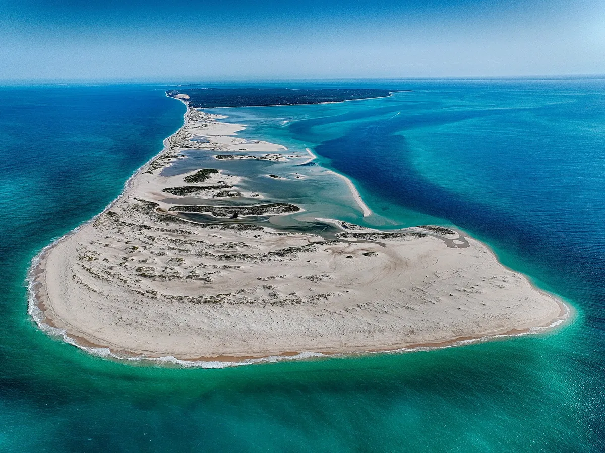
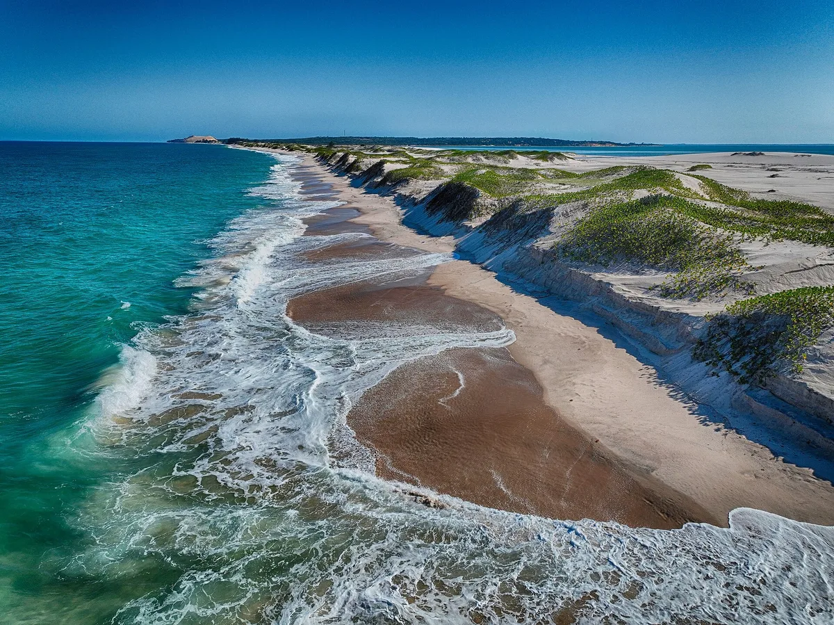
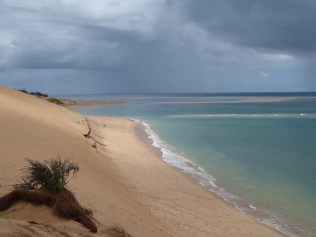
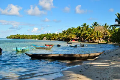
Praia de Benguerra sits on the edge of the Mozambique Channel, a sweeping stretch of white sand that melts into shell-white tidal flats at low tide. The water runs a vivid turquoise where the shallows catch the light, framing a panorama of the Bazaruto Archipelago on the horizon. It's quiet here — wading birds pick through the exposed flats, traditional dhows rock at anchor, and the pace is unhurried. At roughly 2 kilometres long, the beach serves as the principal departure point for Benguerra Island and the wider national park, giving it a purposeful calm rather than a resort feel.
How to get there
There is no road to Praia de Benguerra — you reach it exclusively by boat or helicopter. Daily boat transfers from Vilanculos take around 30 minutes; if you prefer speed, a helicopter from Vilanculos International Airport (VNX) covers the same distance in about 10 minutes. A National Park entry fee of US$15 applies, so have cash or a card ready before you board. Operators based in Vilanculos handle transfers, so arrange your crossing in advance.
Who it's for
For couples
The quiet atmosphere, traditional dhow anchorage, and uninterrupted views across the turquoise channel to the archipelago make this a genuinely peaceful escape for two — especially during the dry season when crossings are reliable and the skies stay clear.
For families
Families should plan around the tide table — the extreme shallows at low tide mean children can wade safely across the flats, but actual swimming requires waiting for high tide. The calm, relaxed pace and birdwatching on the flats give younger visitors plenty to explore without needing organised entertainment.
Our take
Praia de Benguerra is not a beach you stumble upon — the boat-only access and US$15 park fee filter out casual visitors, and that's precisely why it works. The tidal flats are the defining feature: at low tide they stretch out in pale, shell-white sheets that look almost lunar, and at high tide the turquoise water fills in and the swimming becomes genuinely pleasant. Cyclone season is a real constraint, not a footnote — January through March can shut down crossings without warning, so the dry months of May to October are when this beach makes sense. The proximity to Bazaruto Archipelago National Park means the beach functions as a launchpad as much as a destination, and that dual identity gives it an energy that purely decorative beaches lack. Come for the dhows, stay for the birds, and leave with a boat ticket to the archipelago.
What to do
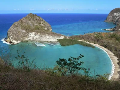
The beach is the gateway to Bazaruto Archipelago National Park, a marine reserve 25 kilometres out that protects dugongs, manta rays, and coral reefs — water safaris operate from the area to get you there. Benguerra Island itself, the second-largest in the archipelago, lies about 14 kilometres away and rewards a day trip with freshwater lakes and pristine beaches. Back on the flats, birdwatching is genuinely rewarding: wading species work the tidal shallows at low water, and the panorama of the archipelago makes simply standing on the sand worthwhile.
The classic frame is a traditional dhow anchored in turquoise water with the Bazaruto Archipelago spread across the background — shoot from the waterline at high tide for maximum colour contrast.
At low tide, the shell-white tidal flats create a near-abstract landscape of reflective water pools and wading birds that rewards a wide-angle composition. The 2-kilometre arc of white sand photographed from the water level at golden hour gives a sense of the beach's scale and solitude.
Where to eat
There are no restaurants or food stalls on the beach itself — bring everything you need for the day. Both Benguerra Lodge and Azura Benguerra Island, the two lodges closest to the beach, cater to their own guests, so independent visitors should pack provisions before leaving Vilanculos.
Where to stay
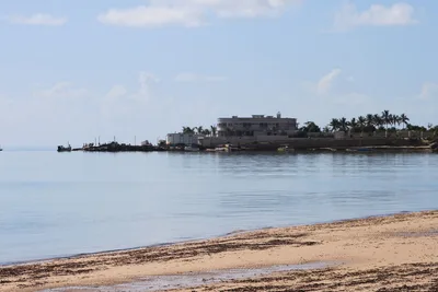
Benguerra Lodge sits just 0.1 kilometres from the beach and is the closest base for exploring the tidal flats and catching early dhow departures. Azura Benguerra Island is 1.3 kilometres away and offers another option within the immediate area. Book well ahead — options are limited and demand is steady during the dry season.
Photography
The shell-white tidal flats at low tide, with dhows anchored against a turquoise backdrop and the Bazaruto Archipelago silhouetted on the horizon, are the standout shot — aim for the golden hour just after sunrise when the light is soft and the flats still hold a thin film of water. High tide in the late afternoon brings the turquoise water right up the white sand and makes for cleaner foreground compositions without the exposed mud.
Good to know
Swimming is only viable near high tide — the beach becomes extremely shallow at low tide, leaving vast exposed flats that are beautiful to walk but impossible to swim in. Time your dip carefully and ask your operator or lodge for the day's tide schedule before you wade in. Cyclone season runs November through April and can make sea crossings unpredictable; January, February, and March carry the highest risk of disruption to dhow and boat services. The tidal flat surface is uneven, so footwear with grip is worth packing if you plan to explore on foot.
Map
Nearby places
Benguerra Lodge
Azura Benguerra Island
ovc water safari
transporte, mergulho, pesca desportiva, prestacao de servicos
Things to see around Vilanculos
Benguerra Island
Second-largest Bazaruto island with freshwater lakes, pristine beaches and luxury lodges
Bazaruto Archipelago National Park
Marine national park protecting dugongs, rays and coral reefs
Vilanculos Beach
Town beach and main dhow harbour with archipelago views
Frequently asked
The information on this page is provided for guidance only and may evolve. Access conditions, safety and infrastructure can change without notice. Always check official sources before traveling.
Other beaches in the region
Reviews of this beach
- No reviews yet, what a shame — leave yours and share your experience.
Photo credits
Sources and licenses for the photos shown above.
- Photo 1 — Tom Corser · source · CC BY-SA 3.0
- Photo 2 — FrogsLegs71 · source · CC BY-SA 3.0
- Photo 3 — Tom Corser · source · CC BY-SA 3.0
- Photo 4 — Tom Corser · source · CC BY-SA 3.0
- Photo 5 — Cornelius Kibelka from Berlin, Germany · source · CC BY-SA 2.0