Maro-Cerro Gordo BeachSpain Beach Guide
Wild limestone coves reachable only by kayak or boot
About
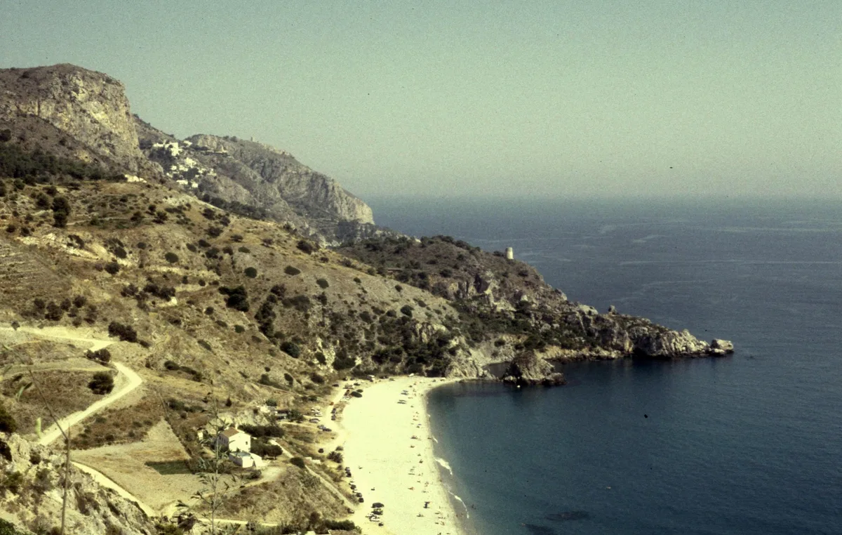
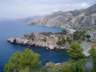
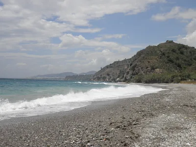
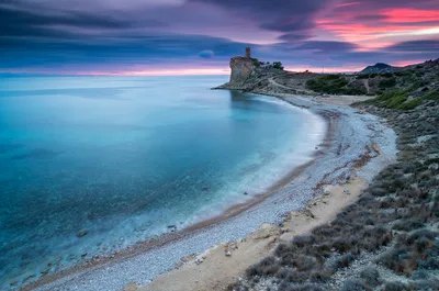
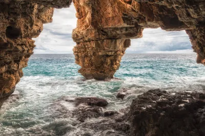
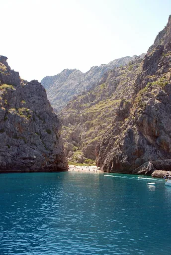
Playa de Maro-Cerro Gordo sits within the Acantilados de Maro-Cerro Gordo Natural Park on the Costa del Sol, where vertical limestone cliff walls plunge straight into crystal-clear water. The shore is mixed rock and sand, shaped by the sea rather than any developer's hand — there's no infrastructure here, no sunbed rental, no beach bar. Isolation is the whole point: the protected area keeps visitor numbers low and the water exceptional for snorkelling and diving. Kayak-access coves punctuate the cliff base, each one a pocket of calm tucked between ancient rock. The vibe is wild, and that's exactly what draws the people who make the effort.
How to get there
There is no road to this beach. Reach it by boat or ferry from Maro beach or La Herradura — the crossing takes around 20 minutes and runs on demand. Alternatively, hike from Maro village via a dirt track, a journey of roughly 45 minutes each way. There is no dedicated parking at or near the beach itself; leave your vehicle in Maro village before setting out on foot or by water.
Who it's for
For couples
For couples who want genuine solitude, the combination of kayak-access coves, protected isolation, and crystal-clear water makes this one of the few stretches of the Costa del Sol where you can genuinely have a cove to yourselves. Arrive early on a calm morning and the limestone cliffs frame the kind of quiet that's hard to find on this coastline.
For families
The complete absence of infrastructure, the difficult access by boat or a 45-minute hike, and the lack of a lifeguard make this a poor choice for families with young children. Playa de Maro, just 1.5 km away, is a far more practical and safer alternative for a family day out.
Our take
No lifeguard, no road, no facilities — Playa de Maro-Cerro Gordo makes you earn it, and that's the entire point. Safety first: swell can make landing genuinely hazardous, kayak access is only safe in calm conditions, and the months of November through February should be avoided outright. Come between June and September, check conditions before you leave Maro village, and never attempt the dirt track after rain. What you get in return is a protected stretch of Costa del Sol coastline that looks nothing like the Costa del Sol — crystal-clear water, limestone cliffs dropping straight into the sea, and the kind of empty shore that has largely disappeared from this coast. The snorkelling and diving are exceptional by any measure. This is not a beach for a casual afternoon; it's a half-day commitment that rewards preparation.
What to do
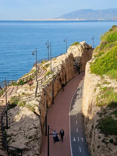
The exceptional snorkelling and diving in the protected waters are the main draw — crystal-clear conditions and limestone formations make for outstanding underwater visibility. Above the waterline, the Mirador de Cerro Gordo, about 1.9 km away, offers a sweeping perspective over the cliffs and coastline that puts the scale of the natural park into context. The Panel Panorámico viewpoint, roughly 1.5 km out, is another strong vantage point worth the short detour. Playa de Maro, just 1.5 km away, provides a gentler base if you want to split the day between wild and accessible.
The shot of vertical limestone cliff walls reflected in crystal-clear water, taken from a kayak at the cove entrance, is the image that defines this place.
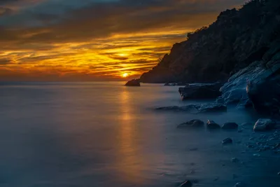
The Mirador de Cerro Gordo, 1.9 km away, gives you the aerial perspective — cliffs, coves, and open sea in a single frame that no beach-level shot can replicate. Early morning light on the mixed rock-and-sand shore, before any other visitors arrive, is worth setting an alarm for.
Where to eat
There are no facilities whatsoever on the beach, so pack everything you need before you leave. Las Piedras, about 0.6 km away, is your closest option for a meal after the return journey. Dis Tinto and MarDela are both within 2.7 km if you want to extend the day with a proper sit-down lunch or dinner back near Maro.
Where to stay
There is no accommodation on or near the beach itself. Nerja, the nearest town, is your practical base for the night, with the full range of options a well-established Costa del Sol town provides. Málaga-Costa del Sol Airport (AGP) is 64.4 km away for onward travel.
Photography
The vertical limestone cliff walls photographed from a kayak at water level — especially in the soft light of early morning — are the defining shot here. For a wider compositional frame, the Mirador de Cerro Gordo at 1.9 km gives you the full sweep of cliff, cove, and crystal-clear water from above.
Good to know
Natural park regulations apply throughout — no camping and no fires, full stop. There is no lifeguard on duty, so you're entirely responsible for your own safety in the water. Swell can make landing on the shore difficult, and kayak access should only be attempted in calm conditions; avoid the months of November through February when swell and rain make access genuinely dangerous. The dirt track from Maro village becomes impassable after heavy rain, so check the weather before you commit to the hike.
Map
Nearby places
Panel Panorámico.
Mirador de Cerro Gordo
Acantilados de Maro-Cerro Gordo Natural Park
Cuevas de Nerja
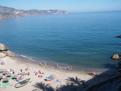
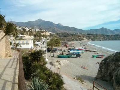
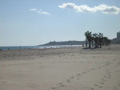
Playa de Maro
Things to see around Nerja
Acantilados de Maro-Cerro Gordo Natural Park
Protected coastal cliffs and coves spanning the Málaga-Granada border.
Cuevas de Nerja
Spectacular cave system with prehistoric paintings and a concert hall.
Playa de Maro
Frequently asked
The information on this page is provided for guidance only and may evolve. Access conditions, safety and infrastructure can change without notice. Always check official sources before traveling.
Nearest beaches
Other wild beaches in Spain
More beaches in Andalusia
Reviews of this beach
- No reviews yet, what a shame — leave yours and share your experience.