Boca de Yuma BeachDominican Republic Beach Guide
Wild Atlantic coast where the river meets the sea
About
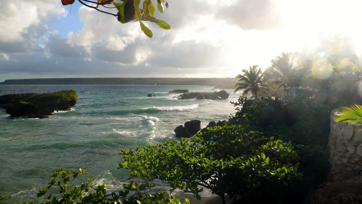
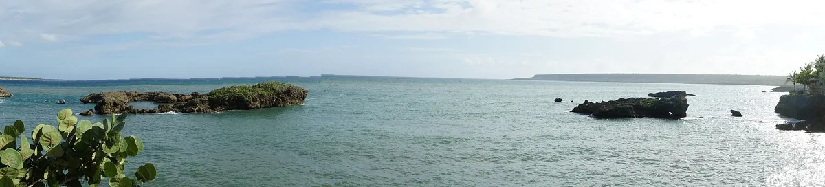
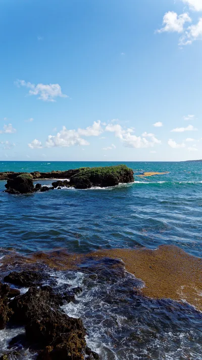
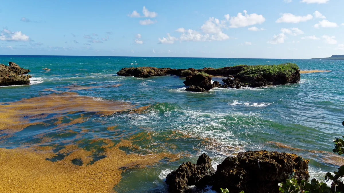
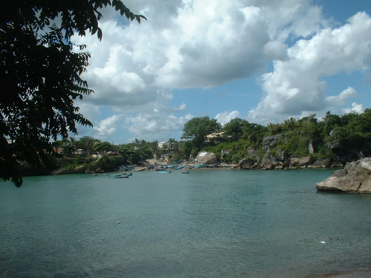
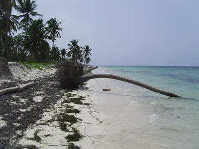
Playa Boca de Yuma sits at the mouth of the Yuma River in San Rafael del Yuma, La Altagracia, where the Atlantic rolls hard against a rocky shoreline backed by dramatic limestone cliffs. There's no sand here — just raw, wave-sculpted rock, deep blue open ocean, and the unhurried rhythm of a working fishing town. The beach stretches roughly 800 metres along this exposed coast, unpolished and unmanaged, with zero resort infrastructure in sight. It's a place defined by its geography: river current meeting Atlantic swell, cliffs framing every view, and fishing boats as the only watercraft you'll see.
How to get there
Drive from Punta Cana International Airport in about 52 minutes, or from the Bávaro resort zone in roughly 54 minutes — both routes are daily and by car. The closest major airport is actually Casa de Campo International Airport (LRM), about 32.7 km away. Access difficulty is rated moderate, and the rocky terrain means wheelchair use is not practical here. Parking is free and informal, tucked into the fishing town itself — no machines, no apps, just find a spot.
Who it's for
For couples
Couples who want raw, uncommercialized coastline without another resort in sight will find Boca de Yuma genuinely different — walk the cliffs, eat fresh fish at El Arponero, and watch the fishing boats without a pool bar in earshot.
For families
Families should know upfront that swimming is not safe here and the rocky terrain is challenging for young children — this is a scenery-and-culture stop, not a beach day. The nearby Cueva de Berna with its Taíno petroglyphs makes for a memorable educational detour 3 km away.
Our take
Do not come to Playa Boca de Yuma expecting to swim — the Atlantic swell and river current are genuinely dangerous, and there is no lifeguard. That safety verdict stated clearly, this is one of the most atmospherically distinct spots on the Dominican Republic's southern coast. Rocky, wild, backed by limestone cliffs, and anchored by a real fishing village that has no interest in catering to tourists — it's the anti-resort. The Mirador, the Taíno caves at Cueva de Berna, and a plate of fresh fish at El Arponero make a full and rewarding half-day. Skip August through October without hesitation. Visit November to April when the dry season keeps conditions at their most stable and the Atlantic, while still powerful, is at least predictable.
What to do
Walk up to the Mirador just 0.4 km away for elevated views over the river mouth and coastline — it's the best vantage point in the area. About 1.3 km out, Hoyo Azulito offers a striking natural feature worth the short trip. For deeper exploration, Cueva de Berna, 3 km away, holds Taíno petroglyphs within Parque Nacional del Este — a genuine archaeological site. The national park itself, 20 km out, protects coastal ecosystems and Taíno heritage, and Isla Saona, a protected island 40 km away, is reachable by boat.
The limestone cliffs rising behind the rocky shoreline are the signature shot — shoot from water level on the rocks with the deep blue Atlantic in frame.
The Mirador at 0.4 km gives an elevated perspective over the river mouth geography that no ground-level angle can replicate.
Where to eat
Restaurante El Arponero, 0.5 km from the beach, is the most reviewed option in the area with over 140 ratings — a reliable stop for fresh seafood after exploring the coast. Closer in at 0.3 km, El peje restaurante and Pescaderia y mariscos both serve local fish dishes and carry strong ratings from those who've found them. El Arrecife Restaurant, also 0.5 km away, rounds out the options with a 4.6-star score.
Where to stay
Hotel Bocaino, just 0.5 km from the beach, is the only listed accommodation in the immediate area. It places you right in the fishing village, which means early mornings with boat engines and genuine local atmosphere rather than resort polish.
Photography
The limestone cliff backdrop frames the blue Atlantic most dramatically in the morning light — position yourself along the rocky shoreline looking south toward the cliffs for the strongest compositions. The river mouth itself, where freshwater meets open ocean, offers a rare geographic shot best captured at low angle from the rocks.
Good to know
There is no lifeguard at Playa Boca de Yuma — ever. Do not enter the water: strong Atlantic swell combined with the river current at the mouth makes swimming genuinely hazardous, and swimming is not recommended under any circumstances. Come for the scenery, the cliffs, and the town — not the water. Avoid visiting in August, September, or October, when peak hurricane season pushes Atlantic swell to its most dangerous levels.
Map
Nearby places
papeleriaDJ y soluciones
El peje restaurante
Pescaderia y mariscos
Restaurante El Arponero
El Arrecife Restaurant
Hotel Bocaino
Mirador
Hoyo Azulito
Things to see around San Rafael del Yuma
Cueva de Berna
Taíno cave with petroglyphs near Boca de Yuma, within Parque Nacional del Este.
Parque Nacional del Este
National park protecting coastal ecosystems, caves and Taíno heritage sites.
Isla Saona
Protected island within Parque Nacional del Este, reachable by boat.
Frequently asked
The information on this page is provided for guidance only and may evolve. Access conditions, safety and infrastructure can change without notice. Always check official sources before traveling.
Nearest beaches
Reviews of this beach
- No reviews yet, what a shame — leave yours and share your experience.
Photo credits
Sources and licenses for the photos shown above.
- Photo 1 — MadameNoire · source · CC BY-SA 3.0
- Photo 2 — https://www.flickr.com/photos/miguel_discart_vrac_3/ · source · CC BY-SA 2.0
- Photo 3 — Miguel Discart & Kiri Karma · source · CC BY-SA 2.0
- Photo 4 — Miguel Discart & Kiri Karma · source · CC BY-SA 2.0
- Photo 5 — Lebob · source · CC BY-SA 3.0