Grand Langoustier BeachFrance Beach Guide
White sand, turquoise water, zero crowds — earn it

About
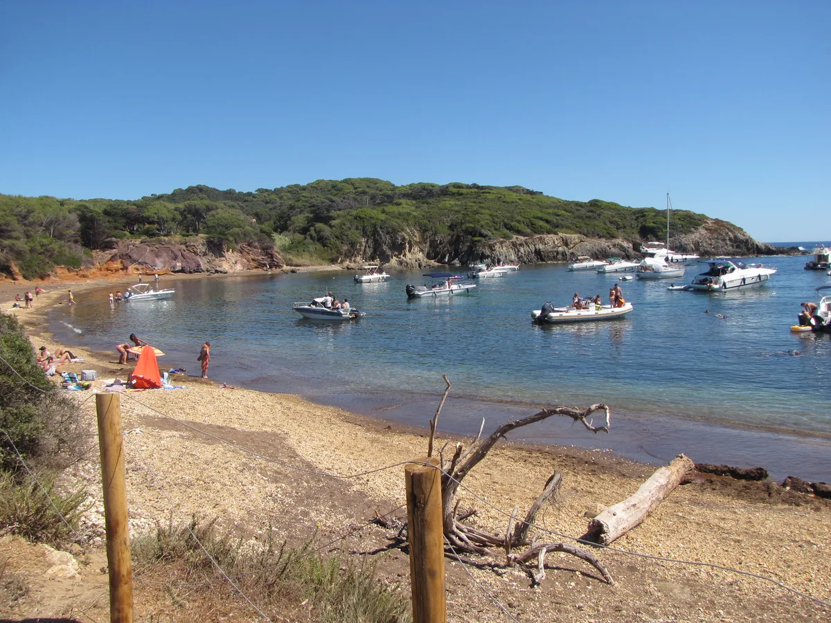
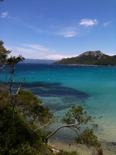
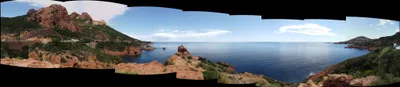
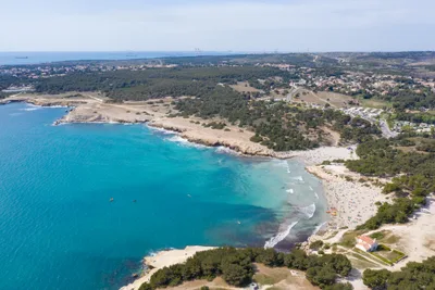
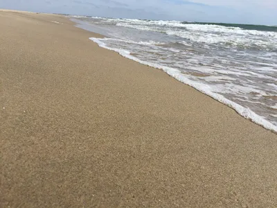
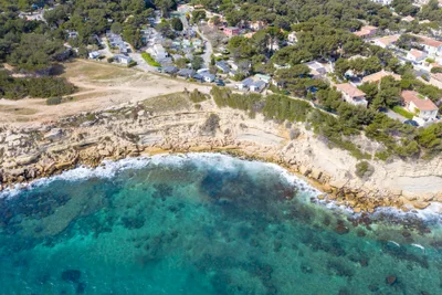
Plage du Grand Langoustier stretches roughly 237 metres along the western shore of Île du Petit Langoustier, part of the Îles d'Hyères off the Var coast of Provence-Alpes-Côte d'Azur. The sand is white, the water a clear turquoise fed by posidonia meadows that carpet the seabed below. A dense wall of maquis scrubland frames the beach on its landward side, and the westward exposure means the bay catches afternoon light and stays sheltered from the prevailing winds. There are zero facilities here — no sunbeds, no snack bar, no shade structures — just the raw Provençal coastline as the national park intends it.
How to get there
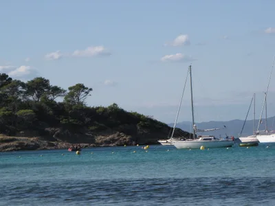
Plage du Grand Langoustier is boat- or ferry-only — there is no road to this beach and no cars on Porquerolles island at all. The most direct route is the ferry from La Tour Fondue on the Giens peninsula, a 20-minute crossing that runs daily; from Porquerolles village you can reach the beach on foot in about 75 minutes or by hired bike in around 45 minutes along a track that is rough and sandy in places — standard road bikes are not suitable. There is no parking anywhere on the island; bicycle hire is available in the village.
Who it's for
For couples
The combination of near-empty white sand, turquoise shallows, and a 75-minute walk through wild maquis to get here makes this one of those rare beaches where the effort itself becomes part of the experience — arrive early and you may have the whole 237 metres to yourselves.
For families
The calm, sheltered water and safe swimming conditions suit confident young swimmers well, but the rough 4 km track from the village, zero shade, no water on-site, and the ban on dogs June–September mean families need to plan carefully — pack more supplies than you think you'll need and keep very young children in mind before committing to the hike.
Our take
Swimming here is safe, the water is genuinely turquoise over posidonia meadows, and the white sand is as clean as it gets — because almost nobody makes the effort to reach it. That effort is real: a 20-minute ferry from the Giens peninsula, then either a 75-minute walk or a 45-minute bike ride on a rough sandy track, with no water, no shade, and no mobile signal waiting at the other end. Come prepared or don't come — the national park rules are strict, the fire-risk closures are enforced, and the beach will not apologise for having zero infrastructure. Go between June and September for the best conditions, avoid November through February when ferry services are reduced and the track deteriorates.
What to do
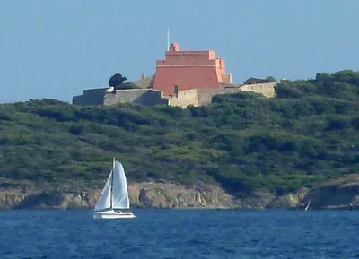
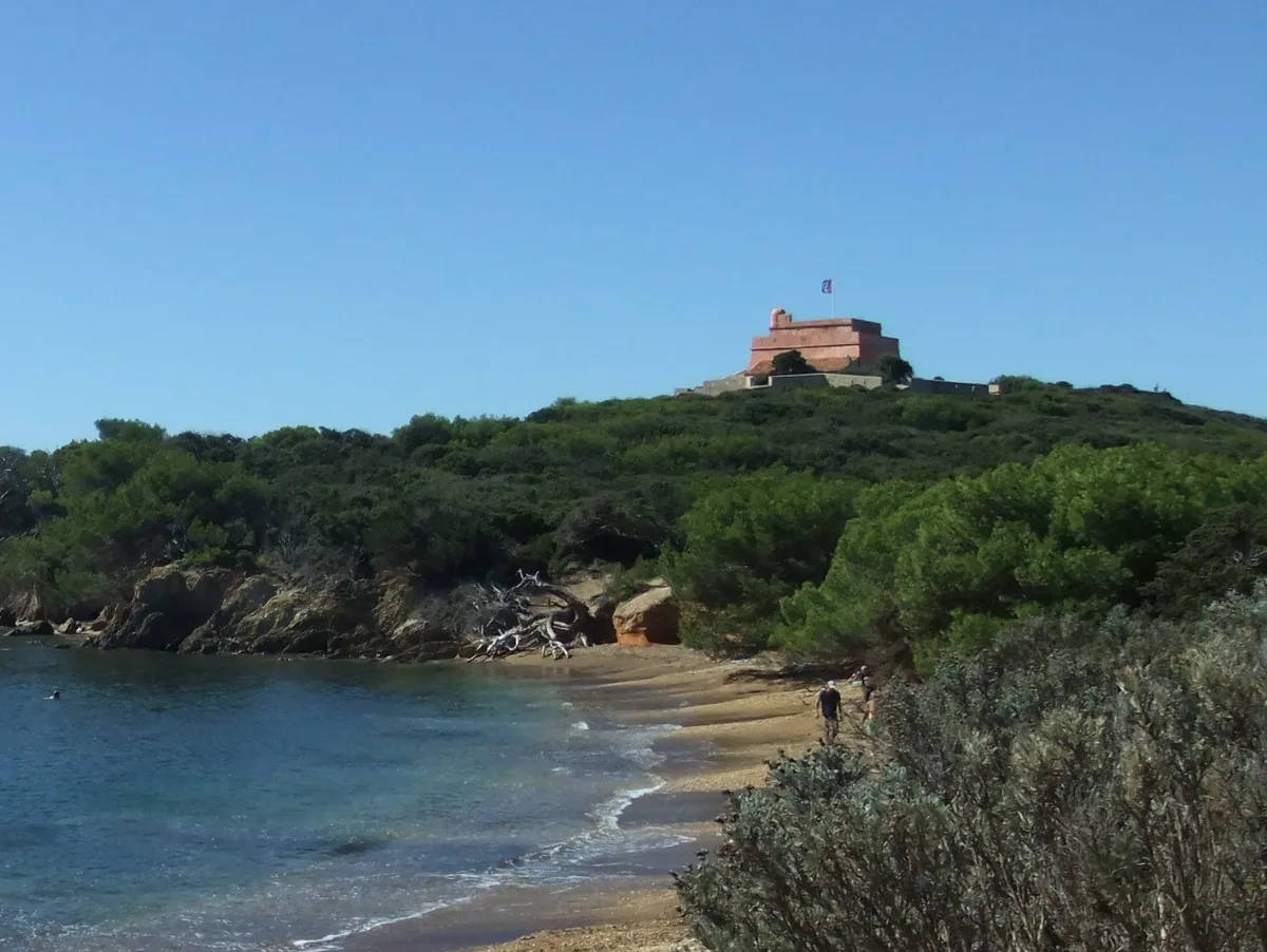
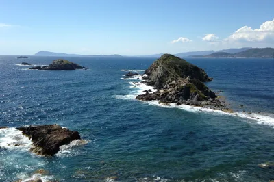
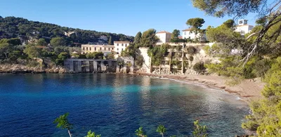
The posidonia meadows just offshore make for excellent snorkelling — the seagrass beds are a protected habitat and the water clarity rewards anyone with a mask. Back toward the village, Fort Sainte-Agathe is a historic fortification worth the detour, sitting about 4.5 km away. The Phare de Porquerolles, an active lighthouse on the island's south coast roughly 3 km from the village, offers panoramic views over the Îles d'Hyères and is a satisfying goal for a bike ride. If you have time for a second island, the neighbouring Parc National de Port-Cros — France's oldest marine national park — is about 14 km away.
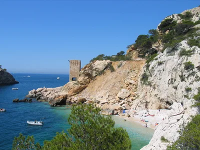
The waterline shot looking inland — white sand in the foreground, turquoise water mid-frame, and the dense maquis rising behind — is the defining image of this beach.
The final bend of the approach track, where the scrubland parts to reveal the bay for the first time, is worth a frame too. Afternoon light on the westward-facing shore turns the turquoise water particularly vivid.
Where to eat
There is absolutely nothing to eat or drink at the beach itself, so pack a full picnic before you leave Porquerolles village. If you need a stop before or after the crossing, Le Glacier Porquerollais - Maison Pesce in the village is the nearest option, about 2.7 km from the beach.
Where to stay
There is no accommodation at or near the beach — camping on the island is prohibited. Take the daily ferry from La Tour Fondue on the Giens peninsula for a day trip.
Photography
The best shots are from the waterline looking back toward the maquis backdrop — the contrast between white sand, turquoise water, and dense green scrub is strongest in the soft afternoon light that the westward exposure delivers. For wider compositions, the approach track through the maquis offers natural framing before the beach opens up.
Good to know
Carry everything you need — there is no water, no shade, and no facilities at the beach, so bring sufficient supplies for the full day. No campfires and no camping are permitted anywhere on the island, and dogs are prohibited on Porquerolles beaches from June through September under national park regulations. Stay on marked paths at all times, and be aware that access to the island can be prohibited on days with very severe or extreme fire risk. Mobile signal is unlikely at this distance from the village, so download offline maps before you leave and tell someone your plan.
Map
Nearby places
Gorges du Loup
Fort Sainte-Agathe
Things to see around Hyères
Fort Sainte-Agathe
Phare de Porquerolles
Active lighthouse on the south coast offering panoramic views over the Îles d'Hyères.
Parc National de Port-Cros
France's oldest marine national park on neighbouring Port-Cros island.
Frequently asked
The information on this page is provided for guidance only and may evolve. Access conditions, safety and infrastructure can change without notice. Always check official sources before traveling.
Nearest beaches
Other wild beaches in France
More beaches in Provence-Alpes-Côte d'Azur
Reviews of this beach
- No reviews yet, what a shame — leave yours and share your experience.
Photo credits
Sources and licenses for the photos shown above.
- Photo 1 — sgustin78 · source · CC BY-SA 2.0
- Photo 2 — sgustin78 · source · CC BY-SA 2.0
- Photo 3 — Bernard Delpeuch · source · CC BY-SA 3.0
- Photo 4 — Gnrc · source · CC BY-SA 4.0