Rogačić BeachCroatia Beach Guide
Cold War pebbles, blue water, zero tourists
About
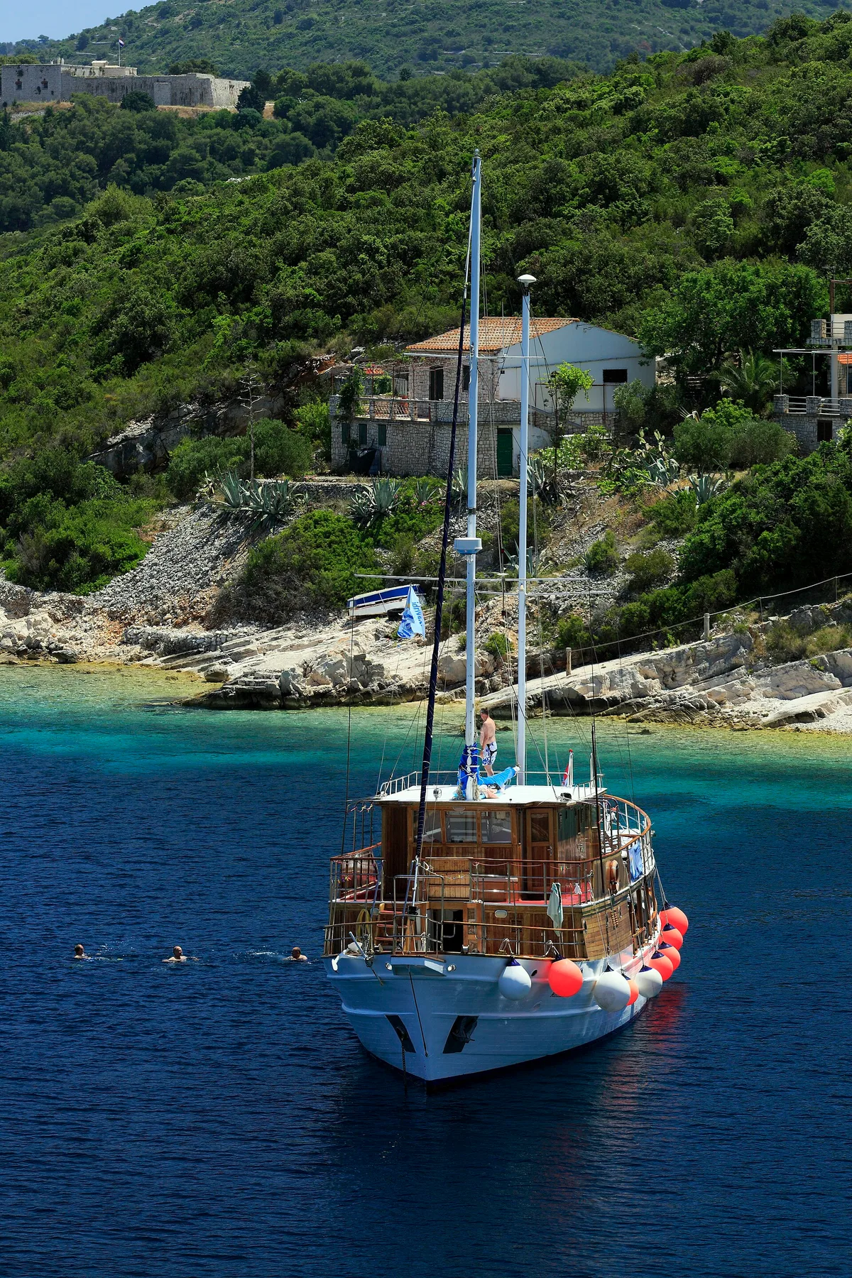
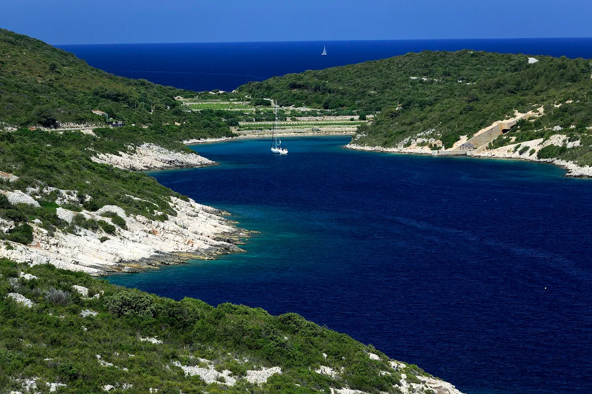
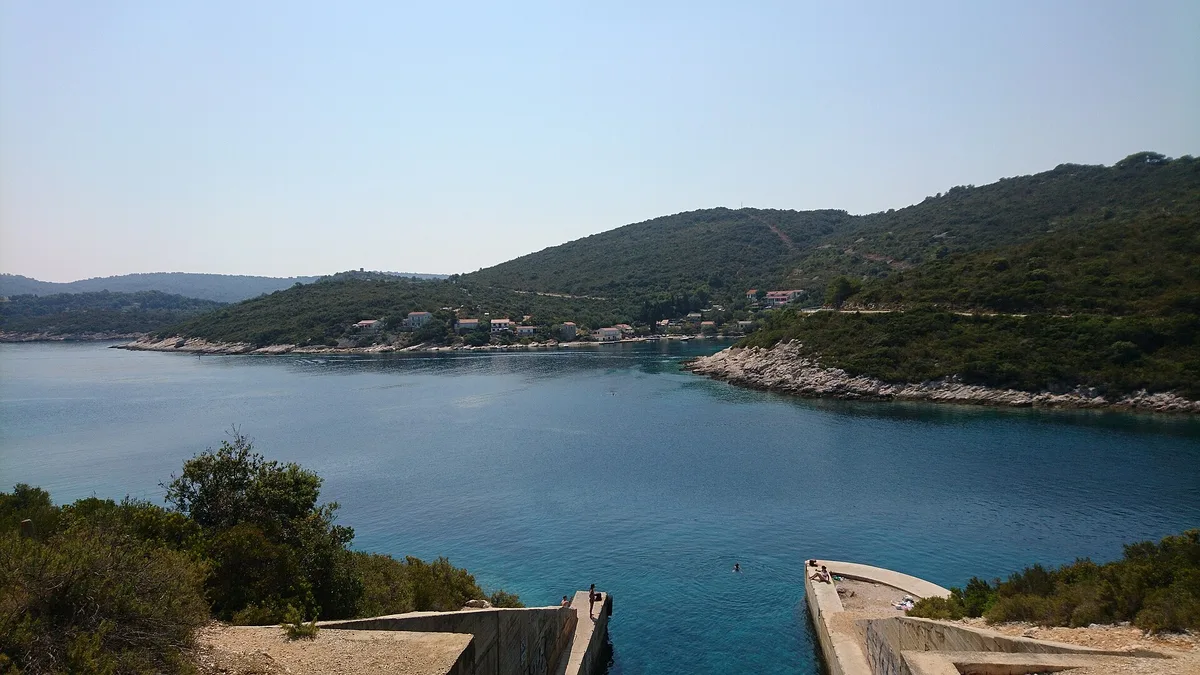
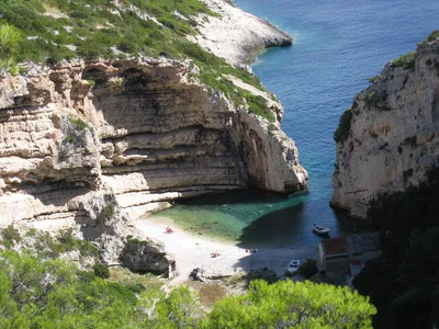
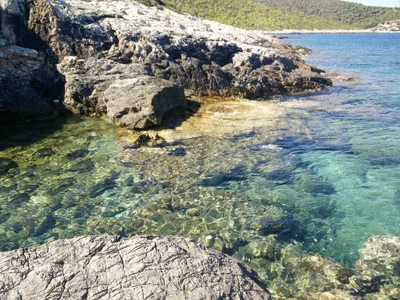
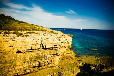
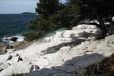
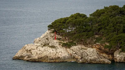
Uvala Rogačić sits on the north coast of Vis island, a compact double-pocket of pebbles tucked against a shoreline that still bears the bones of Yugoslav military history. The intact Cold War jetty juts into blue water, concrete and purposeful, a relic that gives this tiny cove its unmistakable character. At roughly 120 metres across, it's a local morning swim spot rather than a beach resort — no sunbeds, no beach bars, no tourist infrastructure of any kind. The water is clear and blue, the pebbles smooth underfoot, and the atmosphere is genuinely wild. Locals arrive early; by mid-morning you may well have the whole inlet to yourself.
How to get there
From Vis town, you can drive to the inlet in around 10 minutes — informal roadside parking is free near the entrance to the cove. Prefer your own two feet? A 25-minute hike from Vis town brings you down to the pebble pockets along a rough coastal path. There's no entry fee. Note that the terrain to reach the pebble pockets is rough, so wear sturdy footwear.
Who it's for
For couples
The wild, unhurried atmosphere and complete absence of tourist infrastructure make Rogačić a genuinely private escape — pack a picnic, claim a pebble pocket, and spend a morning with nothing but blue water and Cold War history for company.
For families
Families with older children who can manage rough terrain will enjoy the military jetty as a hands-on history lesson, but the uneven pebble access and absence of a lifeguard mean it's not well suited to toddlers or very young swimmers — keep a close eye near the jetty's edges.
Our take
Uvala Rogačić is safe to swim and genuinely worth the short drive or hike from Vis town — but come for the history and the solitude, not for beach amenities, because there are none. The Cold War jetty is the real draw: intact, atmospheric, and completely free of the souvenir-stand treatment that ruins similar sites elsewhere. At roughly 30 metres of pebble shore, this is a spot that rewards early risers and anyone who finds beauty in honest, unpolished places. Skip it in winter — the bura wind on this exposed north coast is no joke from November through February. June to September is your window, and mornings are best before the day heats up. It won't suit everyone, but if you want a swim with a side of Yugoslav military archaeology and zero other tourists, Rogačić delivers.
What to do
The military heritage of Vis rewards curious visitors well beyond the jetty at Rogačić — the bunker complex at Vela Glava is about 3.6 km away and worth the detour for anyone drawn to Cold War history. Closer to town, the Vis Archaeological Museum (2.2 km) displays Greek and Roman artefacts from ancient Issa inside a 19th-century Austrian barracks. For the single most atmospheric site on the island, Tito's Cave (Titova Špilja, 6 km) is the actual WWII partisan headquarters used by Marshal Tito in 1944 and is open to visitors. The Stone Garden activity site is 2.6 km away if you want something more active.
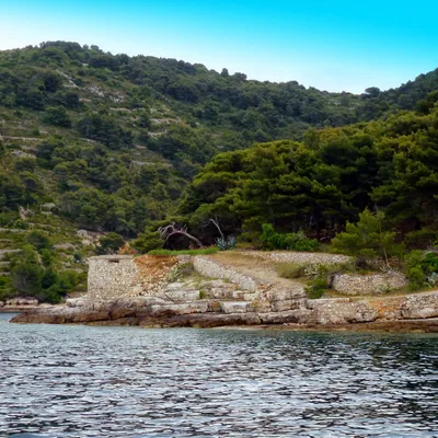
The intact Yugoslav military jetty is the standout frame — shoot along its length toward open blue water for a stark, graphic composition.
The two pebble pockets photographed from the jetty's tip capture the raw, untouched feel of the cove, especially in the soft light of a summer morning.
Where to eat
The nearest options are a short drive or walk back toward Vis town — Pizzeria Charlie and Pomâlo Inn's surrounding area sit around 1.6 km away, while Peskarija 1911 and Konoba Kantun are within 1.8 km for a proper sit-down meal. Kod Paveta, also about 1.8 km out, offers regional Dalmatian cooking worth seeking out after a morning swim. Bring your own water and snacks to the beach itself — there is nothing on site.
Where to stay
Tamaris and Pomâlo Inn are both around 1.6 km from the cove, making either a practical base for exploring the north coast on foot or by car. Staying this close means you can walk down for an early swim before the day warms up — exactly how locals use this spot.
Photography
The intact Yugoslav military jetty against open blue water is the defining shot — arrive in the morning when the light hits the concrete at a low angle and the cove is still empty. The two distinct pebble pockets, framed by the raw Dalmatian coastline, make a strong wide composition from the jetty's landward end.
Good to know
The concrete military jetty is the star feature, but treat it with respect — edges may be sharp and sections could be unstable, so step carefully and don't let children run on it unsupervised. There is no lifeguard on site, so swim within your limits. Avoid the north coast entirely from November through February: the bura wind sweeps in hard here and conditions become unpleasant and potentially dangerous. Dogs are welcome with no restrictions, making this a favourite with local dog walkers.
Map
Nearby places
Pizzeria Charlie
Dionis Pizzeria
Peskarija 1911
Konoba Kantun
Kod Paveta
Tamaris
Pomâlo Inn
Stone Garden
bunker Vela Glava - kupola
bunker Vela Glava - ulaz na vrhu1
Tito's Cave (Titova Špilja)
Vis Archaeological Museum
Blue Cave (Modra Špilja)
Things to see around Vis
Tito's Cave (Titova Špilja)
WWII partisan headquarters cave used by Marshal Tito in 1944, now open to visitors.
Vis Archaeological Museum
Museum in a 19th-century Austrian barracks displaying Greek and Roman artefacts from ancient Issa.
Blue Cave (Modra Špilja)
Famous sea cave on Biševo island where sunlight refracts to create an electric-blue glow.
Frequently asked
The information on this page is provided for guidance only and may evolve. Access conditions, safety and infrastructure can change without notice. Always check official sources before traveling.
Nearest beaches
Other wild beaches in Croatia
More beaches in Dalmatia
Reviews of this beach
- No reviews yet, what a shame — leave yours and share your experience.
Photo credits
Sources and licenses for the photos shown above.
- Photo 1 — Falk2 · source · CC BY-SA 4.0
- Photo 2 — Falk2 · source · CC BY-SA 4.0
- Photo 3 — ModriDirkac · source · CC BY-SA 4.0
- Photo 4 — Anto (talk) 05:13, 7 August 2009 (UTC) · source · CC BY-SA 3.0
- Photo 5 — Anto (talk) 05:19, 7 August 2009 (UTC) · source · CC BY-SA 3.0
- Photo 6 — Anto (talk) 05:19, 7 August 2009 (UTC) · source · CC BY-SA 3.0