Pinitos BeachMexico Beach Guide
Lighthouse cove with grey sand and sunset drama
About
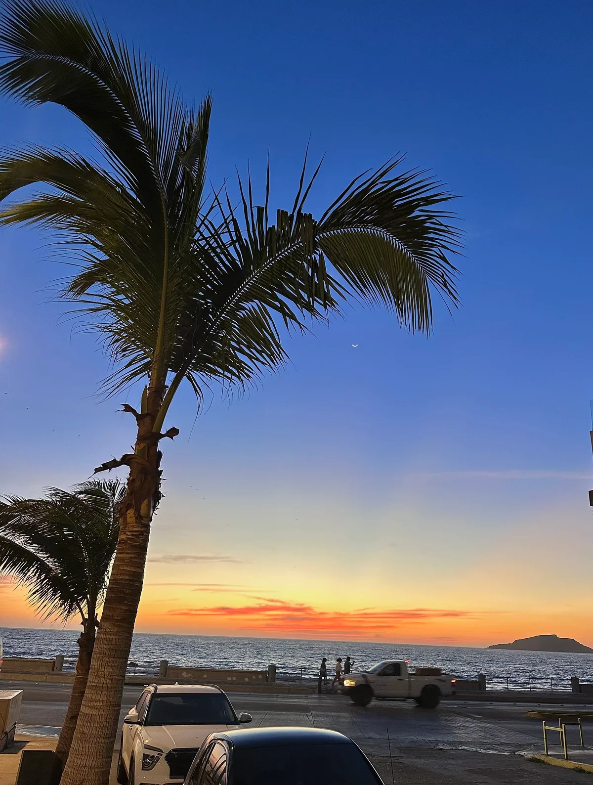
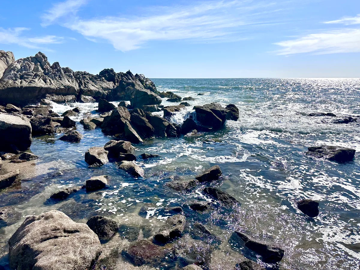
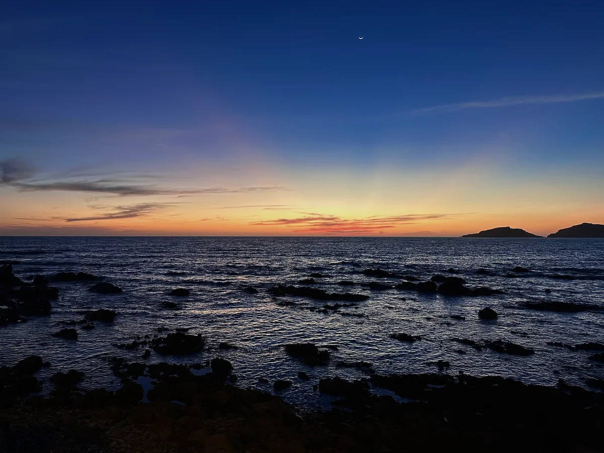
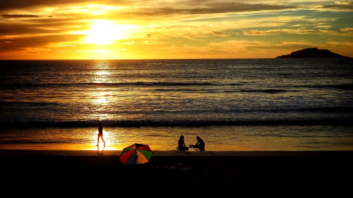
Playa Pinitos is a compact, roughly 165-metre cove tucked beneath the Cerro del Vigía lighthouse on the Pacific edge of Mazatlán, Sinaloa. The sand runs a distinctive grey, and the beach faces west, making it one of the city's most rewarding sunset orientations. Three offshore islands frame the horizon, giving every view a layered, cinematic quality. There's no tourist infrastructure here — no sunbed rental, no snack shack, no lifeguard — just grey sand, rocky water entry, and the kind of quiet that's increasingly rare on the Mexican Pacific. It's romantic precisely because it demands a little effort to reach.
How to get there
The only way in is on foot: follow the Cerro del Vigía lighthouse road and take the steep path down, a walk of roughly 15 minutes. There is no beach-level parking — leave your vehicle near the lighthouse at the top of the hill, where free parking is available. No entry fee is charged. Access is rated moderate overall, but the steep descent means it is not accessible for visitors with limited mobility.
Who it's for
For couples
The combination of a steep, effort-only approach and a west-facing sunset orientation makes Playa Pinitos one of Mazatlán's most naturally romantic spots — you're likely to have the grey sand almost entirely to yourselves as the sun drops behind the three-island horizon.
For families
The steep, slippery path and rocky water entry make this a poor choice for young children or anyone who needs easy beach access — families with older, sure-footed kids can manage the 15-minute descent, but come prepared with water shoes and accept there are no facilities whatsoever on site.
Our take
Playa Pinitos rewards the curious and penalises the unprepared. Swimming is moderate-rated but the rocky entry and absence of any lifeguard or facilities mean you should be cautious and confident before getting in the water — and stay out entirely during the July-to-September rainy season when surf turns rough. What this beach does exceptionally well is solitude and scenery: roughly 165 metres of grey sand, a lighthouse overhead, three islands on the horizon, and a west-facing sunset that needs no filter. It's a 15-minute hike down a steep path with nothing waiting for you at the bottom except the view — no café, no bin, no rescue. Bring water, carry out your waste, and wear shoes you can trust on a wet slope. Skip in August.
What to do
The Cerro del Vigía Lighthouse, just 0.3 km away, is one of the world's highest natural lighthouses and offers panoramic views over the city — visit before or after your descent to the cove. From the beach itself, Isla de los Venados is visible roughly 4 km offshore; that protected island is a recognised snorkelling destination if you want to extend the day. Playa Norte, a white sandy beach and sunset spot in its own right, is only 0.4 km away and makes a natural companion stop.
The lighthouse perched above the cove is the defining shot — frame it from the grey sand below with the Pacific horizon at dusk.
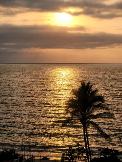
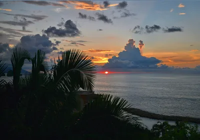
The three-island panorama from the water's edge at sunset is the second key composition, best captured in the final 20 minutes of daylight when the sky layers behind the silhouetted islands.
Where to eat
Mariscos el Pitufo is right on the doorstep for fresh seafood after the hike back up. Cenaduria La Copita and Caguamanta Doña Mary are both within 0.5 km and offer local Sinaloan cooking at an easy walking distance from the lighthouse parking area.
Where to stay
Suites Lincoln is the closest option at 0.2 km, followed by Hotel Torre Claussen at 0.3 km — both put you within easy reach of the lighthouse trailhead. Casa Lulu, Hotel Lerma, and Hotel Mexico are all within 0.6 km if you want a slightly wider choice without straying far.
Photography
The west-facing orientation makes the hour before sunset the prime window — position yourself on the grey sand with the three-island panorama behind you and the lighthouse silhouetted above for the strongest composition. The rocky cove walls also frame tight shots at golden hour; arrive 30 minutes early to scout the best angle before the light drops.
Good to know
This beach has zero facilities — carry out every piece of waste you bring in, no exceptions. The path into the cove becomes slippery after rain, so avoid the descent in wet conditions; July, August, and September are the months to skip entirely, when the rainy season makes the path hazardous and surf turns rough. Water entry is rocky, so sturdy sandals or water shoes are strongly recommended. Dogs are welcome but must be kept on a leash — the steep path makes this a practical safety rule as much as a courtesy one.
Map
Nearby places
Mariscos el pitufo
Cenaduria La Copita
Caguamanta Dona Mary
Clients 7 Antojeria
La Pusteaderia
Suites Lincoln
Hotel Torre Claussen
Casa Lulu
Hotel Lerma
Hotel Mexico
Playa Los Pinitos (beach)
Playa Del Marino (nature preserve)
Playa Norte (white sandy beach & sunset spot)
Things to see around Mazatlán
Cerro del Vigía Lighthouse
One of the world's highest natural lighthouses with panoramic city views.
Teatro Ángela Peralta
Isla de los Venados
Protected offshore island visible from the beach, with snorkelling.
GIFT
🎁 Gift this beach
Its exact coastline, your date, your words — on a print, a mug, or a PDF you print yourself.
Pinitos Beach
THAT DAY
Pinitos Beach, Mexican Pacific

© OpenStreetMap contributors
Clean & decorative, or “That day” with the real sky of your date.
Shipping included 3-6 business days
A question before you order? Contact us
Delivered within minutes on the confirmation page and by email: a ZIP with all 4 print sizes (30×40 cm, 12×16″, 50×70 cm, 18×24″), each as a high-resolution PDF and PNG (300 dpi), plus a screen version. Print at home or at any print shop.
Please complete the delivery address.
Please accept the Terms of Sale.
Almost there — the shop opens very soon.
Secure payment · Printed locally in 30+ countries · 7 languages
Frequently asked
The information on this page is provided for guidance only and may evolve. Access conditions, safety and infrastructure can change without notice. Always check official sources before traveling.
Other beaches in the region
More beaches in Mexican Pacific
Reviews of this beach
- No reviews yet, what a shame — leave yours and share your experience.
Photo credits
Sources and licenses for the photos shown above.
- Photo 1 — Mary P Madigan · source · CC BY 2.0
- Photo 2 — Mary P Madigan · source · CC BY 2.0
- Photo 3 — Mary P Madigan · source · CC BY 2.0
- Photo 4 — TravelingOtter · source · CC BY-SA 2.0
- Photo 5 — Dennis S · source · Public Domain