El Requesón BeachMexico Beach Guide
A wild tombolo where the Sea of Cortez splits in two
About
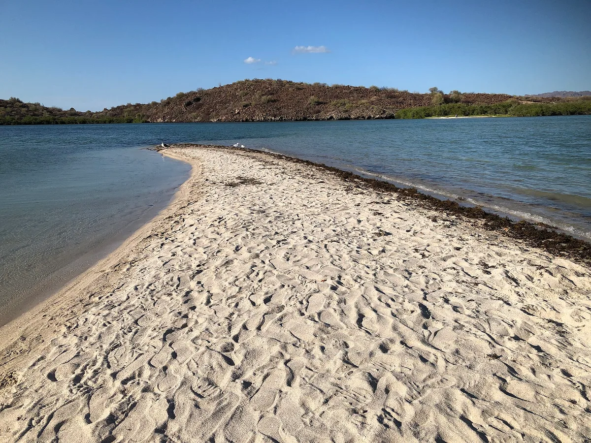
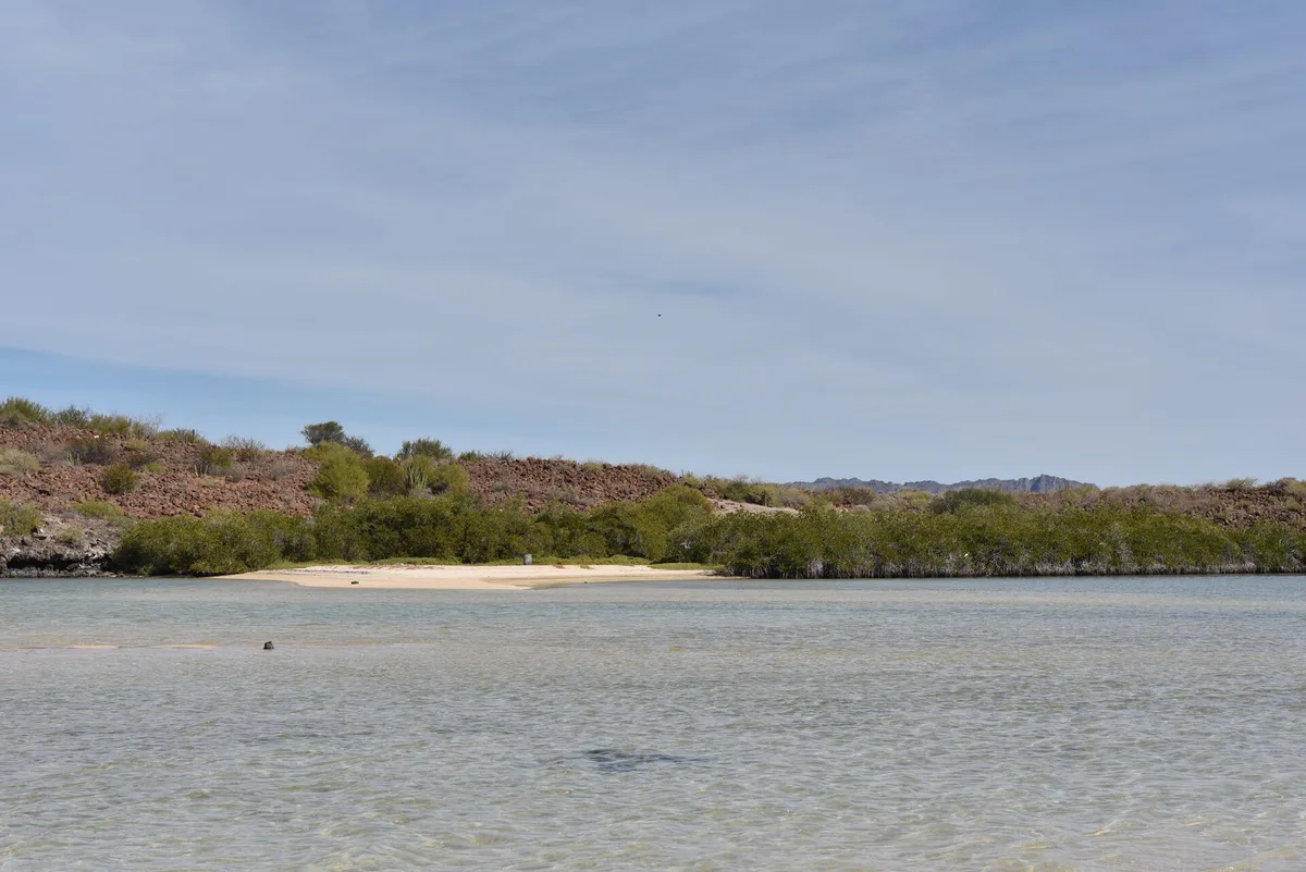
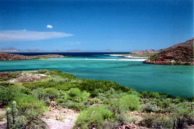
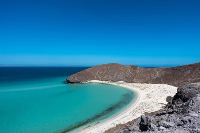
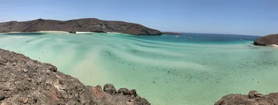
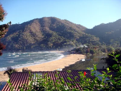
Playa El Requesón is a slender sand spit curling out from the Baja California Sur shoreline near Mulegé, forming one of the Sea of Cortez's most striking geological features — a tombolo that connects the mainland to a small island at low tide. On either side of the spit, white sand meets turquoise water, giving you two beaches for the price of one. At roughly 400 metres long, it's compact but dramatic, the kind of place where the light bounces off the water from both directions at once. The vibe is genuinely wild: no facilities, no vendors, just the sound of the sea and the occasional camper setting up for the night.
How to get there
From Mulegé, it's about a 45-minute drive south; from Loreto International Airport (LTO), allow around 75 minutes. The final stretch runs along a dirt track leading onto the sand spit itself — soft sand and an unpaved approach mean this beach is not accessible for wheelchair users or low-clearance vehicles. Parking is informal, directly on or near the spit; a small ejido fee is sometimes collected, though no fixed system is in place. There is no entry fee beyond that.
Who it's for
For couples
The double-sided beach and near-total quiet make El Requesón a genuinely private escape — set up camp on the spit and you'll have turquoise water on both sides and almost no one else around.
For families
Families who are self-sufficient campers will find the calm, safe swimming water and dog-friendly atmosphere appealing, but the lack of potable water, shade, and facilities means this is better suited to older kids and experienced outdoor families than young children.
Our take
El Requesón is one of the most geologically interesting beaches on the Sea of Cortez, and the double-sided tombolo delivers a visual payoff that few spots in Baja can match. That said, this is a place that demands respect and preparation — no water on site, a spit that can partially submerge in storm conditions, and summer heat that makes June through August genuinely dangerous months to visit. Come between October and May, bring everything you need, and treat the camping rules seriously. Dogs are welcome, the swimming is safe in calm conditions, and the quiet is the real luxury here. Worth the detour — but only if you come prepared.
What to do
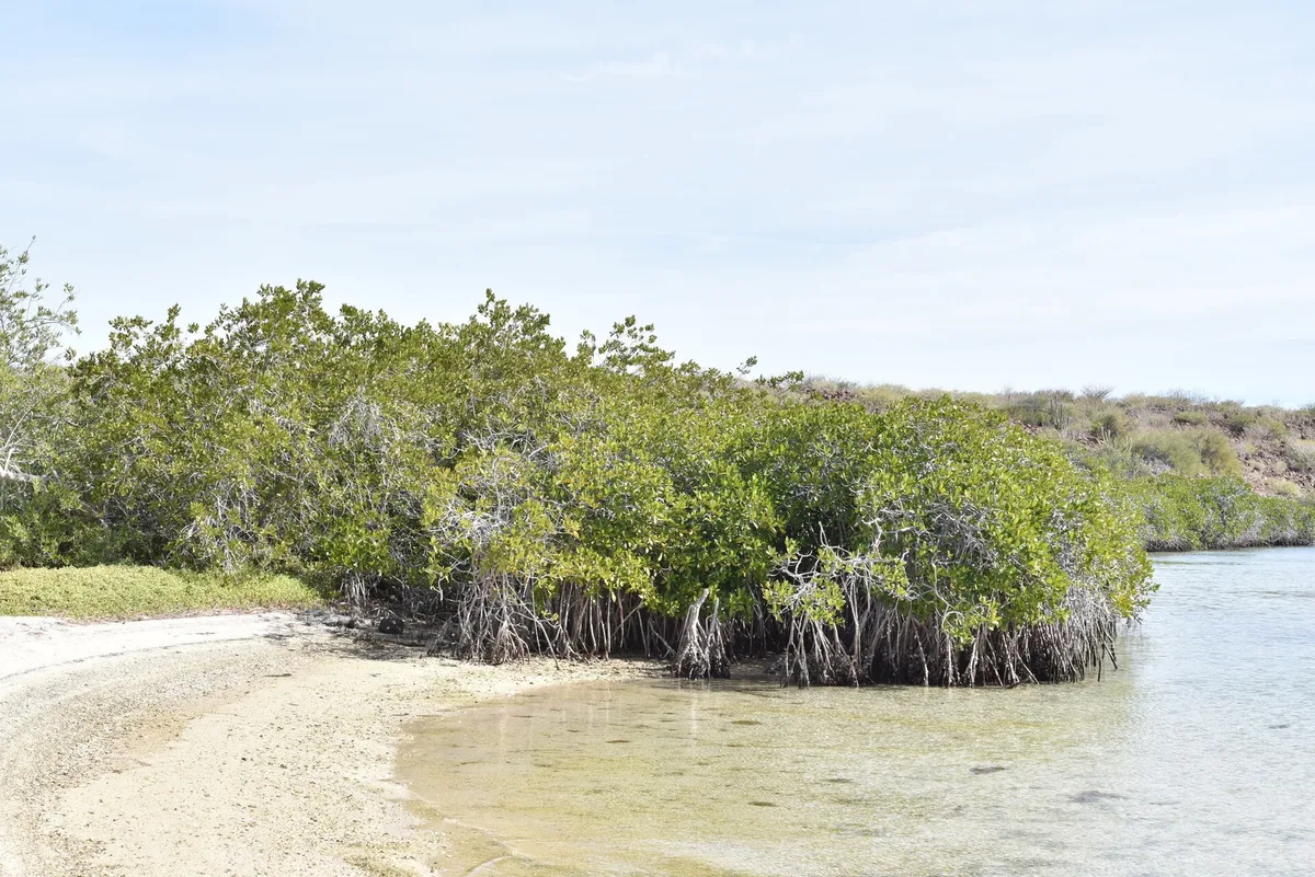
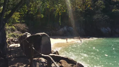
The tombolo itself is the main event: walk the spit at low tide to reach the island and watch the water shift colour on both flanks. About 11 km away, Playa De La Isla Coyote earns near-perfect ratings and makes a worthwhile day trip by car. Further along Bahía Concepción, Playa Coyote offers a mangrove-fringed fishing village atmosphere, while Playa Santispac — around 15 km out — has a natural tidal hot spring worth the short detour. History lovers can continue to the 18th-century Jesuit mission at Mulegé, roughly 45 km north.
The tip of the tombolo at low tide — white sand flanked by turquoise water on both sides — is the defining shot.
Frame the island connection from water level for a perspective that shows the spit disappearing into the Sea of Cortez. Early morning light keeps the surface glassy and reflection-sharp before the afternoon breeze arrives.
Where to eat
There are no restaurants at the beach itself, so pack a full cooler before you leave town. The closest option is JC's Restaurant, serving regional Mexican food about 13 km away — plan your meals around that drive. If you're camping overnight, self-sufficiency isn't optional; it's the only way this place works.
Where to stay
The closest sleep options sit just outside the spit: Playa La Perla is 0.7 km away, and Hotel Buenaventura — rated 4.3 by guests — is 1.5 km out. For a more immersive Baja experience, el burro baja camping (rated 4.5 across 11 reviews) is about 12 km away and suits the camping spirit of this stretch of coastline well.
Photography
Shoot from the tip of the spit at golden hour — the turquoise water flanking both sides of the white sand creates a symmetry that's hard to replicate anywhere else on the Sea of Cortez. At low tide, the exposed sand bridge connecting the island makes a strong compositional foreground, especially in the soft morning light before the wind picks up.
Good to know
Bring every drop of water and all your food — there is no potable water on site and the nearest restaurant is over 13 km away. Pack out all your trash; leave-no-trace is not a suggestion here, it's the local rule. The spit partially submerges during storm conditions, so if you're camping, monitor weather closely and understand you do so at your own risk. Summer heat is extreme and tropical storm risk is real — June, July, and August are best avoided entirely.
Map
Nearby places
JC's Restaurant
Playa La Perla
Hotel Buenaventura
el burro baja camping
A Breathtaking View from Beachfront Villa in Famous Coyote Bay
Coyote Bay View
Playa De La Isla Coyote
Playa El Burro
Playa Coyote
Playa Santispac
Mulegé Mission (Santa Rosalía de Mulegé)
Things to see around Mulegé
Playa Coyote
Mangrove-fringed fishing village beach in Bahía Concepción.
Playa Santispac
Largest Concepción beach with a natural tidal hot spring.
Mulegé Mission (Santa Rosalía de Mulegé)
18th-century Jesuit mission overlooking the Mulegé river oasis.
Frequently asked
The information on this page is provided for guidance only and may evolve. Access conditions, safety and infrastructure can change without notice. Always check official sources before traveling.
Other beaches in the region

Other wild beaches in Mexico
More beaches in Baja California Sur
Reviews of this beach
- No reviews yet, what a shame — leave yours and share your experience.
Photo credits
Sources and licenses for the photos shown above.
- Photo 1 — Purecabo · source · CC BY-SA 4.0
- Photo 2 — Wikimedia contributor · source · CC BY 4.0
- Photo 3 — Wikimedia contributor · source · CC BY 4.0
- Photo 4 — Fulvio Spada from Torino, Italy · source · CC BY-SA 2.0