Fomm ir-Riħ BeachMalta Beach Guide
Malta's most remote beach demands every step to reach it
About
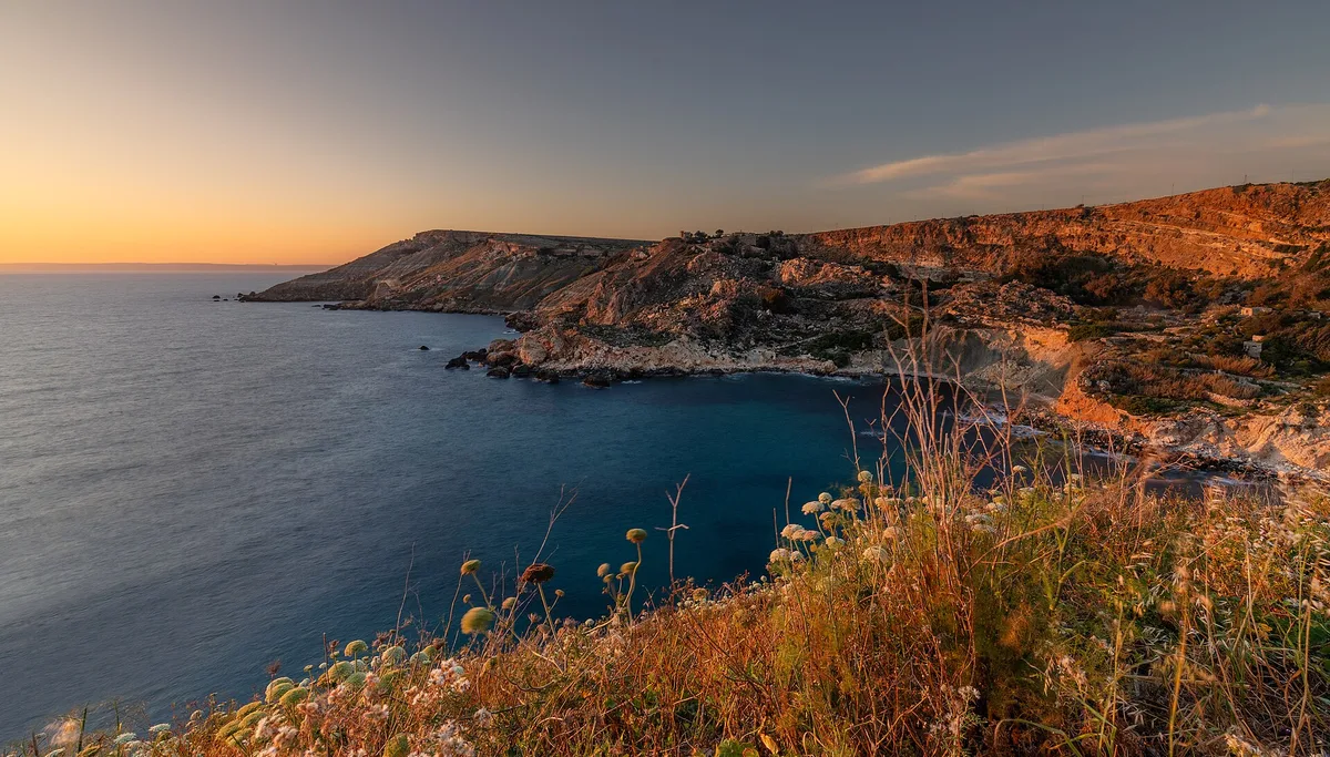
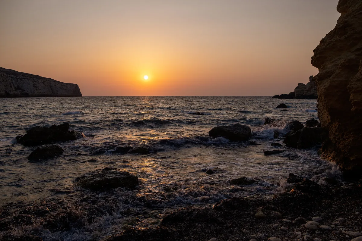
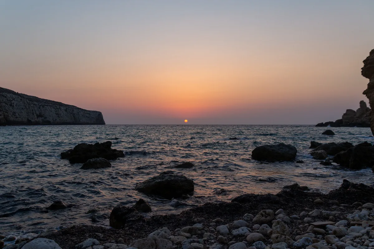
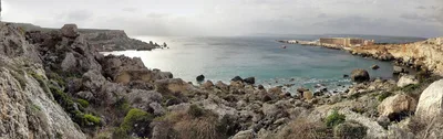
Fomm ir-Riħ sits at the foot of near-vertical clay cliff walls on Malta's wild western coast, reachable only on foot after a 40-minute scramble down an unmarked loose-clay path from Baħrija village. The beach itself is a short pebble shore of grey stone meeting deep blue water — raw, unmanicured, and completely free of facilities or other visitors on most days. Those clay cliffs tower above you in shades of ochre and rust, streaked by centuries of erosion, giving the cove a dramatic, almost primordial atmosphere. There is no road access whatsoever, no café, no sunbed, no lifeguard — just the sound of waves and the wind that gives this place its name, which translates roughly as 'mouth of the wind'. Come prepared or don't come at all.
How to get there
The only way in is on foot from Baħrija village — a 40-minute descent on an unmarked path with loose clay underfoot. Free informal parking is available in Baħrija village before you set off. There is no entry fee, but the path is genuinely demanding and completely unsigned, so study your route before leaving the car. Do not attempt the descent after rain: the clay path becomes dangerously slippery and the cliffs above are unstable in wet conditions.
Who it's for
For couples
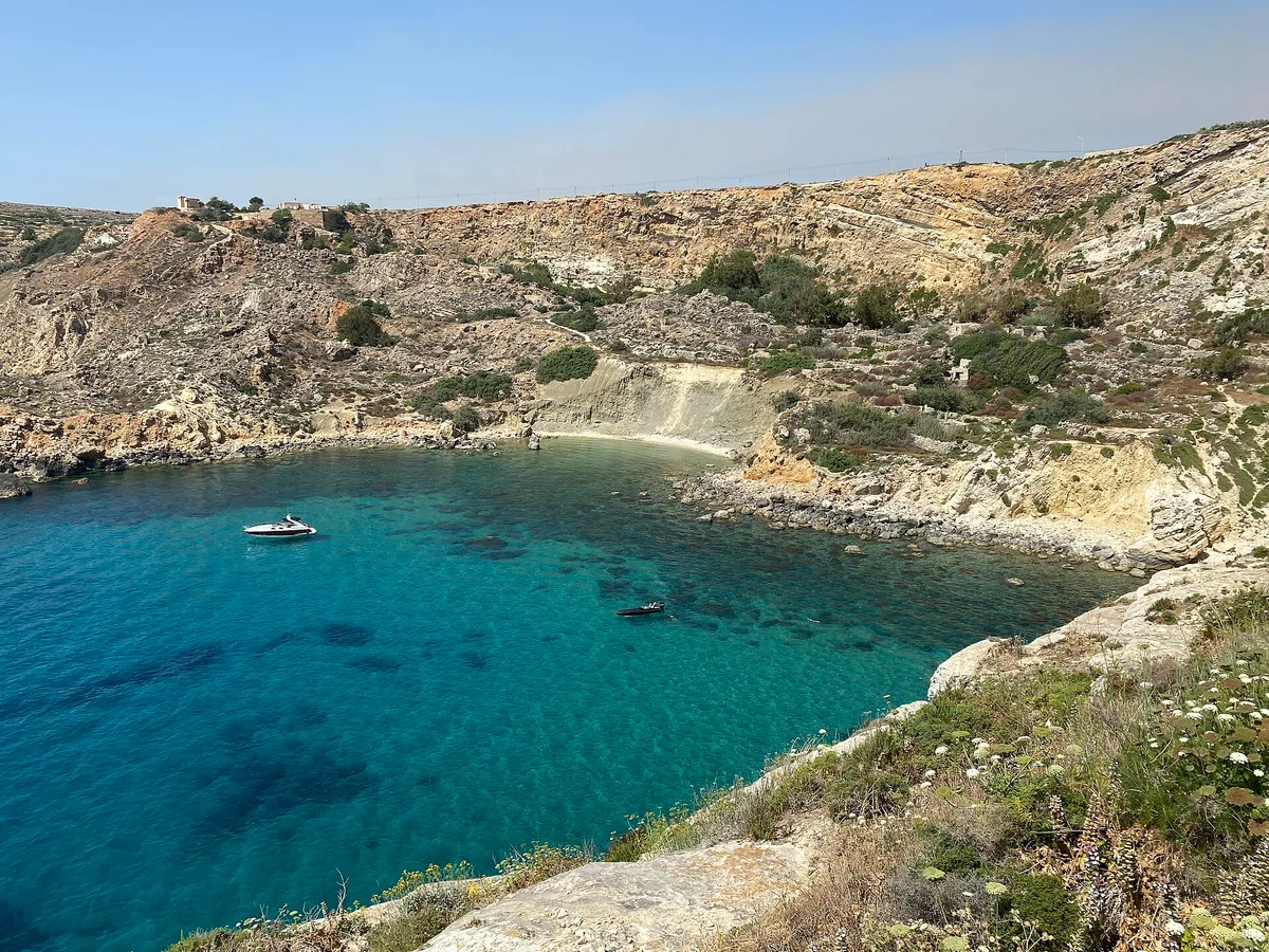
For couples who want genuine solitude — not the performative kind — Fomm ir-Riħ delivers it honestly: grey pebbles, deep blue water, towering clay cliffs, and very likely no one else in sight. The shared effort of the 40-minute scramble makes arriving feel earned rather than accidental.
For families
Fomm ir-Riħ is not suitable for young children or anyone with limited mobility — the 40-minute unmarked scramble on loose clay, combined with unstable cliffs, zero facilities, and no mobile signal, makes it genuinely unsuitable for families with small kids. Gnejna Bay, 4 km away, is a far safer and more practical family alternative.
Our take
Fomm ir-Riħ is not for everyone, and that is precisely the point. The 40-minute unmarked scramble on loose clay is a real physical commitment, and the safety stakes are genuine — unstable cliffs, no mobile signal, no rescue services, and a path that turns dangerous the moment it rains. Go only in dry conditions between June and September, go prepared, and go knowing you're entirely on your own down there. What you get in return is a short grey-pebble shore backed by dramatic clay cliffs, deep blue water, and a level of isolation that has become almost impossible to find on a Mediterranean island. It's wild in the truest sense — not styled, not signposted, not managed. If that trade-off sounds right to you, it absolutely delivers.
What to do
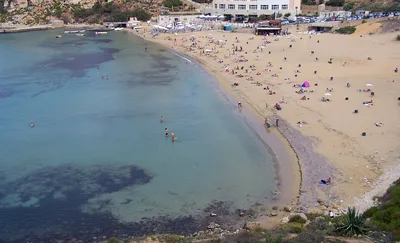
Before or after the hike, the tiny rural settlement of Baħrija village — one of Malta's smallest — is worth a slow walk around; it's the cultural gateway to this whole corner of the island, sitting about 2 km from the beach. Fort Binġemma, roughly 2 km away, offers a compact piece of Maltese military history set against open countryside. For a complete contrast, Gnejna Bay is about 4 km away — an accessible sandy cove with boathouses and a freshwater spring, ideal if you want a gentler swim after the exertion of Fomm ir-Riħ. Dingli Cliffs, 6 km out, rounds off the day with panoramic Mediterranean views from Malta's highest sea cliffs.
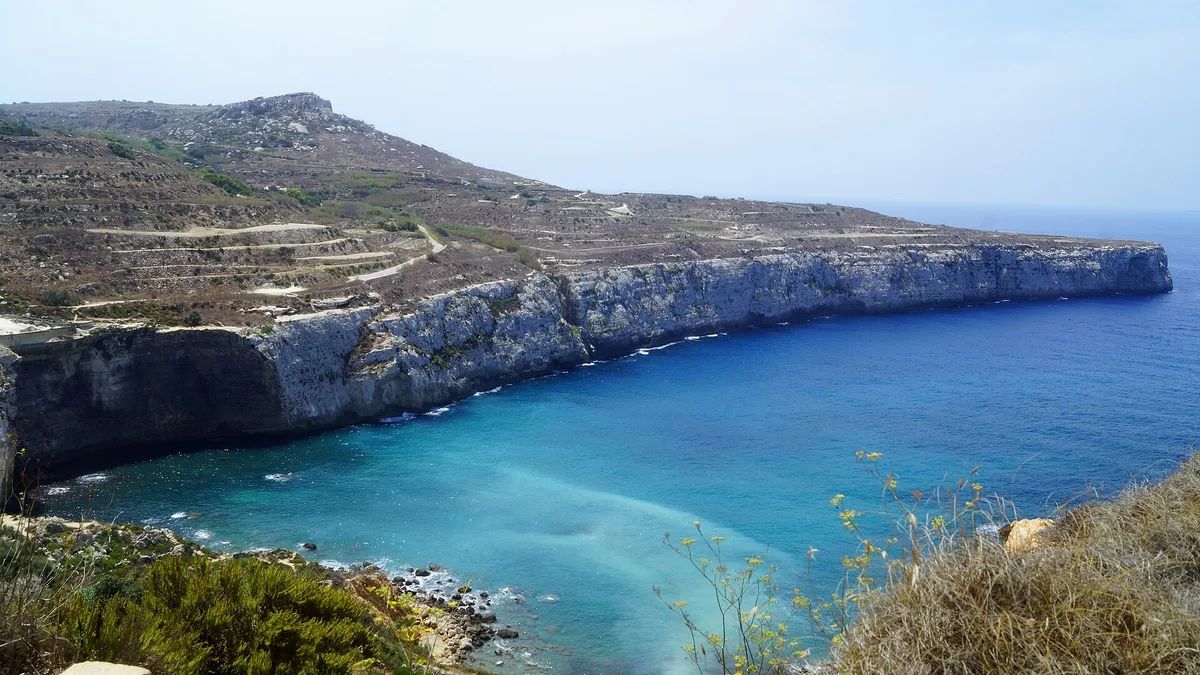
The classic frame is from the waterline looking up at the near-vertical clay cliff walls — their layered ochre and rust tones against the deep blue water are unlike anything else on the Maltese islands.
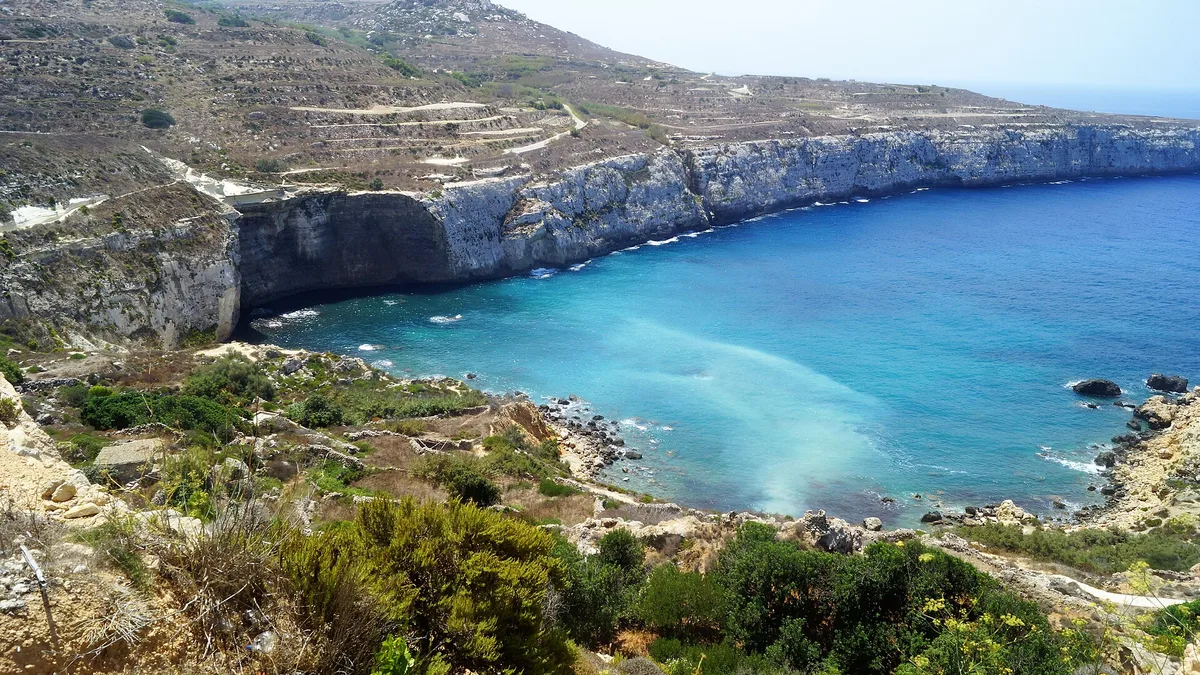
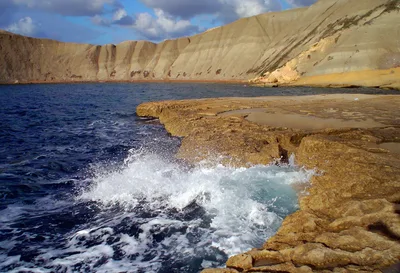
Halfway down the descent path, a natural gap in the clay banks frames the cove below and the open sea beyond, best shot in the sharp morning light of a June or July day.
Where to eat
There are absolutely no food or drink options at the beach, so pack everything you need before you descend. The closest options are North Country (1.6 km from the trailhead area) and a cluster of regional spots — Ta' Gagin, New Life, and Ta' Richard — all within 1.7 km of Baħrija village. Singita is a slightly longer drive at 2.4 km and worth considering for a post-hike meal.
Where to stay
The nearest accommodation options are a short drive away: Tikka is the closest at around 5.9 km, followed by Estrella Lodging, Ushuaia Playa Xemxija Boutique Hotel, and VIU57, all sitting at roughly 6.1 km. For something with a wellness focus, Verdala Wellness Hotel is about 2.3 km away — a reasonable base for exploring this rugged corner of Malta.
Photography
The most striking shots come from the beach looking back up at the clay cliff walls — shoot in the golden hour before midday when the light catches the ochre striations and the deep blue water fills the foreground. The descent path itself, with its raw clay banks and open sea glimpsed below, offers compelling wide-angle frames; arrive early to catch the light before it flattens out.
Good to know
No fires are permitted at any time, and you must pack out every piece of waste you bring — there are zero facilities and no bins on site. The clay cliffs are unstable; do not approach the cliff base or linger beneath them, especially after any rainfall. There is no mobile signal in the valley and no rescue services nearby, so tell someone your plans and carry water, a first-aid kit, and a fully charged phone before you descend. Avoid entirely from November through March, when the wet-season clay path turns the scramble into a serious hazard.
Map
Nearby places
North Country
Ta' Gagin
New Life
Ta' Richard
Singita
Tikka
Estrella Lodging
Ushuaia Playa Xemxija Boutique Hotel
VIU57
Verdala Wellness Hotel
Things to see around Rabat
Baħrija Village
One of Malta's smallest and most rural villages, starting point for the descent.
Gnejna Bay
Accessible sandy cove with boathouses and freshwater spring.
Dingli Cliffs
Malta's highest sea cliffs, offering panoramic views over the Mediterranean.
Frequently asked
The information on this page is provided for guidance only and may evolve. Access conditions, safety and infrastructure can change without notice. Always check official sources before traveling.
Nearest beaches
Reviews of this beach
- No reviews yet, what a shame — leave yours and share your experience.
Photo credits
Sources and licenses for the photos shown above.
- Photo 1 — StudioSelinous · source · CC BY-SA 4.0
- Photo 2 — Mickey Luigi Logitmark from Randers, Denmark · source · CC0
- Photo 3 — Mickey Luigi Logitmark from Randers, Denmark · source · CC0
- Photo 4 — MauiLizard · source · CC BY-SA 4.0
- Photo 5 — futureshape · source · CC BY 2.0
- Photo 6 — Ania Mendrek · source · CC BY-ND 2.0