Derrynane BeachIreland Beach Guide
White sand, abbey ruins, and tidal drama on Kerry's wild coast
About
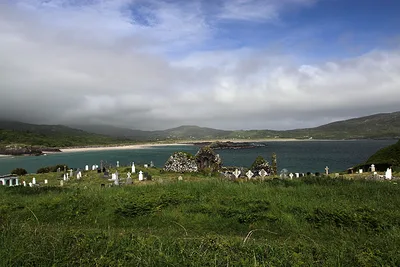
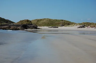
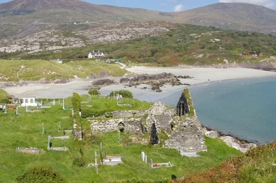
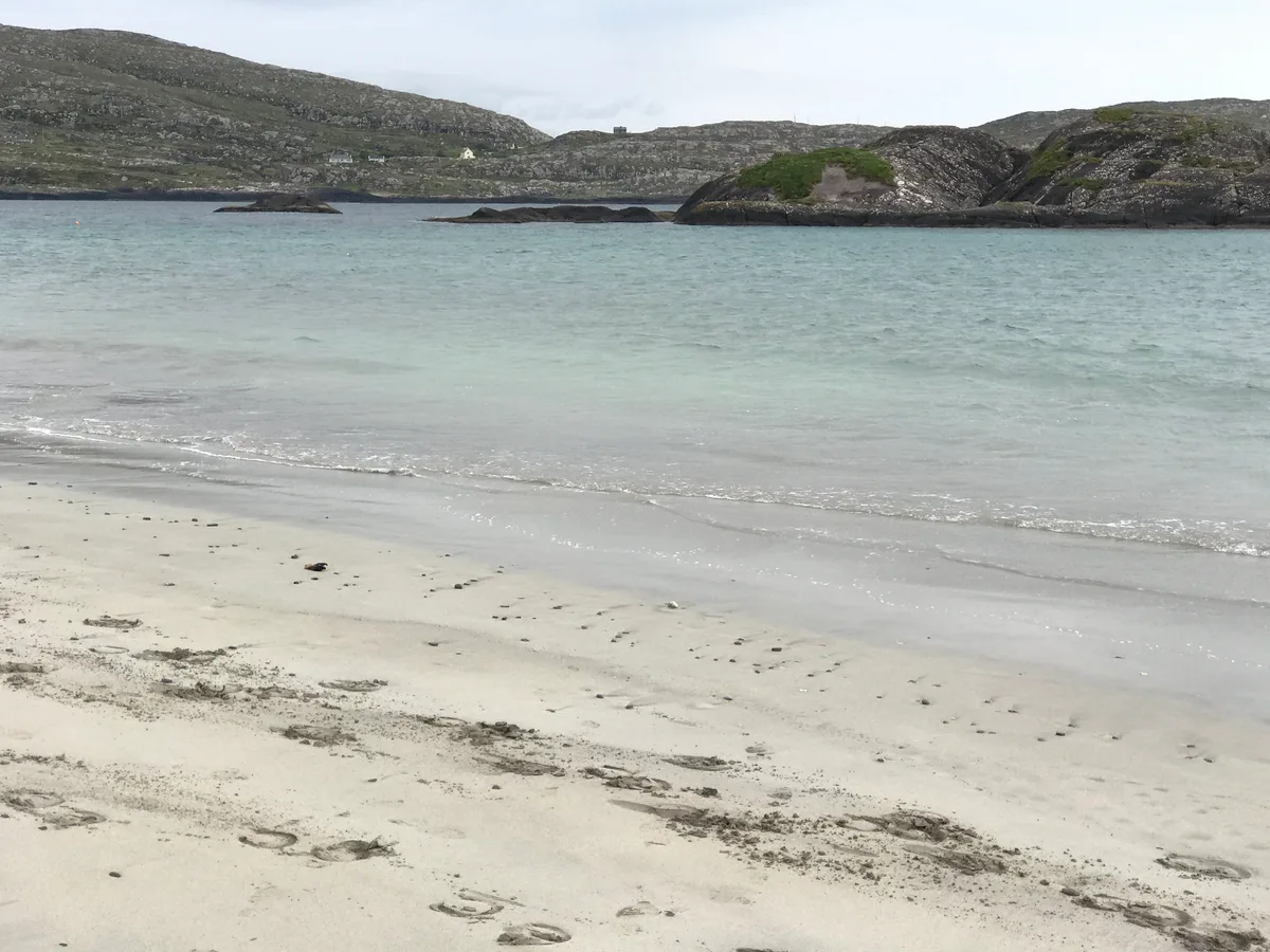
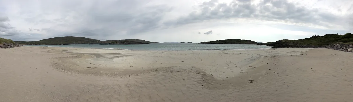
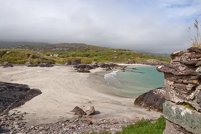
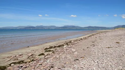
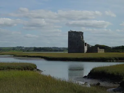
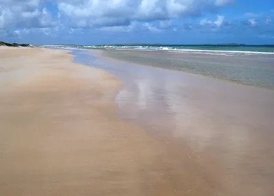
Derrynane Beach curves in a sheltered horseshoe along the southwest Kerry coast, its white sand meeting water that runs a clear, shallow turquoise on calm summer days. At roughly 800 metres long, the beach sits within Derrynane National Historic Park — so the setting feels wilder and less commercial than most Irish strands. At low tide, a tidal causeway connects the shore to Abbey Island, where the roofless ruins of a medieval abbey stand against the Atlantic sky. Behind the beach, a machair dune system softens the landscape, and the whole cove is sheltered enough to make swimming genuinely comfortable when conditions are right. It's a rare combination of natural beauty and layered history in one compact bay.
How to get there
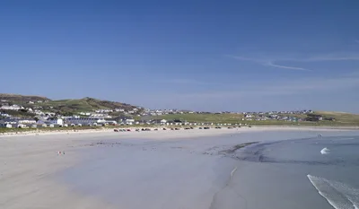
From Caherdaniel village it's a five-minute drive to the beach; from Kenmare allow around 40 minutes along the Ring of Kerry. Free parking is available at Derrynane National Historic Park — note there is a height-restriction barrier at the entrance, and the car park fills quickly on summer weekends, so arrive early. There is no entry fee to the beach itself. The path down to the sand is manageable for most visitors, but the sand and the tidal crossing to Abbey Island are not wheelchair accessible.
Who it's for
For couples
The tidal crossing to Abbey Island at low tide — ruins, sea light, and a walk that requires a little planning — makes for a genuinely memorable afternoon for two. Time it right and you'll have the island largely to yourselves.
For families
The sheltered horseshoe shape keeps the water calmer than exposed Kerry beaches, and the shallow turquoise shallows are reassuring for younger swimmers when conditions are moderate. Just note that dogs aren't allowed in summer, and keep children well away from the 'Danger Beach' section near the island headland.
Our take
Be clear-eyed about the tidal crossing before anything else: the causeway to Abbey Island cuts off fast, and the 'Danger Beach' section near the headland carries real rip currents — read the signage, consult tide tables, and don't treat either as a casual adventure. With that understood, Derrynane is one of the most rewarding beaches on the Kerry coast. The white sand, turquoise water, and sheltered shape would be enough on their own, but the abbey ruins, the national park setting, and the proximity to Derrynane House give the place a depth that purely scenic beaches lack. Come in June or July before the car park fills and the path gets busy. Avoid November through February — facilities close and the Atlantic weather is fully exposed. Worth the detour, but plan it properly.
What to do
Start with Derrynane House, just 0.5km from the beach — it's the ancestral home of Daniel O'Connell, 'The Liberator', and now a national monument and museum well worth an hour of your time. If you're driving further afield, Staigue Stone Fort is about 12km away, one of Ireland's best-preserved Iron Age dry-stone ring forts dating to around 300–400 AD. For the most dramatic excursion in the area, Skellig Michael — a UNESCO World Heritage Site with an early Christian monastic settlement perched on an Atlantic rock pinnacle — lies roughly 30km out.
The low-tide causeway looking toward the abbey ruins on Abbey Island is the defining shot — frame the roofless walls against an open sky with the turquoise shallows in the foreground.
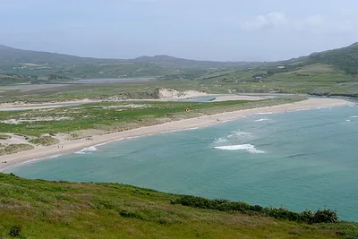
The elevated dune ridge behind the beach captures the full horseshoe sweep of white sand and sea in a single wide frame, best in the soft light of a summer morning.
Where to eat
Skellig Coast Kitchen, about 2.2km from the beach, is the closest dining option and a practical stop before or after your visit. There are no food vendors on the beach itself, so it's worth packing a lunch if you plan a full day out.
Where to stay
The Olde Forge B&B, rated 4.5 out of 5 across 84 reviews, sits about 2.8km away and is the highest-rated sleep in the immediate area. Derrynane Bay House (4.5/5, 53 reviews) is slightly closer at 2.5km, while Wave Crest Caravan Park — a popular choice with 158 reviews and a 4.4 rating — is 3km out and suits those travelling with a campervan or caravan.
Photography
The best shot at Derrynane is from the shoreline at low tide looking toward Abbey Island, with the ruined abbey framed against the sky and the turquoise water of the causeway in the foreground — morning light from the east catches the white sand cleanly. For a wider composition of the horseshoe cove shape, the dune ridge behind the beach gives an elevated angle that shows the full curve of the bay.
Good to know
Always check tide tables before attempting the crossing to Abbey Island — the causeway cuts off rapidly and you can be stranded without warning. A section near the island headland is signed as 'Danger Beach' and carries strong rip currents; heed all signage and do not enter the water in that area. National park rules apply throughout: no fires, no camping. Dogs are not permitted on the beach during the summer season, so leave them at your accommodation.
Map
Nearby places
Skellig Coast Kitchen
Derrynane Bay House
The Olde Forge B&B
Kerry Way Rest Hostel
Wave Crest Caravan Park
Com An Chiste
Coomnahorna
Things to see around Caherdaniel
Derrynane House
Ancestral home of Daniel O'Connell, 'The Liberator', now a national monument and museum.
Staigue Stone Fort
One of Ireland's best-preserved Iron Age dry-stone ring forts, dating to around 300–400 AD.
Skellig Michael
UNESCO World Heritage Site — early Christian monastic settlement on a dramatic Atlantic rock pinnacle.
Frequently asked
The information on this page is provided for guidance only and may evolve. Access conditions, safety and infrastructure can change without notice. Always check official sources before traveling.
Nearest beaches

More beaches in Irish Coast
Reviews of this beach
- No reviews yet, what a shame — leave yours and share your experience.
Photo credits
Sources and licenses for the photos shown above.
- Photo 1 — Mike Searle · source · CC BY-SA 2.0
- Photo 2 — Trevor Harris · source · CC BY-SA 2.0
- Photo 3 — Steve Edge · source · CC BY-SA 2.0
- Photo 4 — Donna_Rutherford · source · CC BY-ND 2.0
- Photo 5 — Donna_Rutherford · source · CC BY-ND 2.0
- Photo 6 — Mike Searle · source · CC BY-SA 2.0